world.wikisort.org - USA
Piedra is an unincorporated community and a census-designated place (CDP) located in and governed by Hinsdale County, Colorado, United States. The population of the Piedra CDP was 31 at the United States Census 2020.[5] The Pagosa Springs post office (Zip Code 81147) serves the area.[4]
Piedra, Colorado | |
|---|---|
Census Designated Place | |
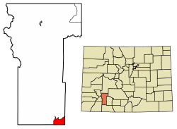 Location of the Piedra CDP in Hinsdale County, Colorado. | |
 Piedra Location of the Piedra CDP in the United States. | |
| Coordinates: 37°26′30″N 107°10′06″W[1] | |
| Country | |
| State | |
| County | Hinsdale County |
| Government | |
| • Type | unincorporated community |
| Area | |
| • Total | 11.6 sq mi (30.098 km2) |
| • Land | 11.6 sq mi (30.098 km2) |
| • Water | 0.000 sq mi (0.000 km2) |
| Elevation | 7,844 ft (2,391 m) |
| Population (2020) | |
| • Total | 31 [3] |
| • Density | 2.67/sq mi (1.03/km2) |
| Time zone | UTC-7 (MST) |
| • Summer (DST) | UTC-6 (MDT) |
| ZIP Code[4] | Pagosa Springs 81147 |
| Area code(s) | 970 |
| GNIS feature[2] | Piedra CDP |
History
The Piedra Post Office was established in 1879, and remained in operation until 1927.[6] Piedra is a name derived from Spanish meaning "stone".[7]
Geography
The Piedra CDP occupies the southeast corner of Hinsdale County in the valley of the Piedra River within San Juan National Forest. It is at the southern edge of the San Juan Mountains. The CDP is 18 miles (29 km) west of Pagosa Springs.
The Piedra CDP has an area of 7,437 acres (30.098 km2), all land.[1]
Demographics
The United States Census Bureau initially defined the Piedra CDP for the United States Census 2010.
| Year | Pop. | ±% |
|---|---|---|
| 2010 | 28 | — |
| 2020 | 31 | +10.7% |
| Source: United States Census Bureau | ||
Education
Archuleta County School District 50-JT operates public schools.[8] Pagosa Springs High School is the comprehensive high school.
See also
- Outline of Colorado
- Index of Colorado-related articles
- State of Colorado
- Colorado cities and towns
- Colorado census designated places
- Colorado counties
- Colorado cities and towns
References
- "State of Colorado Census Designated Places - BAS20 - Data as of January 1, 2020". United States Census Bureau. Retrieved December 22, 2020.
- "U.S. Board on Geographic Names: Domestic Names". United States Geological Survey. Retrieved December 19, 2020.
- "Explore Census Data".
- "Zip Code 81147 Map and Profile". zipdatamaps.com. 2020. Retrieved December 22, 2020.
- "2010: DEC Summary File 1". United States Census Bureau. Retrieved December 22, 2020.
- "Post offices". Jim Forte Postal History. Retrieved 7 July 2016.
- Dawson, John Frank. Place names in Colorado: why 700 communities were so named, 150 of Spanish or Indian origin. Denver, CO: The J. Frank Dawson Publishing Co. p. 41.
- "2020 CENSUS - SCHOOL DISTRICT REFERENCE MAP: Hinsdale County, CO" (PDF). U.S. Census Bureau. Retrieved 2022-07-12.
External links
 Definitions from Wiktionary
 Media from Commons
 News from Wikinews
 Quotations from Wikiquote
 Texts from Wikisource
 Textbooks from Wikibooks
 Resources from Wikiversity
Municipalities and communities of Hinsdale County, Colorado, United States | ||
|---|---|---|
County seat: Lake City | ||
| Town |  | |
| CDPs | ||
| Ghost town |
| |
| ||
Другой контент может иметь иную лицензию. Перед использованием материалов сайта WikiSort.org внимательно изучите правила лицензирования конкретных элементов наполнения сайта.
WikiSort.org - проект по пересортировке и дополнению контента Википедии