world.wikisort.org - USA
Panthersville is a census-designated place (CDP) in DeKalb County, Georgia, United States. The population was 9,749 at the 2010 census.[4]
Panthersville, Georgia | |
|---|---|
CDP | |
 The Barack H. Obama Elementary Magnet School of Technology in Panthersville | |
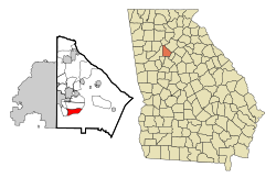 Location in DeKalb County and the state of Georgia | |
 Panthersville location in Metro Atlanta | |
| Coordinates: 33°42′20″N 84°16′43″W | |
| Country | United States |
| State | Georgia |
| County | DeKalb |
| Area | |
| • Total | 3.69 sq mi (9.55 km2) |
| • Land | 3.67 sq mi (9.50 km2) |
| • Water | 0.02 sq mi (0.05 km2) |
| Elevation | 889 ft (271 m) |
| Population (2020) | |
| • Total | 11,237 |
| • Density | 3,064.36/sq mi (1,183.14/km2) |
| Time zone | UTC-5 (Eastern (EST)) |
| • Summer (DST) | UTC-4 (EDT) |
| FIPS code | 13-59080[2] |
| GNIS feature ID | 0332600[3] |

History
The community most likely was named after a Cherokee Indian subtribe.[5]
Geography
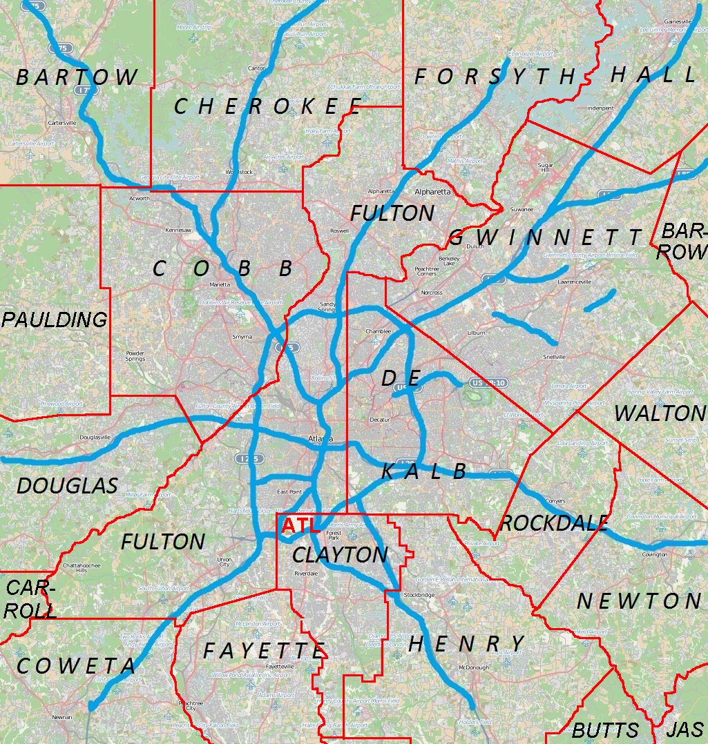
Panthersville is located at 33°42′20″N 84°16′43″W (33.705639, -84.278551).[6] The Candler-McAfee CDP is to the north and Gresham Park CDP is to the west.
According to the United States Census Bureau, the CDP has a total area of 3.7 square miles (9.6 km2), of which 0.27% is water.
Demographics
| Historical population | |||
|---|---|---|---|
| Census | Pop. | %± | |
| 2020 | 11,237 | — | |
| U.S. Decennial Census[7] | |||
2020 census
| Race | Num. | Perc. |
|---|---|---|
| White (non-Hispanic) | 359 | 3.19% |
| Black or African American (non-Hispanic) | 10,197 | 90.74% |
| Native American | 21 | 0.19% |
| Asian | 57 | 0.51% |
| Pacific Islander | 4 | 0.04% |
| Other/Mixed | 294 | 2.62% |
| Hispanic or Latino | 305 | 2.71% |
As of the 2020 United States census, there were 11,237 people, 4,036 households, and 2,251 families residing in the CDP.
2000 census
As of the census[2] of 2000, there were 11,791 people, 4,150 households, and 2,963 families living in the CDP. The population density was 3,162.0 inhabitants per square mile (1,220.9/km2). There were 4,321 housing units at an average density of 1,158.8 per square mile (447.4/km2). The racial makeup of the CDP was 1.91% White, 96.34% African American, 0.16% Native American, 0.20% Asian, 0.05% Pacific Islander, 0.31% from other races, and 1.02% from two or more races. Hispanic or Latino of any race were 1.19% of the population.
There were 4,150 households, out of which 38.7% had children under the age of 18 living with them, 33.3% were married couples living together, 31.9% had a female householder with no husband present, and 28.6% were non-families. 23.2% of all households were made up of individuals, and 2.0% had someone living alone who was 65 years of age or older. The average household size was 2.83 and the average family size was 3.31.
In the CDP, the population was spread out, with 30.1% under the age of 18, 12.0% from 18 to 24, 32.9% from 25 to 44, 21.0% from 45 to 64, and 4.0% who were 65 years of age or older. The median age was 29 years. For every 100 females, there were 85.1 males. For every 100 females age 18 and over, there were 77.3 males.
The median income for a household in the CDP was $38,590, and the median income for a family was $43,363. Males had a median income of $30,836 versus $26,602 for females. The per capita income for the CDP was $16,935. About 7.7% of families and 10.1% of the population were below the poverty line, including 15.2% of those under age 18 and 8.2% of those age 65 or over.
Economy
Panthersville is home to the Gallery at South DeKalb, formerly South DeKalb Mall, a regional shopping center with a Macy's (former Rich's) department store. The former JC Penney now houses independent stores such as Super Beauty and Conway.
The CDP is the headquarters for the Georgia Bureau of Investigation,[9] and for Georgia Regional Hospital state psychiatric ward.[10]
Education
The CDP is incorporated within the DeKalb County Public Schools zone:[11]
- Elementary schools: Barack H. Obama EMST (in the CDP), Flat Shoals (in the CDP), and Columbia (outside of the CDP)[12]
- Middle schools: Ronald E. McNair (most) and Columbia (some) (outside of the CDP)[13]
- High schools: Ronald E. McNair High School (most) and Columbia High School (some) (both outside of the CDP)[14]
References
- "2020 U.S. Gazetteer Files". United States Census Bureau. Retrieved December 18, 2021.
- "U.S. Census website". United States Census Bureau. Retrieved 2008-01-31.
- "US Board on Geographic Names". United States Geological Survey. 2007-10-25. Retrieved 2008-01-31.
- "Race, Hispanic or Latino, Age, and Housing Occupancy: 2010 Census Redistricting Data (Public Law 94-171) Summary File (QT-PL), Panthersville CDP, Georgia". United States Census Bureau. Retrieved October 28, 2011.
- Krakow, Kenneth K. (1975). Georgia Place-Names: Their History and Origins (PDF). Macon, GA: Winship Press. p. 171. ISBN 0-915430-00-2.
- "US Gazetteer files: 2010, 2000, and 1990". United States Census Bureau. 2011-02-12. Retrieved 2011-04-23.
- "Census of Population and Housing". Census.gov. Retrieved June 4, 2016.
- "Explore Census Data". data.census.gov. Retrieved 2021-12-13.
- "Contact Us | Georgia Bureau of Investigation".
- "Georgia Regional Hospital, Decatur, eventseeker".
- "2010 CENSUS - CENSUS BLOCK MAP: Panthersville CDP, GA" (PDF). U.S. Census Bureau. Retrieved 2020-05-07. - Compare with school addresses and boundary maps.
- "Elementary School Attendance Areas 2016 - 2017 School Year." DeKalb County School System. Retrieved on June 1, 2017.
- "Middle School Attendance Areas 2016 - 2017 School Year." DeKalb County School System. Retrieved on June 1, 2017.
- "High School Attendance Areas 2016 - 2017 School Year." DeKalb County School System. Retrieved on June 1, 2017.
Metro Atlanta | ||||||
|---|---|---|---|---|---|---|
|  | |||||
|
| ||||||
Municipalities and communities of DeKalb County, Georgia, United States | ||
|---|---|---|
County seat: Decatur | ||
| Cities |  | |
| CDPs | ||
| Neighborhoods and unincorporated communities |
| |
| Ghost town |
| |
| Footnotes | ‡This populated place also has portions in an adjacent county or counties | |
| ||
Другой контент может иметь иную лицензию. Перед использованием материалов сайта WikiSort.org внимательно изучите правила лицензирования конкретных элементов наполнения сайта.
WikiSort.org - проект по пересортировке и дополнению контента Википедии