world.wikisort.org - USA
Ortonville is a city in Big Stone County in the U.S. state of Minnesota at the southern tip of Big Stone Lake, along the border with South Dakota. The population was 2,021 at the 2020 census.[4] It is the county seat of Big Stone County.[5] Big Stone Lake State Park is nearby.
Ortonville, Minnesota | |
|---|---|
City | |
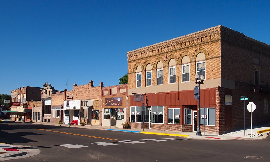 Ortonville's historic downtown | |
 Location of Ortonville within Big Stone County, Minnesota | |
| Coordinates: 45°18′21″N 96°26′38″W | |
| Country | United States |
| State | Minnesota |
| Counties | Big Stone |
| Area | |
| • Total | 4.90 sq mi (12.68 km2) |
| • Land | 4.19 sq mi (10.86 km2) |
| • Water | 0.70 sq mi (1.82 km2) |
| Elevation | 1,017 ft (310 m) |
| Population (2020) | |
| • Total | 2,021 |
| • Density | 481.99/sq mi (186.12/km2) |
| Time zone | UTC-6 (Central (CST)) |
| • Summer (DST) | UTC-5 (CDT) |
| ZIP code | 56278 |
| Area code | 320 |
| FIPS code | 27-48706[2] |
| GNIS feature ID | 0649005[3] |
| Website | mnortonville.com |
History
Ortonville was platted in 1872 by Cornelius Knute Orton, and named for him.[6] Ortonville was incorporated as a city in 1881.[6] The Big Stone County Courthouse was built in 1902.
Geography
According to the United States Census Bureau, the city has a total area of 3.56 square miles (9.22 km2), of which 3.51 square miles (9.09 km2) is land and 0.05 square miles (0.13 km2) is water.[7]
U.S. Highways 12 and 75 bypass the city and a state highway, Minnesota State Highway 7 are three of the main routes in the city.
Demographics
| Historical population | |||
|---|---|---|---|
| Census | Pop. | %± | |
| 1890 | 768 | — | |
| 1900 | 1,247 | 62.4% | |
| 1910 | 1,774 | 42.3% | |
| 1920 | 1,758 | −0.9% | |
| 1930 | 2,017 | 14.7% | |
| 1940 | 2,469 | 22.4% | |
| 1950 | 2,577 | 4.4% | |
| 1960 | 2,674 | 3.8% | |
| 1970 | 2,665 | −0.3% | |
| 1980 | 2,550 | −4.3% | |
| 1990 | 2,205 | −13.5% | |
| 2000 | 2,158 | −2.1% | |
| 2010 | 1,916 | −11.2% | |
| 2020 | 2,021 | 5.5% | |
| U.S. Decennial Census[8] 2020 Census[4] | |||

2010 census
As of the census[9] of 2010, there were 1,916 people, 884 households, and 509 families living in the city. The population density was 545.9 inhabitants per square mile (210.8/km2). There were 1,090 housing units at an average density of 310.5 per square mile (119.9/km2). The racial makeup of the city was 97.0% White, 0.3% African American, 0.6% Native American, 0.1% Asian, 0.7% from other races, and 1.3% from two or more races. Hispanic or Latino of any race were 1.0% of the population.
There were 884 households, of which 22.5% had children under the age of 18 living with them, 45.5% were married couples living together, 8.7% had a female householder with no husband present, 3.4% had a male householder with no wife present, and 42.4% were non-families. 38.6% of all households were made up of individuals, and 21.2% had someone living alone who was 65 years of age or older. The average household size was 2.07 and the average family size was 2.71.
The median age in the city was 49.8 years. 19.7% of residents were under the age of 18; 6.2% were between the ages of 18 and 24; 18.5% were from 25 to 44; 26.7% were from 45 to 64; and 28.8% were 65 years of age or older. The gender makeup of the city was 46.5% male and 53.5% female.
2000 census
As of the census[2] of 2000, there were 2,158 people, 923 households, and 594 families living in the city. The population density was 635.8 people per square mile (245.8/km2). There were 1,125 housing units at an average density of 331.4 per square mile (128.1/km2). The racial makeup of the city was 97.68% White, 0.42% African American, 0.88% Native American, 0.09% Asian, 0.28% from other races, and 0.65% from two or more races. Hispanic or Latino of any race were 0.56% of the population.
There were 923 households, out of which 28.1% had children under the age of 18 living with them, 54.0% were married couples living together, 8.0% had a female householder with no husband present, and 35.6% were non-families. 33.6% of all households were made up of individuals, and 20.4% had someone living alone who was 65 years of age or older. The average household size was 2.25 and the average family size was 2.88.
In the city, the population was spread out, with 23.9% under the age of 18, 5.1% from 18 to 24, 20.2% from 25 to 44, 24.6% from 45 to 64, and 26.1% who were 65 years of age or older. The median age was 45 years. For every 100 females, there were 84.6 males. For every 100 females age 18 and over, there were 79.8 males.
The median income for a household in the city was $30,614, and the median income for a family was $39,375. Males had a median income of $30,590 versus $20,179 for females. The per capita income for the city was $17,132. About 7.2% of families and 9.2% of the population were below the poverty line, including 9.5% of those under age 18 and 10.1% of those age 65 or over.
Politics
| Year | Republican | Democratic | Third parties |
|---|---|---|---|
| 2020 | 60.0% 648 | 37.4% 404 | 2.6% 28 |
| 2016 | 60.5% 617 | 31.9% 325 | 7.6% 77 |
| 2012 | 52.6% 535 | 45.9% 467 | 1.5% 16 |
| 2008 | 50.0% 545 | 48.0% 523 | 2.0% 21 |
| 2004 | 54.9% 628 | 43.3% 495 | 1.8% 20 |
| 2000 | 50.4% 545 | 42.9% 464 | 6.7% 72 |
Education
Public schools in independent district 2903 (Ortonville Public School) include Ortonville Secondary School and James Knoll Elementary School. The schools are housed in one building, making the public education in Ortonville K-12. The athletic teams in Ortonville are called the Trojans, and the school's colors are orange and black. There are no private schools in this district.[16]
The Ortonville Public Library is a part of the Pioneerland Library System.[17]
There is no University in Ortonville, but high school students are able to take college level courses through the public high school via the College in the Schools program.
Media
Newspaper
The Ortonville Independent is a weekly newspaper published in Ortonville on Tuesday. It has a circulation of 1911 in 2019 and is owned by the Kaercher Group.[18]
AM radio
| AM radio stations | |||||
|---|---|---|---|---|---|
| Frequency | Call sign | Name | Format | Owner | City |
| 1350 AM | KDIO | Real Country | Country | Armada Media | Ortonville |
FM radio
| FM radio stations | ||||||
|---|---|---|---|---|---|---|
| Frequency | Call sign | Name | Format | Owner | Target city/market | City of license |
| 101.5 FM | KCGN | Praise FM | Contemporary Christian | Christian Heritage Broadcasting | Ortonville | Ortonville |
| 106.3 FM | KPHR | Power 106.3 | Classic Rock | Armada Media | Watertown | Ortonville |
Notable people
- Samuel Russell Barr, Minnesota state legislator
- Agnes Gardner Eyre, pianist and composer
- Sarah Hart (née Gengler), a perpetrator of the Hart family murders; 1997 Ortonville High School graduate (from neighboring Big Stone City, SD).
- Dan Jurgens, comic book writer and artist, known for his work on the Superman comic books
- Edwin Joseph Martinson, member of the Minnesota House of Representatives
- Liz Olson, member of the Minnesota House of Representatives
- Mike Hunt (American football), former professional American football player.[19]
References
- "2020 U.S. Gazetteer Files". United States Census Bureau. Retrieved July 24, 2022.
- "U.S. Census website". United States Census Bureau. Retrieved January 31, 2008.
- "US Board on Geographic Names". United States Geological Survey. October 25, 2007. Retrieved January 31, 2008.
- "2020 Census Redistricting Data (Public Law 94-171) Summary File". American FactFinder. United States Census Bureau. Retrieved May 1, 2022.
- "Find a County". National Association of Counties. Retrieved June 7, 2011.
- Upham, Warren (1920). Minnesota Geographic Names: Their Origin and Historic Significance. Minnesota Historical Society. p. 55.
- "US Gazetteer files 2010". United States Census Bureau. Archived from the original on January 25, 2012. Retrieved November 13, 2012.
- "U.S. Decennial Census". Census.gov. Retrieved March 25, 2015.
- "U.S. Census website". United States Census Bureau. Retrieved November 13, 2012.
- "Minnesota Secretary of State - 2020 Precinct Results Spreadsheet".
- "Minnesota Secretary of State - 2016 Precinct Results Spreadsheet".
- "Minnesota Secretary of State - 2012 Precinct Results Spreadsheet".
- "Minnesota Secretary of State - 2008 Precinct Results Spreadsheet".
- "Minnesota Secretary of State - 2004 Precinct Results Spreadsheet".
- "Minnesota Secretary of State - 2000 Precinct Results Spreadsheet".
- "Ortonville Public School". www.ortonville.k12.mn.us. Retrieved May 28, 2016.
- "Ortonville Public Library". www.ortonville.lib.mn.us. Retrieved May 28, 2016.
- "Ortonville Independetn, Minnesota Newspaper Directory" (PDF). Minnesota Newspaper Association. Retrieved January 30, 2020.
- "Linebacker Mike Hunt's career ended by concussion".
External links
Municipalities and communities of Big Stone County, Minnesota, United States | ||
|---|---|---|
County seat: Ortonville | ||
| Cities |  | |
| Townships | ||
| Unincorporated communities | ||
| ||
| Authority control |
|
|---|
На других языках
[de] Ortonville (Minnesota)
Ortonville ist eine Kleinstadt (mit dem Status „City“) und Verwaltungssitz des Big Stone County im Westen des US-amerikanischen Bundesstaates Minnesota. Ein kleiner Teil des Stadtgebiets erstreckt sich bis in das Lac qui Parle County. Im Jahr 2010 hatte Ortonville 1916 Einwohner.[1]- [en] Ortonville, Minnesota
[ru] Ортонвилл (город, Миннесота)
Ортонвилл (англ. Ortonville) — город в округах Биг-Стон,Лак-ки-Парл, штат Миннесота, США. На площади 8,9 км² (8,8 км² — суша, 0,1 км² — вода), согласно переписи 2002 года, проживают 2158 человек. Плотность населения составляет 245,5 чел./км².Другой контент может иметь иную лицензию. Перед использованием материалов сайта WikiSort.org внимательно изучите правила лицензирования конкретных элементов наполнения сайта.
WikiSort.org - проект по пересортировке и дополнению контента Википедии