world.wikisort.org - USA
Olmstead is an unincorporated community in Logan County, Kentucky, United States.[1]
Olmstead, Kentucky | |
|---|---|
Unincorporated community | |
 Olmstead  Olmstead | |
| Coordinates: 36°45′8″N 87°00′54″W | |
| Country | United States |
| State | Kentucky |
| County | Logan |
| Elevation | 581 ft (177 m) |
| Time zone | UTC-6 (Central (CST)) |
| • Summer (DST) | UTC-5 (CDT) |
| GNIS feature ID | 499937[1] |
Olmstead was a station on the L & N railroad between Bowling Green, KY and Clarksville, TN that opened in 1860. It was named after a leader in the effort to build the railroad.[2] Olmstead is also the site of an elementary and middle school.[3] A post office has been in operation until recently in Olmstead since 1862.[4]
It is the location of, or nearest community to, Cedar Grove Rosenwald School which was a historic Rosenwald School built in 1928. The school is listed on the National Register of Historic Places.[5]
References
- "Olmstead". Geographic Names Information System. United States Geological Survey, United States Department of the Interior.
- The Heavens are Weeping-The Diaries of George Dick Browder.
- Collins, Lewis (1877). History of Kentucky. p. 480.
- "Logan County". Jim Forte Postal History. Retrieved 18 January 2015.
- "National Register Information System". National Register of Historic Places. National Park Service. July 9, 2010.
Municipalities and communities of Logan County, Kentucky, United States | ||
|---|---|---|
County seat: Russellville | ||
| Cities | 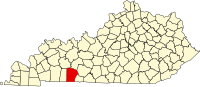 | |
| CDP | ||
| Other unincorporated communities |
| |
| Footnotes | ‡This populated place also has portions in an adjacent county or counties | |
| ||
This Logan County, Kentucky state location article is a stub. You can help Wikipedia by expanding it. |
Текст в блоке "Читать" взят с сайта "Википедия" и доступен по лицензии Creative Commons Attribution-ShareAlike; в отдельных случаях могут действовать дополнительные условия.
Другой контент может иметь иную лицензию. Перед использованием материалов сайта WikiSort.org внимательно изучите правила лицензирования конкретных элементов наполнения сайта.
Другой контент может иметь иную лицензию. Перед использованием материалов сайта WikiSort.org внимательно изучите правила лицензирования конкретных элементов наполнения сайта.
2019-2026
WikiSort.org - проект по пересортировке и дополнению контента Википедии
WikiSort.org - проект по пересортировке и дополнению контента Википедии