world.wikisort.org - USA
Dot is an unincorporated community located in Logan County, Kentucky, United States.
Dot, Kentucky | |
|---|---|
Unincorporated community | |
 Dot Location in Kentucky  Dot Location in the United States | |
| Coordinates: 36°40′40″N 86°57′9″W | |
| Country | United States |
| State | Kentucky |
| County | Logan |
| Elevation | 522 ft (159 m) |
| Time zone | UTC-5 (Eastern (EST)) |
| • Summer (DST) | UTC-4 (EDT) |
| GNIS feature ID | 491028[1] |
The origin of the name "Dot" is obscure.[2]
On February 24, 2018, the community was struck by an EF-2 Tornado.[3] One person, an elderly woman, was killed. The tornado was part of a larger weather system that brought several other tornadoes to portions of Arkansas, Missouri, Ohio, and Tennessee, along with major flooding to portions of the Mississippi and Ohio Valleys.[4][5]
References
- U.S. Geological Survey Geographic Names Information System: Dot, Kentucky
- Moyer, Armond; Moyer, Winifred (1958). The origins of unusual place-names. Keystone Pub. Associates. p. 141.
- Louisville, N. W. S. (2018-02-25). "Preliminary information from an ongoing damage survey in southern Logan county: EF-2 with max winds 135 mph. Max width 400 yards. #lmkwx #kywx". @NWSLouisville. Retrieved 2018-02-25.
- "Severe Storms, Possible Tornadoes Strike the Mid-South; At Least 2 Dead | The Weather Channel". The Weather Channel. Retrieved 2018-02-25.
- "4 killed across 3 southern states following reported tornadoes". ABC News. 2018-02-25. Retrieved 2018-02-25.
Municipalities and communities of Logan County, Kentucky, United States | ||
|---|---|---|
County seat: Russellville | ||
| Cities | 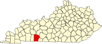 | |
| CDP | ||
| Other unincorporated communities |
| |
| Footnotes | ‡This populated place also has portions in an adjacent county or counties | |
| ||
This Logan County, Kentucky state location article is a stub. You can help Wikipedia by expanding it. |
Текст в блоке "Читать" взят с сайта "Википедия" и доступен по лицензии Creative Commons Attribution-ShareAlike; в отдельных случаях могут действовать дополнительные условия.
Другой контент может иметь иную лицензию. Перед использованием материалов сайта WikiSort.org внимательно изучите правила лицензирования конкретных элементов наполнения сайта.
Другой контент может иметь иную лицензию. Перед использованием материалов сайта WikiSort.org внимательно изучите правила лицензирования конкретных элементов наполнения сайта.
2019-2026
WikiSort.org - проект по пересортировке и дополнению контента Википедии
WikiSort.org - проект по пересортировке и дополнению контента Википедии