world.wikisort.org - USA
North Platte is a city in and the county seat of Lincoln County, Nebraska, United States.[4] It is located in the west-central part of the state, along Interstate 80, at the confluence of the North and South Platte Rivers forming the Platte River. The population was 23,390 at the 2020 census.[5]
North Platte, Nebraska | |
|---|---|
City | |
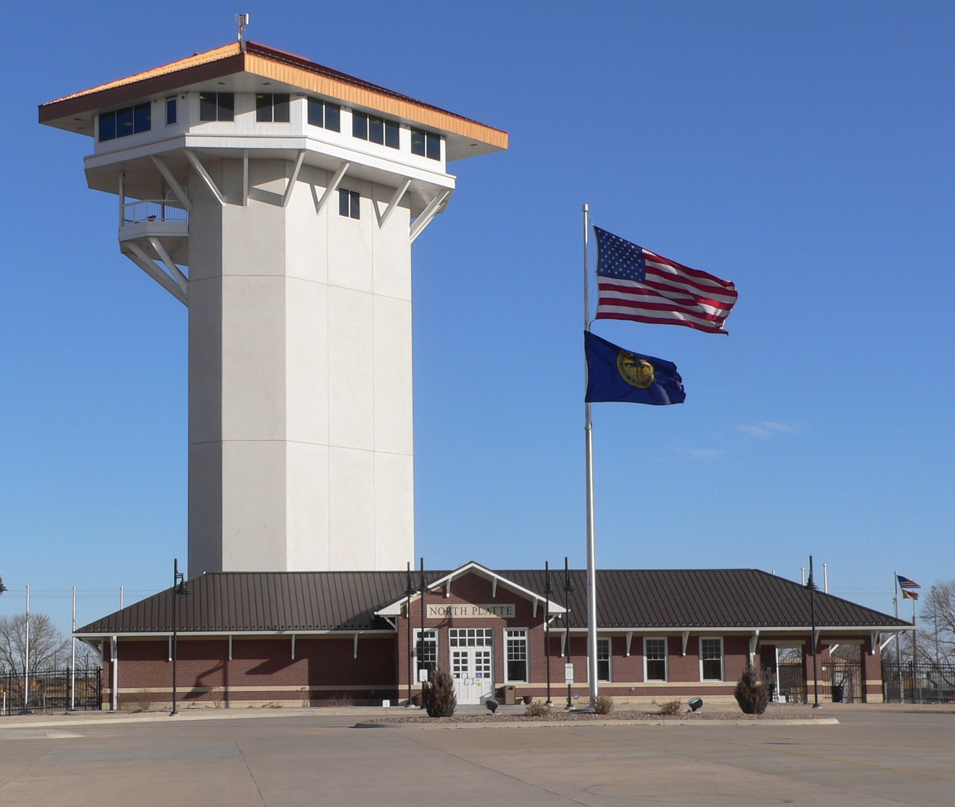 Golden Spike Tower and visitor center at Union Pacific's Bailey Yards | |
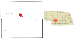 Location of North Platte within Lincoln County and Nebraska | |
| Coordinates: 41.136°N 100.763°W | |
| Country | United States |
| State | Nebraska |
| County | Lincoln |
| Government | |
| • Mayor | Brandon Kelliher[1] |
| Area | |
| • Total | 13.71 sq mi (35.50 km2) |
| • Land | 13.52 sq mi (35.02 km2) |
| • Water | 0.19 sq mi (0.48 km2) |
| Elevation | 2,802 ft (854 m) |
| Population (2020) | |
| • Total | 23,390 |
| • Density | 1,729.90/sq mi (667.93/km2) |
| Time zone | UTC−6 (Central (CST)) |
| • Summer (DST) | UTC−5 (CDT) |
| ZIP codes | 69101, 69103 |
| Area code | 308 |
| FIPS code | 31-35000 |
| GNIS feature ID | 0831719[3] |
| Website | www |
North Platte is a railroad town; Union Pacific Railroad's large Bailey Yard is located within the city. Today, North Platte is served only by freight trains, but during World War II the city was known for the North Platte Canteen, a volunteer organization serving food to millions of traveling soldiers.
North Platte is the principal city of the North Platte Micropolitan Statistical Area, which includes Lincoln, Logan, and McPherson counties.
History
This section needs expansion with: Some things in the history section that are mentioned but could be expanded upon are:
|
North Platte was established in 1866 when the Union Pacific Railroad was extended to that point.[6] It derives its name from the North Platte River.[7][8]
North Platte was the western terminus of the Union Pacific Railway from the summer of 1867 until the next section to Laramie, Wyoming, was opened the following summer. Even though Congress had authorized the building of the Transcontinental Railroad in 1862, it had been extended only as far as Nebraska City by the start of the summer of 1867. The 275-mile (443 km) section from Nebraska City to North Platte was completed in less than six weeks.[citation needed]

In the 1880s, Buffalo Bill Cody established his ranch, known as Scout's Rest Ranch, just north of town. It is now a National Historic Landmark.[9]
On July 13, 1929, a black man shot and killed a white police officer. The black man reportedly took his own life, being trapped by a mob.[10][11] This led to the formation of white mobs combing the city, and ordering black residents to leave North Platte. Fearing mob violence, most of North Platte's black residents fled.[12]
| External video | |
|---|---|
The North Platte Canteen was one of the largest volunteer efforts of World War II, originating in 1941.[13][14] Tens of thousands of volunteers from North Platte and surrounding towns met the troop trains passing through North Platte, offering coffee, sandwiches, dessert, and hospitality to nearly seven million servicemen.[15][16]
Geography
According to the United States Census Bureau, the city has a total area of 13.39 square miles (34.68 km2), of which 13.20 square miles (34.19 km2) is land and 0.19 square miles (0.49 km2) is water.[17]
Climate
North Platte experiences a dry continental climate similar to that of the Nebraska High Plains, classified as hot-summer humid continental (Köppen Dwa), and, with an annual average precipitation of 21.08 inches (535 mm), barely avoids semi-arid classification; it is part of USDA Hardiness zone 5a.[18] The normal monthly mean temperature ranges from 26.3 °F (−3.2 °C) in January to 75.6 °F (24.2 °C) in July.[19] On an average year, there are 3.8 afternoons that reach 100 °F (37.8 °C) or higher, 39 afternoons that reach 90 °F (32.2 °C) or higher, 31.4 afternoons that do not climb above freezing, and 12.2 mornings with a low of 0 °F (−17.8 °C) or below.[19] The average window for freezing temperatures is September 30 thru May 13,[19] allowing a growing season of 139 days. Extreme temperatures officially range from −35 °F (−37.2 °C) on January 15, 1888 and February 12, 1899, up to 112 °F (44.4 °C) on July 11, 1954; the record cold daily maximum is −15 °F (−26.1 °C) on January 14, 1888, while, conversely, the record warm daily minimum is 80 °F (26.7 °C) on July 25, 1940.[19]
Precipitation is greatest in May and June and has ranged from 10.01 inches (254.3 mm) in 1931 to 33.44 inches (849.4 mm) in 1951.[19] Snowfall averages 29.6 inches (0.75 m) per season, and has historically ranged from 3.0 inches (0.08 m) in 1903–04 to 66.3 inches (1.68 m) in 1979–80;[19] the average window for measurable (≥0.1 inches or 0.0025 metres) snowfall is November 1 thru April 12, with May and October snow being rare.[19]
| Climate data for North Platte Regional Airport, Nebraska (1991–2020 normals,[lower-alpha 1] extremes 1874–present)[lower-alpha 2] | |||||||||||||
|---|---|---|---|---|---|---|---|---|---|---|---|---|---|
| Month | Jan | Feb | Mar | Apr | May | Jun | Jul | Aug | Sep | Oct | Nov | Dec | Year |
| Record high °F (°C) | 74 (23) |
79 (26) |
91 (33) |
98 (37) |
99 (37) |
108 (42) |
112 (44) |
108 (42) |
105 (41) |
96 (36) |
87 (31) |
76 (24) |
112 (44) |
| Mean maximum °F (°C) | 63 (17) |
67 (19) |
78 (26) |
85 (29) |
90 (32) |
97 (36) |
101 (38) |
98 (37) |
95 (35) |
86 (30) |
74 (23) |
64 (18) |
102 (39) |
| Average high °F (°C) | 40.7 (4.8) |
43.9 (6.6) |
55.2 (12.9) |
63.2 (17.3) |
72.8 (22.7) |
84.0 (28.9) |
89.7 (32.1) |
87.2 (30.7) |
80.0 (26.7) |
66.0 (18.9) |
52.6 (11.4) |
42.0 (5.6) |
64.8 (18.2) |
| Daily mean °F (°C) | 26.3 (−3.2) |
29.4 (−1.4) |
39.6 (4.2) |
48.2 (9.0) |
58.5 (14.7) |
69.7 (20.9) |
75.6 (24.2) |
73.0 (22.8) |
64.2 (17.9) |
50.2 (10.1) |
37.0 (2.8) |
27.5 (−2.5) |
49.9 (9.9) |
| Average low °F (°C) | 11.9 (−11.2) |
14.8 (−9.6) |
23.9 (−4.5) |
33.2 (0.7) |
44.2 (6.8) |
55.4 (13.0) |
61.4 (16.3) |
58.8 (14.9) |
48.3 (9.1) |
34.3 (1.3) |
21.4 (−5.9) |
13.1 (−10.5) |
35.1 (1.7) |
| Mean minimum °F (°C) | −8 (−22) |
−5 (−21) |
5 (−15) |
17 (−8) |
28 (−2) |
41 (5) |
50 (10) |
47 (8) |
32 (0) |
17 (−8) |
4 (−16) |
−5 (−21) |
−15 (−26) |
| Record low °F (°C) | −35 (−37) |
−35 (−37) |
−25 (−32) |
−3 (−19) |
18 (−8) |
29 (−2) |
39 (4) |
35 (2) |
17 (−8) |
4 (−16) |
−25 (−32) |
−34 (−37) |
−35 (−37) |
| Average precipitation inches (mm) | 0.39 (9.9) |
0.57 (14) |
1.00 (25) |
2.29 (58) |
3.35 (85) |
3.54 (90) |
3.18 (81) |
2.56 (65) |
1.61 (41) |
1.65 (42) |
0.49 (12) |
0.45 (11) |
21.08 (535) |
| Average snowfall inches (cm) | 5.1 (13) |
6.9 (18) |
4.2 (11) |
3.6 (9.1) |
0.0 (0.0) |
0.0 (0.0) |
0.0 (0.0) |
0.0 (0.0) |
0.1 (0.25) |
2.2 (5.6) |
3.0 (7.6) |
4.5 (11) |
29.6 (75) |
| Average extreme snow depth inches (cm) | 4 (10) |
4 (10) |
3 (7.6) |
2 (5.1) |
0 (0) |
0 (0) |
0 (0) |
0 (0) |
0 (0) |
1 (2.5) |
2 (5.1) |
3 (7.6) |
7 (18) |
| Average precipitation days (≥ 0.01 in) | 4.4 | 5.3 | 6.5 | 9.0 | 11.5 | 10.8 | 10.2 | 8.9 | 6.7 | 6.8 | 4.2 | 3.7 | 88.0 |
| Average snowy days (≥ 0.1 in) | 4.3 | 4.3 | 3.4 | 2.2 | 0.1 | 0.0 | 0.0 | 0.0 | 0.1 | 0.9 | 2.1 | 3.6 | 21.0 |
| Average relative humidity (%) | 69.3 | 68.2 | 64.4 | 59.6 | 63.3 | 63.9 | 63.0 | 64.1 | 63.8 | 61.5 | 66.9 | 69.6 | 64.8 |
| Mean monthly sunshine hours | 185.0 | 180.2 | 227.4 | 257.5 | 290.8 | 322.9 | 352.9 | 319.2 | 259.5 | 236.2 | 174.0 | 170.0 | 2,975.6 |
| Percent possible sunshine | 62 | 60 | 61 | 64 | 65 | 71 | 77 | 75 | 69 | 69 | 59 | 59 | 67 |
| Source: NOAA (relative humidity and sun 1961–1990)[19][21][22] | |||||||||||||
Demographics
| Historical population | |||
|---|---|---|---|
| Census | Pop. | %± | |
| 1880 | 363 | — | |
| 1890 | 3,055 | 741.6% | |
| 1900 | 3,640 | 19.1% | |
| 1910 | 4,793 | 31.7% | |
| 1920 | 10,466 | 118.4% | |
| 1930 | 12,061 | 15.2% | |
| 1940 | 12,429 | 3.1% | |
| 1950 | 15,433 | 24.2% | |
| 1960 | 17,184 | 11.3% | |
| 1970 | 19,447 | 13.2% | |
| 1980 | 24,509 | 26.0% | |
| 1990 | 22,605 | −7.8% | |
| 2000 | 23,878 | 5.6% | |
| 2010 | 24,733 | 3.6% | |
| 2020 | 23,390 | −5.4% | |
| U.S. Decennial Census[23] | |||
2010 census
As of the census[24] of 2010, there were 24,733 people, 10,560 households, and 6,290 families residing in the city. The population density was 1,873.7 inhabitants per square mile (723.4/km2). There were 11,450 housing units at an average density of 867.4 per square mile (334.9/km2). The racial makeup of the city was 93.1% White, 1.0% African American, 0.7% Native American, 0.7% Asian, 2.8% from other races, and 1.7% from two or more races. Hispanic or Latino of any race were 8.8% of the population.
There were 10,560 households, of which 30.4% had children under the age of 18 living with them, 44.5% were married couples living together, 10.7% had a female householder with no husband present, 4.3% had a male householder with no wife present, and 40.4% were non-families. 34.8% of all households were made up of individuals, and 13.9% had someone living alone who was 65 years of age or older. The average household size was 2.29 and the average family size was 2.95.
The median age in the city was 37.1 years. 24.9% of residents were under the age of 18; 9% were between the ages of 18 and 24; 25% were from 25 to 44; 25.6% were from 45 to 64; and 15.5% were 65 years of age or older. The gender makeup of the city was 48.8% male and 51.2% female.
2000 census
As of the census of 2000, there were 23,878 people, 9,944 households, and 6,224 families residing in the city. The population density was 2,281.5 people per square mile (880.5/km2). There were 10,718 housing units at an average density of 1,024.1 per square mile (395.2/km2). The racial makeup of the city was 93.47% White, 0.71% African American, 0.64% Native American, 0.39% Asian, 0.03% Pacific Islander, 3.30% from other races, and 1.45% from two or more races. Hispanic or Latino of any race were 6.68% of the population.
There were 9,944 households, out of which 31.0% had children under the age of 18 living with them, 49.8% were married couples living together, 9.6% had a female householder with no husband present, and 37.4% were non-families. 31.9% of all households were made up of individuals, and 13.0% had someone living alone who was 65 years of age or older. The average household size was 2.34 and the average family size was 2.97.
In the city, the population was spread out, with 26.0% under the age of 18, 9.5% from 18 to 24, 26.8% from 25 to 44, 21.9% from 45 to 64, and 15.8% who were 65 years of age or older. The median age was 36 years. For every 100 females, there were 94.5 males. For every 100 females age 18 and over, there were 90.0 males.
As of 2000 the median income for a household in the city was $34,181, and the median income for a family was $42,753. Males had a median income of $36,445 versus $20,157 for females. The per capita income for the city was $18,306. About 7.8% of families and 10.5% of the population were below the poverty line, including 13.2% of those under age 18 and 9.8% of those age 65 or over.
Arts and culture
Lincoln County Historical Museum contains a display detailing the history of the North Platte Canteen. It also contains a Prairie Village with local landmark homes and other buildings, including a Pony Express station and pioneer church among many others.[25]
Buffalo Bill Ranch State Historical Park is located near North Platte, a Nebraska living history park about "Buffalo Bill" Cody. The park includes his actual house known as Scout's Rest Ranch. The park is two miles west of U.S. Highway 83 along U.S. Highway 30.[26]
Every June, North Platte hosts the annual "Nebraskaland Days". The event includes parades, art shows, rodeos, concerts, and food events. It draws over 100,000 attendees every year.[27]
North Platte is host to the annual Miss Nebraska pageant, an official preliminary for the Miss America Organization.[28]
Infrastructure

Transportation
North Platte is home to the world's largest rail yard, Bailey Yard. The Golden Spike Tower and Visitor Center is an eight-story building which overlooks the expansive classification yard and engine facilities. The tower and visitor center are open to the public year-round.[29] Passenger train service was discontinued in 1971.[30]
North Platte is home to North Platte Regional Airport. United Express serves the airport with twice-daily service to Denver International Airport. There is also a door-to-door bus system available for residents of the town.[31]
Media
Notable people
This section needs additional citations for verification. (October 2012) |
- Chris Başak, baseball infielder was born in North Platte. He played in the New York Mets, Minnesota Twins and New York Yankees organizations. He made five appearances in the major leagues in 2007 with the Yankees, going 0-for-1.
- Howard Baskerville, American teacher in the Presbyterian mission school in Tabriz, Iran; born in North Platte. He was killed defending the Constitutional Revolution of Iran and known as "American Martyr of the Constitutional Revolution."
- Buffalo Bill Cody, iconic Wild West showman, owned a ranch in North Platte.[32]
- Nathan Enderle, football quarterback, selected by the Chicago Bears in the fifth round of the 2011 NFL Draft; born in North Platte and attended North Platte High School.[33]
- Paul Faulkner (1913–1997), artist; born in North Platte.[34]
- Chuck Hagel, Nebraska U.S. Senator and U.S. Secretary of Defense; born in North Platte.[35]
- Bill Hayes, baseball player, lived in North Platte and attended Saint Patrick's High School.
- Henry Hill (1943–2012), New York City mobster; worked as a cook in North Platte.
- John Howell, former American football safety in the National Football League, played for the Tampa Bay Buccaneers and Seattle Seahawks; born in North Platte.[36]
- Glenn Miller, popular big band leader; lived in North Platte for one year during his early childhood.[37]
- Keith Neville, 18th governor of Nebraska; born in North Platte.[38]
- Joe Ragland (born 1989), American-Liberian basketball player for Hapoel Holon of the Israeli Basketball Premier League
- Red Cloud, Sioux warrior; born near North Platte in 1822.[39]
- Dr. Don Rose, San Francisco Bay Area disc jockey; born and raised in North Platte and frequently referred to the city on his morning show.
- Ryan Schultz, professional mixed martial artist, Lightweight Champion of defunct IFL; raised in North Platte.[40]
- Zane Smith, professional baseball player, was a two-sport athlete for North Platte 1978-79, before spending 13 years in major league baseball.[41]
- Danny Woodhead, retired NFL running back; born in North Platte and attended North Platte High School.[42]
See also
- National Register of Historic Places in Lincoln County, Nebraska
Explanatory notes
- Mean monthly maxima and minima (i.e. the expected highest and lowest temperature readings at any point during the year or given month) calculated based on data at said location from 1991 to 2020.
- Official records for North Platte kept at downtown from September 1874 to December 1947 and at North Platte Regional Airport since January 1948.[20]
References
- von Kampen, Todd (November 3, 2020). "Brandon Kelliher wins North Platte mayoral contest". The North Platte Telegraph.
- "ArcGIS REST Services Directory". United States Census Bureau. Retrieved September 18, 2022.
- "US Board on Geographic Names". United States Geological Survey. 2007-10-25. Retrieved 2008-01-31.
- "Find a County". National Association of Counties. Retrieved 2011-06-07.
- "Explore Census Data". data.census.gov. Retrieved 2021-09-20.
- "North Platte, Lincoln County". Center for Advanced Land Management Information Technologies. University of Nebraska. Archived from the original on 19 August 2014. Retrieved 19 August 2014.
- "Profile for North Platte, NE". ePodunk. Archived from the original on 20 August 2014. Retrieved 19 August 2014.
- Fitzpatrick, Lillian L. (1960). Nebraska Place-Names. University of Nebraska Press. p. 96. ISBN 0-8032-5060-6. A 1925 edition is available for download at University of Nebraska—Lincoln Digital Commons.
- "NPGallery Asset Detail". npgallery.nps.gov. Retrieved 2021-12-15.
- Dales, David (1979). "North Platte Racial Incident: Black-White Confrontation, 1929". Nebraska History. 60: 424–446 – via history.nebraska.gov.
- "Jul. 13, 1929 | White Mob Forces 200 Black People Out of North Platte, Nebraska". calendar.eji.org. Equal Justice Initiative. Retrieved 7 October 2021.
- Dales, David G (1979). "North Platte Racial Incident: Black-White Confrontation, 1929" (PDF). Nebraska History (60): 426–446. Archived from the original on May 22, 2013.
{{cite journal}}: CS1 maint: unfit URL (link) - Greene, Bob (2003). Once upon a town : the miracle of the North Platte Canteen (1st Perennial ed.). New York: Perennial. ISBN 0-06-008197-X. OCLC 52242740.
- Reisdorff, James J. (1986). North Platte canteen. Service Press). David City, Neb.: South Platte Press. ISBN 0-9609568-5-9. OCLC 14639915.
- Spencer, Matthew. "NORTH PLATTE CANTEEN". www.nebraskalife.com. Retrieved 2021-04-08.
- "North Platte Canteen: Where The Heartland Opened Its Heart In WWII". NPR.org. Retrieved 2021-04-07.
- "US Gazetteer files 2010". United States Census Bureau. Archived from the original on 2012-07-02. Retrieved 2012-06-24.
- "USDA Plant Hardiness Zone Map". United States Department of Agriculture. Archived from the original on 2014-02-27. Retrieved 2014-06-01.
- "NOWData - NOAA Online Weather Data". National Oceanic and Atmospheric Administration. Retrieved November 27, 2021.
- "Threaded Extremes". threadex.rcc-acis.org. Retrieved 31 March 2018.
- "Station: North Platte RGNL AP, NE". U.S. Climate Normals 2020: U.S. Monthly Climate Normals (1991–2020). National Oceanic and Atmospheric Administration. Retrieved November 27, 2021.
- "WMO Climate Normals for North Platte/Lee Bird FLD, NE 1961–1990". National Oceanic and Atmospheric Administration. Retrieved November 27, 2021.
- United States Census Bureau. "Census of Population and Housing". Retrieved October 16, 2013.
- "U.S. Census website". United States Census Bureau. Retrieved 2012-06-24.
- Description from Lincolncountymuseum.org. Retrieved on 2015-10-23.
- Description from visitnorthplatte.com. Retrieved on 2015-10-23.
- "About Us". Archived 2011-07-14 at the Wayback Machine Nebraskaland Days website. Archived 2011-07-28 at the Wayback Machine Retrieved 2011-07-27.
- "Events". Archived 2016-06-06 at the Wayback Machine VisitNorthPlatte.com. Retrieved May 31, 2016.
- Description from goldenspiketower.com Archived 2009-03-29 at the Wayback Machine. Retrieved on 2009-03-15.
- "The Work of Giants". Golden Spike Tower. Archived from the original on 7 February 2012. Retrieved 30 October 2021.
- "Transportation". Visit North Platte. Retrieved 13 March 2021.
- "Buffalo Bill Ranch State Historical Park". Visit North Platte. Retrieved 14 March 2017.
- "Nathan Enderle #4 QB". NFL Enterprises LLC. Retrieved October 22, 2012.
- "Paul Faulkner-Was NFA artist", The Day (New London, Connecticut), January 6, 1997, p.B4
- "Biography of Senator Chuck Hagel". Official website of Senator Chuck Hagel. Archived from the original on 2008-05-19. Retrieved 2008-02-20.
- "John Howell". databaseFootball.com. Archived from the original on October 25, 2012. Retrieved October 22, 2012.
- "Sandhill highway to be named after Glenn Miller". McCook Daily Gazette. 1999-09-01. Retrieved 2012-10-22.
- "Nebraska Governor Keith M. Neville". National Governors Association. Retrieved September 29, 2012.
- "Red Cloud". New Perspectives of the West. Retrieved October 22, 2012.
- "Northern Colorado's Premier MMA Gym". Trials Martial Arts and Fitness. Archived from the original on 25 December 2011. Retrieved October 22, 2012.
- reports, Telegraph staff. "Legion announces 2015 Hall of Fame". North Platte Nebraska's Newspaper. Retrieved 2021-04-08.
- "Danny Woodhead #39 RB". NFL Enterprises LLC. Retrieved October 22, 2012.
Further reading
- Adamson, Archibald (1910). North Platte and Its Associations. North Platte, NE: The Evening Telegraph.
- Beckius, Jim (2002). North Platte: City Between Two Rivers. Chicago: Arcadia.
- Greene, Bob (2002). Once Upon a Town: The Miracle of the North Platte Canteen. Morrow/Avon. ISBN 0-06-008196-1.
External links
- City of North Platte
- North Platte Area Chamber of Commerce
- North Platte Lincoln County Convention and Visitors Bureau
Municipalities and communities of Lincoln County, Nebraska, United States | ||
|---|---|---|
County seat: North Platte | ||
| City |  | |
| Villages | ||
| Unincorporated communities | ||
| ||
State of Nebraska | |
|---|---|
Lincoln (capital) | |
| Topics |
|
| Society |
|
| Regions |
|
| Largest cities | |
| Counties |
|
Authority control | |
|---|---|
| General | |
| National libraries | |
| Other |
|
На других языках
[de] North Platte
North Platte ist eine Kleinstadt in Nebraska im Mittleren Westen der USA. Sie liegt am Zusammenfluss von North Platte River und South Platte River im Südwesten des Bundesstaates Nebraska. North Platte ist die größte Stadt und der County Seat von Lincoln County und liegt an der Interstate 80.- [en] North Platte, Nebraska
[ru] Норт-Платт (Небраска)
Норт-Платт (англ. North Platte) — город, расположенный в округе Линкольн (штат Небраска, США) с населением в 24 733 человека по статистическим данным переписи 2010 года. Норт-Платт является окружным центром округа Линкольн. Норт-Платт — город железных дорог[источник не указан 3938 дней]. В черте города находится крупнейшая в мире сортировочная станция Бейли-Ярд, принадлежащая компании Union Pacific Railroad[источник не указан 3938 дней].Другой контент может иметь иную лицензию. Перед использованием материалов сайта WikiSort.org внимательно изучите правила лицензирования конкретных элементов наполнения сайта.
WikiSort.org - проект по пересортировке и дополнению контента Википедии