world.wikisort.org - USA
Mulvane is a city in Sedgwick and Sumner counties in the U.S. state of Kansas.[1] As of the 2020 census, the population of the city was 6,286.[4][5]
Mulvane, Kansas | |
|---|---|
City | |
 Location within Sedgwick County and Kansas | |
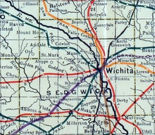
 KDOT map of Sedgwick County (legend) | |
| Coordinates: 37°28′47″N 97°14′32″W[1] | |
| Country | United States |
| State | Kansas |
| Counties | Sedgwick, Sumner |
| Founded | 1870s |
| Platted | 1879 |
| Incorporated | 1883 |
| Named for | Joab Mulvane |
| Government | |
| • Mayor | Shelly Steadman[2] |
| Area | |
| • Total | 4.47 sq mi (11.58 km2) |
| • Land | 4.46 sq mi (11.56 km2) |
| • Water | 0.01 sq mi (0.02 km2) |
| Elevation | 1,237 ft (377 m) |
| Population | |
| • Total | 6,286 |
| • Density | 1,400/sq mi (540/km2) |
| Time zone | UTC-6 (CST) |
| • Summer (DST) | UTC-5 (CDT) |
| ZIP code | 67110 |
| Area code | 316 |
| FIPS code | 20-49100 [1] |
| GNIS ID | 470229 [1] |
| Website | mulvanekansas.com |
History
Mulvane was laid out in 1879[6] at the junction of five Santa Fe rail lines. It is named for Joab R. Mulvane, a railroad official who was instrumental in bringing the Atchison, Topeka, and Santa Fe Railroad to Mulvane.[7]
Geography
Mulvane is located at 37°28′47″N 97°14′32″W (37.479746, -97.242309).[8] According to the United States Census Bureau, the city has a total area of 4.52 square miles (11.71 km2), of which, 4.50 square miles (11.65 km2) is land and 0.02 square miles (0.05 km2) is water.[9]
Mulvane's Main Street follows part of the Sedgwick and Sumner county lines, and the town center is about five miles west of the spot where Sedgwick, Sumner, Butler and Cowley counties meet.
Demographics
| Historical population | |||
|---|---|---|---|
| Census | Pop. | %± | |
| 1880 | 215 | — | |
| 1890 | 724 | 236.7% | |
| 1900 | 667 | −7.9% | |
| 1910 | 1,084 | 62.5% | |
| 1920 | 1,239 | 14.3% | |
| 1930 | 1,042 | −15.9% | |
| 1940 | 940 | −9.8% | |
| 1950 | 1,387 | 47.6% | |
| 1960 | 2,981 | 114.9% | |
| 1970 | 3,185 | 6.8% | |
| 1980 | 4,254 | 33.6% | |
| 1990 | 4,674 | 9.9% | |
| 2000 | 5,155 | 10.3% | |
| 2010 | 6,111 | 18.5% | |
| 2020 | 6,286 | 2.9% | |
| U.S. Decennial Census 2010-2020[5] | |||
Mulvane is a part of the Wichita, KS Metropolitan Statistical Area.
2010 census
As of the census[10] of 2010, there were 6,111 people, 2,244 households, and 1,661 families living in the city.[11] The population density was 1,358.0 inhabitants per square mile (524.3/km2). There were 2,357 housing units at an average density of 523.8 per square mile (202.2/km2). The racial makeup of the city was 94.4% White, 0.6% African American, 1.1% Native American, 0.8% Asian, 0.1% Pacific Islander, 0.7% from other races, and 2.4% from two or more races. Hispanic or Latino of any race were 3.5% of the population.
There were 2,244 households, of which 40.4% had children under the age of 18 living with them, 59.3% were married couples living together, 10.5% had a female householder with no husband present, 4.2% had a male householder with no wife present, and 26.0% were non-families. 23.4% of all households were made up of individuals, and 10.5% had someone living alone who was 65 years of age or older. The average household size was 2.70 and the average family size was 3.18.
The median age in the city was 35.1 years. 30.4% of residents were under the age of 18; 6.9% were between the ages of 18 and 24; 25.5% were from 25 to 44; 24.2% were from 45 to 64; and 13.1% were 65 years of age or older. The gender makeup of the city was 48.0% male and 52.0% female.
2000 census
As of the census[12] of 2000, there were 5,155 people, 1,896 households, and 1,444 families living in the city. The population density was 2,261.1 people per square mile (873.0/km2). There were 1,963 housing units at an average density of 861.0 per square mile (332.4/km2). The racial makeup of the city was 96.39% White, 0.17% African American, 0.99% Native American, 0.29% Asian, 0.06% Pacific Islander, 0.60% from other races, and 1.49% from two or more races. Hispanic or Latino of any race were 2.58% of the population.
There were 1,896 households, of which 41.0% had children under the age of 18 living with them, 63.0% were married couples living together, 9.3% had a female householder with no husband present, and 23.8% were non-families. 21.0% of all households were made up of individuals, and 9.1% had someone living alone who was 65 years of age or older. The average household size was 2.69 and the average family size was 3.14.
In the city, the population was spread out, with 30.4% under the age of 18, 8.4% from 18 to 24, 28.8% from 25 to 44, 20.7% from 45 to 64, and 11.7% were 65 years of age or older. The median age was 34 years. For every 100 females, there were 93.1 males. For every 100 females age 18 and over, there were 89.8 males.
The median income for a household in the city was $46,923, and the median income for a family was $56,285. Males had a median income of $39,732 versus $26,797 for females. The per capita income for the city was $19,523. About 2.1% of families and 3.4% of the population were below the poverty line, including 4.0% of those under age 18 and 1.6% of those age 65 or over.
Area events and attractions
- Mulvane Old Settlers - one of the longest-running community events in Kansas, having started in 1873 (ten years before the town was officially incorporated).
- Kansas Star Casino
- Doc Sunback Film Festival - annual film festival held in Mulvane, with a focus on independent films and filmmakers from Kansas.[13]
- The Lumberyard - an independently owned venue that hosts free shows, from both local and touring bands; operated by members of local bands Peters 1914[14] and Jackass.
Education
Primary and secondary
The community is served by Mulvane USD 263 public school district. Munson Primary School teaches grades pre-kindergarten through 2nd grade, Mulvane Grade School teaches 3rd grade-5th grade while Mulvane Middle School teaches 6th through 8th, and Mulvane High School teaches 9th though 12th.
Colleges and universities
Cowley County Community College operates a satellite campus within city limits.
Notable people
- Laura Cobb, United States Navy nurse during World War II
- Dennis Franchione, college football coach.
References
- "Mulvane, Kansas", Geographic Names Information System, United States Geological Survey, United States Department of the Interior
- "Mayor's Office / Mulvane, Kansas". mulvanekansas.com. Retrieved December 27, 2019.
- "2019 U.S. Gazetteer Files". United States Census Bureau. Retrieved July 24, 2020.
- "Profile of Mulvane, Kansas in 2020". United States Census Bureau. Archived from the original on April 4, 2022. Retrieved April 4, 2022.
- "QuickFacts; Mulvane, Kansas; Population, Census, 2020 & 2010". United States Census Bureau. Archived from the original on August 27, 2021. Retrieved August 27, 2021.
- Blackmar, Frank Wilson (1912). Kansas: A Cyclopedia of State History, Volume 2. Standard Publishing Company. pp. 332.
- Bentley, Orsemus Hills (1910). History of Wichita and Sedgwick County, Kansas: Past and Present. Windmill Publications. p. 637.
- "US Gazetteer files: 2010, 2000, and 1990". United States Census Bureau. 2011-02-12. Retrieved 2011-04-23.
- "US Gazetteer files 2010". United States Census Bureau. Archived from the original on 2012-01-25. Retrieved 2012-07-06.
- "U.S. Census website". United States Census Bureau. Retrieved 2012-07-06.
- "2010 City Population and Housing Occupancy Status". U.S. Census Bureau. Retrieved March 6, 2011.[dead link]
- "U.S. Census website". United States Census Bureau. Retrieved 2008-01-31.
- "Doc Sunback Film Festival Returns With A Look At Wichita Filmmakers". KMUW. 2021-06-16. Retrieved 2022-05-02.
- "Robert Long (Peters 1914, Singer/Songwriter, The Lumber Yard)". waitandseekansas.medium.com. 2020-11-26. Retrieved 2022-05-02.
Further reading
External links
Municipalities and communities of Sedgwick County, Kansas, United States | ||
|---|---|---|
County seat: Wichita | ||
| Cities |  | |
| Unincorporated communities |
| |
| Townships | ||
| Footnotes | †This community is designated a Census-Designated Place (CDP) by the United States Census Bureau. ‡This community also has portions in an adjacent county or counties. | |
| ||
Municipalities and communities of Sumner County, Kansas, United States | ||
|---|---|---|
County seat: Wellington | ||
| Cities |  | |
| Unincorporated communities | ||
| Ghost towns |
| |
| Footnotes | †This community is designated a Census-Designated Place (CDP) by the United States Census Bureau. ‡This community also has portions in an adjacent county or counties. | |
| ||
Authority control | |
|---|---|
| General | |
| National libraries | |
| Other |
|
Другой контент может иметь иную лицензию. Перед использованием материалов сайта WikiSort.org внимательно изучите правила лицензирования конкретных элементов наполнения сайта.
WikiSort.org - проект по пересортировке и дополнению контента Википедии