world.wikisort.org - USA
Mount Auburn Township is one of seventeen townships in Christian County, Illinois, USA. As of the 2010 census, its population was 1,028 and it contained 458 housing units.[2]
Mount Auburn Township | |
|---|---|
Township | |
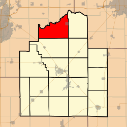 Location in Christian County | |
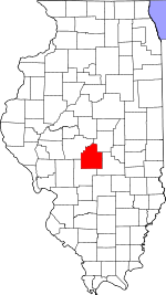 Christian County's location in Illinois | |
| Coordinates: 39°43′51″N 89°19′42″W | |
| Country | |
| State | |
| County | Christian |
| Established | November 7, 1865 |
| Area | |
| • Total | 45.78 sq mi (118.6 km2) |
| • Land | 45.74 sq mi (118.5 km2) |
| • Water | 0.03 sq mi (0.08 km2) 0.07% |
| Elevation | 594 ft (181 m) |
| Population (2010) | |
| • Estimate (2016)[1] | 985 |
| • Density | 22.5/sq mi (8.7/km2) |
| Time zone | UTC-6 (CST) |
| • Summer (DST) | UTC-5 (CDT) |
| ZIP codes | 62513, 62515, 62531, 62545, 62547, 62563 |
| FIPS code | 17-021-50842 |
Geography
According to the 2010 census, the township has a total area of 45.78 square miles (118.6 km2), of which 45.74 square miles (118.5 km2) (or 99.91%) is land and 0.03 square miles (0.078 km2) (or 0.07%) is water.[2]
Cities, towns, villages
- Mount Auburn
Unincorporated towns
- Bolivia at 39.742268°N 89.34703°W
- Grove City at 39.706711°N 89.297029°W
- Roby at 39.739214°N 89.399255°W
Cemeteries
The township contains these five cemeteries: Furrow, Grove City Methodist, Hinckle, Milligan and Mount Auburn.
Airports and landing strips
- Hardy Airport
Demographics
| Historical population | |||
|---|---|---|---|
| Census | Pop. | %± | |
| 2016 (est.) | 985 | [1] | |
| U.S. Decennial Census[3] | |||
School districts
- Edinburg Community Unit School District 4
- Rochester Community Unit School District 3a
- Taylorville Community Unit School District 3
Political districts
- State House District 87
- State Senate District 44
References
- "Mount Auburn Township, Christian County, Illinois". Geographic Names Information System. United States Geological Survey. Retrieved 2010-01-10.
- United States Census Bureau 2009 TIGER/Line Shapefiles
- United States National Atlas
- "Population and Housing Unit Estimates". Retrieved June 9, 2017.
- "Population, Housing Units, Area, and Density: 2010 - County -- County Subdivision and Place -- 2010 Census Summary File 1". United States Census. Archived from the original on 2020-02-12. Retrieved 2013-05-28.
- "Census of Population and Housing". Census.gov. Retrieved June 4, 2016.
External links
Places adjacent to Mount Auburn Township, Christian County, Illinois | ||||||||||||||||
|---|---|---|---|---|---|---|---|---|---|---|---|---|---|---|---|---|
| ||||||||||||||||
Municipalities and communities of Christian County, Illinois, United States | ||
|---|---|---|
County seat: Taylorville | ||
| Cities |
|  |
| Villages |
| |
| Townships |
| |
| CDP | ||
| Other unincorporated communities |
| |
| Footnotes | ‡This populated place also has portions in an adjacent county or counties | |
| ||
Текст в блоке "Читать" взят с сайта "Википедия" и доступен по лицензии Creative Commons Attribution-ShareAlike; в отдельных случаях могут действовать дополнительные условия.
Другой контент может иметь иную лицензию. Перед использованием материалов сайта WikiSort.org внимательно изучите правила лицензирования конкретных элементов наполнения сайта.
Другой контент может иметь иную лицензию. Перед использованием материалов сайта WikiSort.org внимательно изучите правила лицензирования конкретных элементов наполнения сайта.
2019-2025
WikiSort.org - проект по пересортировке и дополнению контента Википедии
WikiSort.org - проект по пересортировке и дополнению контента Википедии