world.wikisort.org - USA
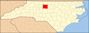
Monticello is an unincorporated community in Guilford County, North Carolina, United States. It is east of Browns Summit and lies east of U.S. Route 29, on North Carolina Highway 150. Its elevation is 855 feet (261 m) above sea level.
Monticello, Guilford County, North Carolina | |
|---|---|
Unincorporated community | |
 Monticello  Monticello | |
| Coordinates: 36°13′9″N 79°40′40″W | |
| Country | United States |
| State | North Carolina |
| County | Guilford |
| Elevation | 855 ft (261 m) |
| Time zone | UTC-5 (Eastern (EST)) |
| • Summer (DST) | UTC-4 (EDT) |
| ZIP code | 27214 |
| GNIS feature ID | 990156 |
Other communities in North Carolina
Another community named Monticello is located in Iredell County at coordinates 354756N 0805606W, and another was located in Washington County at coordinates 35.7657178 -76.7363312 354557N 0764411W, but no longer exists, according to the Geographic Names Information System of the USGS.[1]
References
Municipalities and communities of Guilford County, North Carolina, United States | ||
|---|---|---|
County seat: Greensboro | ||
| Cities |
|  |
| Towns |
| |
| CDPs |
| |
| Unincorporated communities |
| |
| Footnotes | ‡This populated place also has portions in an adjacent county or counties | |
| ||
Текст в блоке "Читать" взят с сайта "Википедия" и доступен по лицензии Creative Commons Attribution-ShareAlike; в отдельных случаях могут действовать дополнительные условия.
Другой контент может иметь иную лицензию. Перед использованием материалов сайта WikiSort.org внимательно изучите правила лицензирования конкретных элементов наполнения сайта.
Другой контент может иметь иную лицензию. Перед использованием материалов сайта WikiSort.org внимательно изучите правила лицензирования конкретных элементов наполнения сайта.
2019-2026
WikiSort.org - проект по пересортировке и дополнению контента Википедии
WikiSort.org - проект по пересортировке и дополнению контента Википедии