world.wikisort.org - USA
Michigamme is an unincorporated community in Marquette County in the U.S. state of Michigan. It is located within Michigamme Township on the north shores of Lake Michigamme. For statistical purposes, the United States Census Bureau has defined Michigamme as a census-designated place (CDP). The CDP had a population of 271 at the 2010 census.
Michigamme, Michigan | |
|---|---|
Unincorporated community Census-designated place | |
 Location within Marquette County | |
 Michigamme Location within the state of Michigan  Michigamme Michigamme (the United States) | |
| Coordinates: 46°32′05″N 88°06′36″W | |
| Country | United States |
| State | Michigan |
| County | Marquette |
| Township | Michigamme |
| Area | |
| • Total | 4.65 sq mi (12.05 km2) |
| • Land | 2.38 sq mi (6.16 km2) |
| • Water | 2.27 sq mi (5.89 km2) |
| Elevation | 1,627 ft (496 m) |
| Population (2020) | |
| • Total | 255 |
| • Density | 107.19/sq mi (41.39/km2) |
| Time zone | UTC-5 (Eastern (EST)) |
| • Summer (DST) | UTC-4 (EDT) |
| ZIP code(s) | 49861 |
| Area code(s) | 906 |
| FIPS code | 26-53520[3] |
| GNIS feature ID | 632193[2] |
The Michigamme ZIP code, 49861, serves a much larger area to the north and west of the lake, including portions of Michigamme Township and Republic Township in Marquette County and Spurr Township and Covington Township in Baraga County.[4]
History
The Michigamme Post Office has been in operation since 1873.[5] The community took its name from nearby Lake Michigamme.[6]
Geography
According to the United States Census Bureau, the CDP has a total area of 4.65 square miles (12.04 km2), of which 2.38 square miles (6.16 km2) is land and 2.27 square miles (5.88 km2) (48.82%) is water.[7]
Demographics
| Historical population | |||
|---|---|---|---|
| Census | Pop. | %± | |
| 2020 | 255 | — | |
As of the census[3] of 2000, there were 287 people, 138 households, and 94 families residing in the CDP. The population density was 114.7 per square mile (44.3/km2). There were 271 housing units at an average density of 108.3 per square mile (41.9/km2). The racial makeup of the CDP was 99.30% White and 0.70% Native American.
There were 138 households, out of which 19.6% had children under the age of 18 living with them, 60.1% were married couples living together, 6.5% had a female householder with no husband present, and 31.2% were non-families. 28.3% of all households were made up of individuals, and 12.3% had someone living alone who was 65 years of age or older. The average household size was 2.08 and the average family size was 2.45.
In the CDP, the population was spread out, with 16.4% under the age of 18, 3.5% from 18 to 24, 20.9% from 25 to 44, 37.3% from 45 to 64, and 22.0% who were 65 years of age or older. The median age was 50 years. For every 100 females, there were 95.2 males. For every 100 females age 18 and over, there were 96.7 males.
The median income for a household in the CDP was $27,083, and the median income for a family was $33,438. Males had a median income of $30,833 versus $21,250 for females. The per capita income for the CDP was $21,285. About 5.2% of families and 11.6% of the population were below the poverty line, including 11.6% of those under the age of eighteen and 9.3% of those 65 or over.
Transportation
Indian Trails bus lines operates daily intercity bus service between Hancock and Milwaukee with a stop in Michigamme.[9] US Highway 41/M-28 passes through the community.
References
- "2020 U.S. Gazetteer Files". United States Census Bureau. Retrieved May 21, 2022.
- U.S. Geological Survey Geographic Names Information System: Michigamme, Michigan
- "U.S. Census website". United States Census Bureau. Retrieved 2008-01-31.
- 49861 5-Digit ZCTA, 498 3-Digit ZCTA - Reference Map - American FactFinder[permanent dead link], U.S. Census Bureau, 2000 census
- "Marquette County". Jim Forte Postal History. Retrieved 1 March 2015.
- Chicago and North Western Railway Company (1908). A History of the Origin of the Place Names Connected with the Chicago & North Western and Chicago, St. Paul, Minneapolis & Omaha Railways. p. 101.
- "Michigan: 2010 Population and Housing Unit Counts 2010 Census of Population and Housing" (PDF). 2010 United States Census. United States Census Bureau. September 2012. p. 32 Michigan. Retrieved August 28, 2020.
- "Census of Population and Housing". Census.gov. Retrieved June 4, 2016.
- "HANCOCK-MARQUETTE-GREEN BAY-MILWAUKEE" (PDF). Indian Trails. January 12, 2012. Archived from the original (PDF) on February 22, 2014. Retrieved 2013-02-27.
External links
Municipalities and communities of Marquette County, Michigan, United States | ||
|---|---|---|
County seat: Marquette | ||
| Cities | 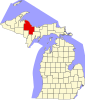 | |
| Charter townships | ||
| Civil townships | ||
| CDPs | ||
| Other unincorporated communities | ||
| Indian reservations |
| |
| Footnotes | ‡This populated place also has portions in an adjacent county or counties | |
| ||
Authority control | |
|---|---|
| General |
|
| National libraries | |
Другой контент может иметь иную лицензию. Перед использованием материалов сайта WikiSort.org внимательно изучите правила лицензирования конкретных элементов наполнения сайта.
WikiSort.org - проект по пересортировке и дополнению контента Википедии