world.wikisort.org - USA
Melia is an unincorporated community in Sarpy County, Nebraska, United States.[2]
Melia | |
|---|---|
Unincorporated community | |
 West on Melia Road overlooking the Platte River | |
 Melia Location within the state of Nebraska | |
| Coordinates: | |
| Country | United States |
| State | Nebraska |
| County | Sarpy |
| Area | |
| • Total | 1.44 sq mi (3.73 km2) |
| • Land | 1.44 sq mi (3.73 km2) |
| • Water | 0.00 sq mi (0.00 km2) |
| Elevation | 1,132 ft (345 m) |
| Population (2020) | |
| • Total | 98 |
| • Density | 68.06/sq mi (26.27/km2) |
| Time zone | UTC-6 (Central (CST)) |
| • Summer (DST) | UTC-5 (CDT) |
| ZIP codes | 68028 |
| FIPS code | 31-31605 |
| GNIS feature ID | 835379 |
Melia was named in honor of an early settler. It was a station on the Chicago, Burlington, and Quincy Railroad.[3]
Demographics
| Historical population | |||
|---|---|---|---|
| Census | Pop. | %± | |
| 2020 | 98 | — | |
| U.S. Decennial Census[4] | |||
References
- "ArcGIS REST Services Directory". United States Census Bureau. Retrieved September 18, 2022.
- U.S. Geological Survey Geographic Names Information System: Melia, Nebraska
- Fitzpatrick, Lillian L. (1960). Nebraska Place-Names. University of Nebraska Press. p. 125. ISBN 0-8032-5060-6. A 1925 edition is available for download at University of Nebraska—Lincoln Digital Commons.
- "Census of Population and Housing". Census.gov. Retrieved June 4, 2016.
Municipalities and communities of Sarpy County, Nebraska, United States | ||
|---|---|---|
County seat: Papillion | ||
| Cities | 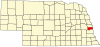 | |
| CDPs |
| |
| Other communities | ||
| ||
This Sarpy County, Nebraska state location article is a stub. You can help Wikipedia by expanding it. |
Текст в блоке "Читать" взят с сайта "Википедия" и доступен по лицензии Creative Commons Attribution-ShareAlike; в отдельных случаях могут действовать дополнительные условия.
Другой контент может иметь иную лицензию. Перед использованием материалов сайта WikiSort.org внимательно изучите правила лицензирования конкретных элементов наполнения сайта.
Другой контент может иметь иную лицензию. Перед использованием материалов сайта WikiSort.org внимательно изучите правила лицензирования конкретных элементов наполнения сайта.
2019-2026
WikiSort.org - проект по пересортировке и дополнению контента Википедии
WikiSort.org - проект по пересортировке и дополнению контента Википедии