world.wikisort.org - USA
Marysvale is a town in Piute County, Utah, United States. The population was 408 at the 2010 census. Marysvale is a trail head for the Paiute ATV Trail.
Marysvale, Utah | |
|---|---|
Town | |
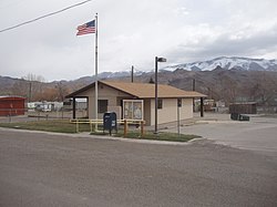 Marysvale post office | |
 Location in Piute County and the state of Utah. | |
| Coordinates: 38°26′51″N 112°13′58″W | |
| Country | United States |
| State | Utah |
| County | Piute |
| Settled | 1863 |
| Incorporated | 1913 |
| Area | |
| • Total | 17.99 sq mi (46.60 km2) |
| • Land | 17.98 sq mi (46.57 km2) |
| • Water | 0.01 sq mi (0.03 km2) |
| Elevation | 5,863 ft (1,787 m) |
| Population (2010) | |
| • Total | 408 |
| • Estimate (2019)[2] | 437 |
| • Density | 24.31/sq mi (9.38/km2) |
| Time zone | UTC-7 (Mountain (MST)) |
| • Summer (DST) | UTC-6 (MDT) |
| ZIP code | 84750 |
| Area code | 435 |
| FIPS code | 49-48610[3] |
| GNIS feature ID | 1443220[4] |
History
A post office called Marysvale has been in operation since 1872.[5] The town's name probably commemorates the Virgin Mary.[6]
In the late 1860s, silver ore was discovered in the Volcanic Series of Bullion Canyon and Mount Belknap, west of Marysvale in the Tushar Mountains. In 1889, gold was discovered. Then in 1949, uranium was discovered, prompting the United States Atomic Energy Commission to establish an ore purchasing station and field office in Marysvale. The uranium occurs as veins within quartz monzonite, granite and rhyolite, usually in the form of pitchblende, but also as umohoite, which was first identified at Marysvale. The pitchblende has been age dated to the Late Miocene. Total uranium production from the Marysvale area amounted to about 275,000 tons of 0.2 per cent U2O8.[7]
Geography
According to the United States Census Bureau, the town has a total area of 15.1 square miles (39.1 km2), of which 15.1 square miles (39.1 km2) is land and 0.07% is water.
Climate
The Köppen Climate Classification subtype for this climate is "Dfb" (Warm Summer Continental Climate).[8]
Demographics
| Historical population | |||
|---|---|---|---|
| Census | Pop. | %± | |
| 1880 | 297 | — | |
| 1890 | 259 | −12.8% | |
| 1900 | 435 | 68.0% | |
| 1910 | 495 | 13.8% | |
| 1920 | 624 | 26.1% | |
| 1930 | 471 | −24.5% | |
| 1940 | 626 | 32.9% | |
| 1950 | 520 | −16.9% | |
| 1960 | 354 | −31.9% | |
| 1970 | 289 | −18.4% | |
| 1980 | 359 | 24.2% | |
| 1990 | 364 | 1.4% | |
| 2000 | 381 | 4.7% | |
| 2010 | 408 | 7.1% | |
| 2019 (est.) | 437 | [2] | 7.1% |
| U.S. Decennial Census[9] | |||
At the 2000 census there were 381 people, 149 households, and 113 families in the town. The population density was 25.2 people per square mile (9.7/km2). There were 222 housing units at an average density of 14.7 per square mile (5.7/km2). The racial makeup of the town was 98.43% White, 0.79% from other races, and 0.79% from two or more races. Hispanic or Latino of any race were 2.10%.[3]
Of the 149 households 27.5% had children under the age of 18 living with them, 63.8% were married couples living together, 8.7% had a female householder with no husband present, and 23.5% were non-families. Of the 149 households, 8 are unmarried partner households: 2 heterosexual, 2 same-sex male, and 4 same-sex female. 21.5% of households were one person and 9.4% were one person aged 65 or older. The average household size was 2.56 and the average family size was 2.96.
The age distribution was 24.7% under the age of 18, 6.6% from 18 to 24, 20.2% from 25 to 44, 31.2% from 45 to 64, and 17.3% 65 or older. The median age was 44 years. For every 100 females, there were 96.4 males. For every 100 females age 18 and over, there were 91.3 males.
The median household income was $31,875 and the median family income was $35,417. Males had a median income of $33,125 versus $21,667 for females. The per capita income for the town was $12,715. About 9.1% of families and 11.8% of the population were below the poverty line, including 14.8% of those under age 18 and 2.9% of those age 65 or over.
Notable person
Actress Marie Windsor was born in Marysvale in 1919.
See also
- List of cities and towns in Utah
References
- "2019 U.S. Gazetteer Files". United States Census Bureau. Retrieved August 7, 2020.
- "Population and Housing Unit Estimates". United States Census Bureau. May 24, 2020. Retrieved May 27, 2020.
- "U.S. Census website". United States Census Bureau. Retrieved 2008-01-31.
- "US Board on Geographic Names". United States Geological Survey. 2007-10-25. Retrieved 2008-01-31.
- "Piute County". Jim Forte Postal History. Retrieved 18 October 2015.
- Van Atta, Dale (Jan 22, 1977). "You name it - there's a town for it". The Deseret News. pp. W6. Retrieved 18 October 2015.
- Kerr, Paul (1968). Ridge, John (ed.). The Marysvale Utah, Uranium Deposits, in Ore deposits of the United States, 1933-1967. New York: The American Institute of Mining, Metallurgical, and Petroleum engineers, Inc. pp. 1020–1042.
- Climate Summary for Marysvale, Utah
- "Census of Population and Housing". Census.gov. Retrieved June 4, 2015.
External links
Places adjacent to Marysvale, Utah | |
|---|---|
Municipalities and communities of Piute County, Utah, United States | ||
|---|---|---|
County seat: Junction | ||
| Towns |  | |
| Unincorporated communities | ||
| Ghost towns | ||
| ||
Authority control | |
|---|---|
| General | |
| National libraries | |
Другой контент может иметь иную лицензию. Перед использованием материалов сайта WikiSort.org внимательно изучите правила лицензирования конкретных элементов наполнения сайта.
WikiSort.org - проект по пересортировке и дополнению контента Википедии