world.wikisort.org - USA
Circleville is a town in Piute County, Utah, United States. The population was 547 at the 2010 census.
Circleville, Utah | |
|---|---|
Town | |
 Circleville fire station | |
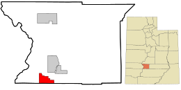 Location in Piute County and the state of Utah. | |
| Coordinates: 38°10′13″N 112°16′18″W | |
| Country | United States |
| State | Utah |
| County | Piute |
| Founded | 1864 |
| Incorporated | August 24, 1921 |
| Founded by | William Allred |
| Area | |
| • Total | 11.04 sq mi (28.60 km2) |
| • Land | 11.04 sq mi (28.60 km2) |
| • Water | 0.00 sq mi (0.00 km2) |
| Elevation | 6,066 ft (1,849 m) |
| Population (2010) | |
| • Total | 547 |
| • Estimate (2019)[2] | 489 |
| • Density | 44.29/sq mi (17.10/km2) |
| Time zone | UTC-7 (Mountain (MST)) |
| • Summer (DST) | UTC-6 (MDT) |
| ZIP code | 84723 |
| Area code | 435 |
| FIPS code | 49-12970[3] |
| GNIS feature ID | 1439749[4] |
| Website | www |

Geography
According to the United States Census Bureau, the town has a total area of 9.1 square miles (23.5 km2), all land.
The American Discovery Trail runs through Circleville.[5]
Climate
The Köppen Climate Classification subtype for this climate is "Dfb" (Warm Summer Continental Climate).[6]
History
Circleville was originally settled in 1864.[7] The town was named for the shape of the valley in which it is located, Circle Valley.[8] The valley is completely circled by mountains except where the Sevier River flows through the valley on the north and south.
In April 1866, the settlement was the site of the Circleville Massacre, an incident of Utah's Black Hawk War. On April 22, 2016, a monument was dedicated in the town park to remember the Southern Paiute people slain during the massacre.[9]
On June 28, 1866, the town was abandoned by the original settlers due to the war.[10] A few settlers began to trickle back into the area in 1873 [11] and the town was re-established in 1874 when Charles Wakeman Dalton crossed the mountain from Beaver with two of his wives and family.
Circleville became an incorporated community on August 24, 1921. Local residents were interested in facilitating the public services which municipal government provides, and they were particularly interested in building a culinary water system.[11]
Demographics
| Historical population | |||
|---|---|---|---|
| Census | Pop. | %± | |
| 1880 | 416 | — | |
| 1890 | 458 | 10.1% | |
| 1900 | 538 | 17.5% | |
| 1910 | 523 | −2.8% | |
| 1920 | 586 | 12.0% | |
| 1930 | 435 | −25.8% | |
| 1940 | 683 | 57.0% | |
| 1950 | 603 | −11.7% | |
| 1960 | 478 | −20.7% | |
| 1970 | 443 | −7.3% | |
| 1980 | 445 | 0.5% | |
| 1990 | 417 | −6.3% | |
| 2000 | 505 | 21.1% | |
| 2010 | 547 | 8.3% | |
| 2019 (est.) | 489 | [2] | −10.6% |
| U.S. Decennial Census[12] | |||
As of the census[3] of 2000, there were 505 people, 172 households, and 132 families residing in the town. The population density was 55.7 people per square mile (21.5/km2). There were 222 housing units at an average density of 24.5 per square mile (9.5/km2). The racial makeup of the town was 97.23% White, 0.20% African American, 0.40% Native American, 0.20% Asian, 0.20% Pacific Islander, 0.99% from other races, and 0.79% from two or more races. Hispanic or Latino of any race were 4.36% of the population.
There were 172 households, out of which 37.2% had children under the age of 18 living with them, 68.0% were married couples living together, 5.8% had a female householder with no husband present, and 22.7% were non-families. 22.1% of all households were made up of individuals, and 14.5% had someone living alone who was 65 years of age or older. The average household size was 2.94 and the average family size was 3.45.
In the town, the population was spread out, with 34.7% under the age of 18, 5.9% from 18 to 24, 18.4% from 25 to 44, 23.2% from 45 to 64, and 17.8% who were 65 years of age or older. The median age was 37 years. For every 100 females, there were 98.8 males. For every 100 females age 18 and over, there were 98.8 males.
The median income for a household in the town was $32,083, and the median income for a family was $36,875. Males had a median income of $25,536 versus $19,063 for females. The per capita income for the town was $12,919. About 8.7% of families and 12.8% of the population were below the poverty line, including 15.2% of those under age 18 and 12.5% of those age 65 or over.
Notable people
Utah's most notorious native son, the elusive international cowboy outlaw, Robert Leroy Parker, better known as Butch Cassidy, grew up in Circle Valley just a mile from Circleville (but he was born considerably further to the west, across the Tushar Mountains, in the town of Beaver, Utah). His family's small cabin, on the outskirts of town, is still standing on the land they homesteaded. It can be seen on the west side of the road almost exactly one mile to the south of Circleville on what is now US Highway 89. The cabin's location is also just 6 miles (9.7 km) south of the smaller town of Junction, the county seat, and about 26 miles (42 km) north of Panguitch.
Charlie Siringo visited Circleville while in pursuit of the Wild Bunch. Siringo wrote, "a week was spent in the straggling village of Circleville, and I found out all about 'Butch's' early life and much about his late doings. His true name was Parker, his nickname being 'Sallie' Parker when a boy. This nickname of itself was enough to drive a sensitive boy to the 'bad'. I had hard work to keep from falling in love with Miss Parker, the pretty young sister of 'Butch' Casiday. She was the deputy postmistress in Circleville, and I made her acquaintance."[13]
Lula Parker Betenson (b. 1884), sister of "Butch" Cassidy, lived in Circleville, dying aged 96 in 1980.[14][15] Betenson's 1975 book Butch Cassidy, My Brother,[16] co-authored with Dora Flack, recounts her memory that Cassidy visited Circleville in 1924, adding to the controversy over whether he had died previously in South America. This visit by Cassidy to Circleville is also reported by author W. C. Jameson in Butch Cassidy: Beyond the Grave.[17]
Carrie Allen, born in Circleville in 1889, was a spinster and a school teacher. She wrote a history of Circleville. She died in 1983 in Circleville.
See also
- Circleville Massacre
Sources
- "2019 U.S. Gazetteer Files". United States Census Bureau. Retrieved August 7, 2020.
- "Population and Housing Unit Estimates". United States Census Bureau. May 24, 2020. Retrieved May 27, 2020.
- "U.S. Census website". United States Census Bureau. Retrieved 2008-01-31.
- "US Board on Geographic Names". United States Geological Survey. 2007-10-25. Retrieved 2008-01-31.
- American Discovery Trail
- Climate Summary for Circlevile, Utah
- Jenson, Andrew. Encyclopedic History of the Church of Jesus Christ of Latter-day Saints. (Salt Lake City: Deseret News Press, 1941) p. 141
- Van Atta, Dale (Jan 22, 1977). "You name it - there's a town for it". The Deseret News. p. 15. Retrieved 18 October 2015.
- "Circleville Massacre Memorial Dedication". Utah Historical Quarterly. 84 (3): 262–268. Summer 2016. doi:10.5406/utahhistquar.84.3.0262. S2CID 246576342.
- Indian depredations in Utah p. 220
- Utah State Archives"
- "Census of Population and Housing". Census.gov. Retrieved June 4, 2015.
- Siringo, Charles (1912). A Cowboy Detective. Arcadia Press. p. 137. ISBN 9781545001882.
- http://www.genealogy.com/forum/surnames/topics/parker/17196/ [bare URL]
- Redford, Robert (1976). The Outlaw Trail: A Journey Through Time. New York: Grosset & Dunlap. pp. 209–219. ISBN 0448145901.
- Betenson, Lula Parker; Flack, Dora. Butch Cassidy, My Brother. 1975. ISBN 978-0-84251-222-0
- Jameson, W.C. Butch Cassidy: Beyond the Grave. 2012. ISBN 978-1-58979-739-0
External links
Places adjacent to Circleville, Utah | ||||||||||||||||
|---|---|---|---|---|---|---|---|---|---|---|---|---|---|---|---|---|
| ||||||||||||||||
Municipalities and communities of Piute County, Utah, United States | ||
|---|---|---|
County seat: Junction | ||
| Towns |  | |
| Unincorporated communities | ||
| Ghost towns | ||
| ||
Authority control | |
|---|---|
| General | |
| National libraries | |
Другой контент может иметь иную лицензию. Перед использованием материалов сайта WikiSort.org внимательно изучите правила лицензирования конкретных элементов наполнения сайта.
WikiSort.org - проект по пересортировке и дополнению контента Википедии