world.wikisort.org - USA
Marmaton Township is one of twelve townships in Allen County, Kansas, United States. As of the 2010 census, its population was 877.[1] The majority of inhabitants are farmers.
Marmaton Township | |
|---|---|
Township | |
 Location in Allen County | |
| Coordinates: 37°54′25″N 095°09′36″W | |
| Country | United States |
| State | Kansas |
| County | Allen |
| Area | |
| • Total | 55.8 sq mi (144.6 km2) |
| • Land | 55.6 sq mi (143.9 km2) |
| • Water | 0.3 sq mi (0.7 km2) 0.5% |
| Elevation | 1,099 ft (335 m) |
| Population (2010) | |
| • Total | 877 |
| • Density | 16/sq mi (6.1/km2) |
| GNIS feature ID | 0474522 |
Geography
Marmaton Township covers an area of 55.8 square miles (144.6 km2) and contains one incorporated settlement, Moran. According to the USGS, it contains one cemetery, Moran.
The stream of Sweet Branch runs through this township.
References
- "Geographic Identifiers: 2010 Demographic Profile Data (G001): Marmaton township, Allen County, Kansas". U.S. Census Bureau, American Factfinder. Archived from the original on February 12, 2020. Retrieved May 10, 2013.
External links
Municipalities and communities of Allen County, Kansas, United States | ||
|---|---|---|
County seat: Iola | ||
| Cities | 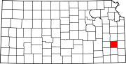 | |
| Unincorporated communities | ||
| Ghost towns |
| |
| Townships | ||
| Footnotes | †This community is designated a Census-Designated Place (CDP) by the United States Census Bureau. ‡This community also has portions in an adjacent county or counties. | |
| ||
Текст в блоке "Читать" взят с сайта "Википедия" и доступен по лицензии Creative Commons Attribution-ShareAlike; в отдельных случаях могут действовать дополнительные условия.
Другой контент может иметь иную лицензию. Перед использованием материалов сайта WikiSort.org внимательно изучите правила лицензирования конкретных элементов наполнения сайта.
Другой контент может иметь иную лицензию. Перед использованием материалов сайта WikiSort.org внимательно изучите правила лицензирования конкретных элементов наполнения сайта.
2019-2026
WikiSort.org - проект по пересортировке и дополнению контента Википедии
WikiSort.org - проект по пересортировке и дополнению контента Википедии