world.wikisort.org - USA
Petrolia is an unincorporated community in Allen County, Kansas, United States.[1] It is situated along the Neosho River.
Petrolia, Kansas | |
|---|---|
Unincorporated community | |
 KDOT map of Allen County (legend) | |
 Petrolia  Petrolia | |
| Coordinates: 37°44′45″N 95°28′18″W[1] | |
| Country | United States |
| State | Kansas |
| County | Allen |
| Elevation | 955 ft (291 m) |
| Time zone | UTC-6 (CST) |
| • Summer (DST) | UTC-5 (CDT) |
| ZIP code | 66720 |
| Area code | 620 |
| FIPS code | 20-55625 [1] |
| GNIS ID | 474962 [1] |
History
In 1910, Petrolia had a money order postoffice, an express office, and was a trading point for the neighborhood. The population that year was 200.[2]
Petrolia had a post office from July 1905 until September 1953.[3]
Geography
Petrolia is located at 37°44′45″N 95°28′18″W (37.7458767, -95.4716486),[1] in Sections 31–32, Township 26 south, Range 18 east. Less than a mile from the southern border of Allen County, it is situated west of the Neosho River and to the south of Scatter Creek. Contained entirely within Logan Township, it is about 5 miles south-southwest of Humboldt and 13 miles from Iola (the county seat).[4] U.S. Route 169 crosses the Neosho River a mile to the south of Petrolia.
Education
The community is served by Chanute USD 413 public school district.
See also
- Great Flood of 1951
References
- "Petrolia, Kansas", Geographic Names Information System, United States Geological Survey
- Frank W. Blackmar, ed. (1912). "Petrolia". Kansas: a cyclopedia of state history, embracing events, institutions, industries, counties, cities, towns, prominent persons, etc ... Vol. II. Chicago: Standard Pub Co. p. 369. Archived from the original on 2007-12-03. Retrieved 2007-12-15.
- "Kansas Post Offices Database". Kansas State Historical Society. Retrieved 2007-12-15. Containing information taken from Baughman, Robert W. Kansas Post Offices, May 29, 1828–August 3, 1961. Kansas Postal History Society.
- "KDOT County Maps". 1999. Retrieved 2007-12-15.
Further reading
External links
Municipalities and communities of Allen County, Kansas, United States | ||
|---|---|---|
County seat: Iola | ||
| Cities | 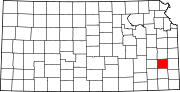 | |
| Unincorporated communities | ||
| Ghost towns |
| |
| Townships | ||
| Footnotes | †This community is designated a Census-Designated Place (CDP) by the United States Census Bureau. ‡This community also has portions in an adjacent county or counties. | |
| ||
Другой контент может иметь иную лицензию. Перед использованием материалов сайта WikiSort.org внимательно изучите правила лицензирования конкретных элементов наполнения сайта.
WikiSort.org - проект по пересортировке и дополнению контента Википедии