world.wikisort.org - USA
Lowell is an unincorporated community in Cherokee County, Kansas, United States. As of the 2010 census, the CDP population was 283.[1]
Lowell, Kansas | |
|---|---|
Unincorporated community | |
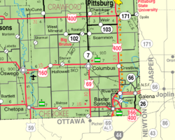 KDOT map of Cherokee County (legend) | |
 Lowell  Lowell | |
| Coordinates: 37°02′55″N 94°42′05″W | |
| Country | United States |
| State | Kansas |
| County | Cherokee |
| Elevation | 850 ft (260 m) |
| Population (2010)[1] | |
| • Total | 283 |
| Time zone | UTC-6 (CST) |
| • Summer (DST) | UTC-5 (CDT) |
| ZIP code | 66713, 66739 |
| Area code | 620 |
| FIPS code | 20-43050[2] |
| GNIS ID | 469344[2] |
History
A post office was opened in Lowell in 1868, and remained in operation until it was discontinued in 1905.[3]
Geography
Lowell is located in southeastern Cherokee County near the southeastern corner of Kansas. It is bordered to the north by the Spring River, a tributary of the Neosho River. Across the river is the community of Riverton. Baxter Springs is 4 miles (6 km) by road to the southwest.
Demographics
For statistical purposes, the United States Census Bureau has defined Lowell as a census-designated place (CDP).
References
- "Geographic Identifiers: 2010 Demographic Profile Data (G001): Lowell CDP, Kansas". U.S. Census Bureau, American Factfinder. Archived from the original on February 12, 2020. Retrieved August 4, 2014.
- "US Board on Geographic Names". United States Geological Survey. 2007-10-25. Retrieved 2008-01-31.
- "Kansas Post Offices, 1828-1961 (archived)". Kansas Historical Society. Archived from the original on 9 October 2013. Retrieved 6 June 2014.
Further reading
External links
Municipalities and communities of Cherokee County, Kansas, United States | ||
|---|---|---|
County seat: Columbus | ||
| Cities |  | |
| Unincorporated communities | ||
| Ghost towns | ||
| Townships | ||
| Footnotes | †This community is designated a Census-Designated Place (CDP) by the United States Census Bureau. ‡This community also has portions in an adjacent county or counties. | |
| ||
Authority control | |
|---|---|
| General |
|
| National libraries | |
Текст в блоке "Читать" взят с сайта "Википедия" и доступен по лицензии Creative Commons Attribution-ShareAlike; в отдельных случаях могут действовать дополнительные условия.
Другой контент может иметь иную лицензию. Перед использованием материалов сайта WikiSort.org внимательно изучите правила лицензирования конкретных элементов наполнения сайта.
Другой контент может иметь иную лицензию. Перед использованием материалов сайта WikiSort.org внимательно изучите правила лицензирования конкретных элементов наполнения сайта.
2019-2026
WikiSort.org - проект по пересортировке и дополнению контента Википедии
WikiSort.org - проект по пересортировке и дополнению контента Википедии