world.wikisort.org - USA
Long Beach Township is a Walsh Act Township in Ocean County, New Jersey. As of the 2010 United States Census, the township's population was 3,051[8][9][10][11] reflecting a decline of 278 (−8.4%) from the 3,329 counted in the 2000 Census, which had in turn declined by 78 (−2.3%) from the 3,407 counted in the 1990 Census.[20]
Long Beach Township, New Jersey | |
|---|---|
Township | |
| Township of Long Beach | |
 Map of Long Beach Township in Ocean County. Inset: Location of Ocean County highlighted in the State of New Jersey. | |
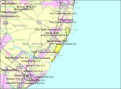 Census Bureau map of Long Beach Township, New Jersey | |
| Coordinates: 39.60155°N 74.226367°W[1][2] | |
| Country | |
| State | |
| County | |
| Incorporated | March 23, 1899 |
| Government | |
| • Type | Walsh Act |
| • Body | Board of Commissioners |
| • Mayor | Joseph H. Mancini (term ends December 31, 2024)[4][5] |
| • Administrator | Kyle Ominski[6] |
| • Municipal clerk | Danielle La Valle[6] |
| Area | |
| • Total | 21.99 sq mi (56.95 km2) |
| • Land | 5.45 sq mi (14.11 km2) |
| • Water | 16.54 sq mi (42.84 km2) 75.22% |
| • Rank | 124th of 565 in state 13th of 33 in county[1] |
| Elevation | 0 ft (0 m) |
| Population | |
| • Total | 3,051 |
| • Estimate (2019)[12] | 3,071 |
| • Rank | 451st of 566 in state 18th of 33 in county[13] |
| • Density | 560.5/sq mi (216.4/km2) |
| • Rank | 435th of 566 in state 26th of 33 in county[13] |
| Time zone | UTC−05:00 (Eastern (EST)) |
| • Summer (DST) | UTC−04:00 (Eastern (EDT)) |
| ZIP Code | |
| Area code(s) | 609 exchanges: 207, 361, 492, 494[16] |
| FIPS code | 3402941250[1][17][18] |
| GNIS feature ID | 0882066[1][19] |
| Website | www |
Most of the township is located on Long Beach Island, a barrier island along the Atlantic Ocean whose summer population swells to as much as 130,000, including part-time residents and tourists.[21] In October 2012, Long Beach Township was severely affected by Hurricane Sandy, with township mayor Joe Mancini estimating that potential costs to repair the damage estimated as high as $1 billion across Long Beach Island.[22] As a result of the storm surge, flooding and high winds, dozens of homes and businesses were damaged or destroyed. After the waters receded, streets were left covered with up to four feet of sand in some spots.[23] Governor Chris Christie issued a mandatory evacuation order on October 28, and it remained in place until a full 13 days after the storm.[24] The township established a Sandy Relief Fund to assist residents in their recovery from the hurricane.[25]
Long Beach Township was incorporated as a township by an act of the New Jersey Legislature on March 23, 1899, from portions of Eagleswood Township, Little Egg Harbor Township, Ocean Township, Stafford Township and Union Township (now known as Barnegat Township). Portions of the township were taken to form Barnegat City (March 29, 1904, now Barnegat Light) and Ship Bottom-Beach Arlington (March 3, 1925, now Ship Bottom).[26] The name derives from the length of the island along Barnegat Bay.[27]
Geography
According to the United States Census Bureau, the township had a total area of 21.99 square miles (56.95 km2), including 5.45 square miles (14.11 km2) of land and 16.54 square miles (42.84 km2) of water (75.22%).[1][2]
North Beach Haven (with a 2010 Census population of 2,235[28]) is an unincorporated community and census-designated place (CDP) located within Long Beach Township.[29][30][31] Other unincorporated communities, localities and place names located partially or completely within the township include the Long Beach Island communities of Bay Vista, Beach Haven Crest, Beach Haven Gardens, Beach Haven Heights, Beach Haven Inlet, Beach Haven Park, Beach Haven Terrace, Brant Beach, Brighton Beach, Haven Beach, High Bar Harbor, Holgate, Loveladies, North Beach, North Beach Haven, Peahala Park, South Beach Haven, Spray Beach, and the Dunes.[32][33]
The township is divided into four noncontiguous land areas. The most populous, with most of the named places, is located north of Beach Haven and south of Ship Bottom. The Holgate section is south of Beach Haven; most of it is a wildlife preserve. Loveladies and High Bar Harbor form the northernmost, between Harvey Cedars and Barnegat Light. North Beach and Frazier Park north of Surf City and south of Harvey Cedars.
The township borders the Ocean County municipalities of Barnegat Light, Barnegat Township, Beach Haven, Eagleswood Township, Harvey Cedars, Little Egg Harbor Township, Ocean Township, Ship Bottom, Stafford Township and Surf City.[34][35][36]
Demographics
| Historical population | |||
|---|---|---|---|
| Census | Pop. | %± | |
| 1900 | 152 | — | |
| 1910 | 107 | * | −29.6% |
| 1920 | 106 | −0.9% | |
| 1930 | 355 | * | 234.9% |
| 1940 | 425 | 19.7% | |
| 1950 | 840 | 97.6% | |
| 1960 | 1,561 | 85.8% | |
| 1970 | 2,910 | 86.4% | |
| 1980 | 3,488 | 19.9% | |
| 1990 | 3,407 | −2.3% | |
| 2000 | 3,329 | −2.3% | |
| 2010 | 3,051 | −8.4% | |
| 2019 (est.) | 3,071 | [12][37] | 0.7% |
| Population sources: 1900–2000[38] 1900–1920[39] 1900–1910[40] 1910–1930[41] 1930–1990[42] 2000[43][44] 2010[8][9][10][11] * = Lost territory in previous decade.[26] | |||
Census 2010
The 2010 United States census counted 3,051 people, 1,539 households, and 943 families in the township. The population density was 560.5 per square mile (216.4/km2). There were 9,216 housing units at an average density of 1,693.0 per square mile (653.7/km2). The racial makeup was 96.98% (2,959) White, 0.26% (8) Black or African American, 0.03% (1) Native American, 0.49% (15) Asian, 0.00% (0) Pacific Islander, 1.57% (48) from other races, and 0.66% (20) from two or more races. Hispanic or Latino of any race were 4.13% (126) of the population.[9]
Of the 1,539 households, 9.6% had children under the age of 18; 53.9% were married couples living together; 4.7% had a female householder with no husband present and 38.7% were non-families. Of all households, 34.8% were made up of individuals and 19.4% had someone living alone who was 65 years of age or older. The average household size was 1.98 and the average family size was 2.48.[9]
9.9% of the population were under the age of 18, 3.9% from 18 to 24, 12.7% from 25 to 44, 33.4% from 45 to 64, and 40.1% who were 65 years of age or older. The median age was 61.3 years. For every 100 females, the population had 96.6 males. For every 100 females ages 18 and older there were 97.3 males.[9]
The Census Bureau's 2006–2010 American Community Survey showed that (in 2010 inflation-adjusted dollars) median household income was $77,396 (with a margin of error of +/− $15,929) and the median family income was $95,417 (+/− $12,507). Males had a median income of $69,922 (+/− $25,066) versus $59,688 (+/− $18,587) for females. The per capita income for the borough was $63,020 (+/− $9,706). About 2.3% of families and 3.5% of the population were below the poverty line, including none of those under age 18 and 7.1% of those age 65 or over.[45]
Census 2000
As of the 2000 United States Census[17] there were 3,329 people, 1,664 households, and 1,038 families residing in the township. The population density was 627.3 inhabitants per square mile (242.2/km2). There were 9,023 housing units at an average density of 1,700.1 per square mile (656.4/km2). The racial makeup of the township was 98.53% White, 0.24% African American, 0.03% Native American, 0.36% Asian, 0.33% from other races, and 0.51% from two or more races. Hispanic or Latino of any race were 2.10% of the population.[43][44]
There were 1,664 households, out of which 12.3% had children under the age of 18 living with them, 53.5% were married couples living together, 6.4% had a female householder with no husband present, and 37.6% were non-families. 33.8% of all households were made up of individuals, and 19.9% had someone living alone who was 65 years of age or older. The average household size was 2.00 and the average family size was 2.50.[43][44]
In the township the population was spread out, with 11.7% under the age of 18, 3.9% from 18 to 24, 17.9% from 25 to 44, 30.0% from 45 to 64, and 36.5% who were 65 years of age or older. The median age was 57 years. For every 100 females, there were 90.2 males. For every 100 females age 18 and over, there were 89.2 males.[43][44]
The median income for a household in the township was $48,697, and the median income for a family was $59,833. Males had a median income of $41,681 versus $31,528 for females. The per capita income for the township was $33,404. About 3.8% of families and 5.1% of the population were below the poverty line, including 7.6% of those under age 18 and 5.8% of those age 65 or over.[43][44]
Government
Local government
Long Beach Township has been governed under the Walsh Act form of New Jersey municipal government, since 1936.[46][47] The township is one of 30 municipalities (of the 564) statewide that use the commission form of government.[48] The governing body is comprised of three commissioners, who are elected to serve concurrent four-year terms on a non-partisan basis, in elections held as part of the November general election.[3] The Board of Commissioners passed an ordinance in February 2011 shifting the nonpartisan elections from May to November, beginning as of the November 2012 election.[49]
As of 2022[update], the members of the Long Beach Township Board of Commissioners are Mayor Joseph H. Mancini (Commissioner of Public Affairs and Public Safety), Ralph H. Bayard (Commissioner of Public Works, Parks and Public Property) and Dr. Joseph P. Lattanzi (Commissioner of Revenue and Finance), all serving terms of office that end December 31, 2024.[4][50][51][52][53]
On August 12, 2009, Commissioner DiAnne Gove was selected by Republican county committee members to fill the remainder of the term of Daniel Van Pelt in the General Assembly representing the 9th Legislative District after Van Pelt had resigned after being arrested on corruption charges.[54]
Federal, state and county representation
Long Beach Township is located in the 2nd Congressional District[55] and is part of New Jersey's 9th state legislative district.[10][56][57] Prior to the 2010 Census, Long Beach Township had been part of the 3rd Congressional District, a change made by the New Jersey Redistricting Commission that took effect in January 2013, based on the results of the November 2012 general elections.[58]
For the 117th United States Congress, New Jersey's Second Congressional District is represented by Jeff Van Drew (R, Dennis Township).[59] New Jersey is represented in the United States Senate by Democrats Cory Booker (Newark, term ends 2027)[60] and Bob Menendez (Harrison, term ends 2025).[61][62]
For the 2022–2023 session, the 9th Legislative District of the New Jersey Legislature is represented in the State Senate by Christopher J. Connors (R, Lacey Township) and in the General Assembly by DiAnne Gove (R, Long Beach Township) and Brian E. Rumpf (R, Little Egg Harbor Township).[63]
Ocean County is governed by a Board of County Commissioners comprised of five members who are elected on an at-large basis in partisan elections and serving staggered three-year terms of office, with either one or two seats coming up for election each year as part of the November general election. At an annual reorganization held in the beginning of January, the board chooses a Director and a Deputy Director from among its members.[64] As of 2022[update], Ocean County's Freeholders (with party affiliation, term-end year and residence) are Commissioner Director John P. Kelly (R, 2022, Eagleswood Township),[65] Commissioner Deputy Director Virginia E. Haines (R, 2022, Toms River),[66] Barbara Jo Crea (R, 2024, Little Egg Harbor Township)[67] Gary Quinn (R, 2024, Lacey Township)[68] and Joseph H. Vicari (R, 2023, Toms River).[69][70][71] Constitutional officers elected on a countywide basis are County Clerk Scott M. Colabella (R, 2025, Barnegat Light),[72][73] Sheriff Michael G. Mastronardy (R, 2022; Toms River)[74][75] and Surrogate Jeffrey Moran (R, 2023, Beachwood).[76][77][78]
Politics
As of March 23, 2011, there were a total of 2,955 registered voters in Long Beach Township, of which 544 (18.4%) were registered as Democrats, 1,215 (41.1%) were registered as Republicans and 1,195 (40.4%) were registered as Unaffiliated. There was one voter registered to another party.[79] Among the township's 2010 Census population, 96.9% (vs. 63.2% in Ocean County) were registered to vote, including 107.5% of those ages 18 and over (vs. 82.6% countywide).[79][80]
In the 2012 presidential election, Republican Mitt Romney received 64.3% of the vote (1,166 cast), ahead of Democrat Barack Obama with 34.8% (632 votes), and other candidates with 0.9% (16 votes), among the 1,844 ballots cast by the township's 3,027 registered voters (30 ballots were spoiled), for a turnout of 60.9%.[81][82] In the 2008 presidential election, Republican John McCain received 61.3% of the vote (1,441 cast), ahead of Democrat Barack Obama with 36.8% (865 votes) and other candidates with 1.1% (26 votes), among the 2,351 ballots cast by the township's 3,132 registered voters, for a turnout of 75.1%.[83] In the 2004 presidential election, Republican George W. Bush received 63.1% of the vote (1,499 ballots cast), outpolling Democrat John Kerry with 35.6% (847 votes) and other candidates with 0.6% (20 votes), among the 2,377 ballots cast by the township's 3,128 registered voters, for a turnout percentage of 76.0.[84]
In the 2013 gubernatorial election, Republican Chris Christie received 81.4% of the vote (1,267 cast), ahead of Democrat Barbara Buono with 17.7% (275 votes), and other candidates with 1.0% (15 votes), among the 1,570 ballots cast by the township's 2,960 registered voters (13 ballots were spoiled), for a turnout of 53.0%.[85][86] In the 2009 gubernatorial election, Republican Chris Christie received 63.7% of the vote (1,167 ballots cast), ahead of Democrat Jon Corzine with 27.9% (512 votes), Independent Chris Daggett with 6.6% (121 votes) and other candidates with 0.8% (14 votes), among the 1,833 ballots cast by the township's 3,041 registered voters, yielding a 60.3% turnout.[87]
Education
For pre-kindergarten through sixth grade, public school students attend the Long Beach Island Consolidated School District, which serves students from Barnegat Light, Harvey Cedars, Long Beach Township, Ship Bottom and Surf City.[3][88][89] As of the 2020–2021 school year, the district, comprised of two schools, had an enrollment of 215 students and 30.7 classroom teachers (on an FTE basis), for a student–teacher ratio of 7.0:1.[90] Schools in the district (with 2020–2021 enrollment data from the National Center for Education Statistics[91]) are Ethel Jacobsen School[92] in Surf City with 111 students in pre-kindergarten to second grade and Long Beach Island Grade School[93] in Ship Bottom with 125 students in grades 3–6.[94][95][96] The district's board of education is comprised of nine members who are directly elected from the constituent municipalities on a staggered basis, with three members elected each year.[97][98] Of the nine seats, four are elected from Long Beach Township.[99]
Students in public school for seventh through twelfth grades attend the Southern Regional School District, which serves the five municipalities in the Long Beach Island Consolidated School District, along with students from Beach Haven and Stafford Township, as well as students from Ocean Township (including its Waretown section) who attend as part of a sending/receiving relationship.[3][100][101] Schools in the district (with 2020–2021 enrollment data from the National Center for Education Statistics[102]) are Southern Regional Middle School[103] with 902 students in grades 7–8 and Southern Regional High School[104] with 1,975 students in grades 9–12.[105][106] Both schools are in the Manahawkin section of Stafford Township.
At the time of its founding in 1957, the Southern Regional School District had a roughly equal number of students from Long Beach Island and Stafford Township. By 2016, the overwhelming majority of students were from Stafford Township, accounting for nearly 90% of enrollment. These demographic changes have led to significant discrepancies in the cost per pupil sent to the district from each community, with Harvey Cedars and Long Beach Township paying more than $200,000 per pupil, while Stafford Township's costs are $3,600 for each student. These widely different costs result from a formula that uses the taxable property value in each municipality to apportion costs, which means that municipalities with relatively high property values and small numbers of students pay a higher share of total district costs. Some residents of Long Beach Island communities are seeking to amend the formula to take advantage of a 1993 law that allows districts to use both property value and enrollment to allocate property taxes, though that would require passage of referendums in each municipality.[107]
St. Mary Academy near Manahawkin, a K–8 school of the Roman Catholic Diocese of Trenton, is in the area. From 1997,[108] until 2019 it operated as All Saints Regional Catholic School and was collectively managed by five churches,[109] with one being St. Francis of Assisi Church in Brant Beach.[108] In 2019, St. Mary Church in Barnegat took entire control of the school, which remained on the same Manahawkin campus, and changed its name. The other churches no longer operate the school but still may send students there.[109]
Transportation

Roads and highways
As of May 2010[update], the township had a total of 66.33 miles (106.75 km) of roadways, of which 54.41 miles (87.56 km) were maintained by the municipality and 11.92 miles (19.18 km) by Ocean County.[110]
No Interstate, U.S. or state highways serve Long Beach Township. The main road serving the township is County Route 607 (Long Beach Boulevard).
Public transportation
Ocean Ride local service is provided on the OC9 LBI North / South route.[111][112][113]
The LBI Shuttle operates along Long Beach Boulevard, providing free service every 5 to 20 minutes from 10:00 AM to 10:00 PM. It serves the Long Beach Island municipalities/communities of Barnegat Light, Loveladies, Harvey Cedars, North Beach, Surf City, Ship Bottom, Long Beach Township, Beach Haven and Holgate.[114]
Surf Line Bus services sections of Long Beach Township in the summer months, with buses from New York City to LBI on Friday night, returning to New York City on Sunday night. Transportazumah provides daily bus service to and from New York during the summer season.[115]
Climate
According to the Köppen climate classification system, Long Beach Township, New Jersey has a humid subtropical climate (Cfa) with hot, moderately humid summers, cool winters and year-around precipitation. Cfa climates are characterized by all months having an average mean temperature > 32.0 °F (> 0.0 °C), at least four months with an average mean temperature ≥ 50.0 °F (≥ 10.0 °C), at least one month with an average mean temperature ≥ 71.6 °F (≥ 22.0 °C) and no significant precipitation difference between seasons. During the summer months in Long Beach Township, a cooling afternoon sea breeze is present on most days, but episodes of extreme heat and humidity can occur with heat index values ≥ 95 °F (≥ 35 °C). During the winter months, episodes of extreme cold and wind can occur with wind chill values < 0 °F (< −18 °C). The plant hardiness zone at Long Beach Township Beach is 7a with an average annual extreme minimum air temperature of 4.3 °F (−15.4 °C).[116] The average seasonal (November–April) snowfall total is 12 to 18 inches (30 to 46 cm) and the average snowiest month is February which corresponds with the annual peak in nor'easter activity.
| Climate data for Long Beach Township Beach, NJ (1981–2010 Averages) | |||||||||||||
|---|---|---|---|---|---|---|---|---|---|---|---|---|---|
| Month | Jan | Feb | Mar | Apr | May | Jun | Jul | Aug | Sep | Oct | Nov | Dec | Year |
| Average high °F (°C) | 40.3 (4.6) |
42.4 (5.8) |
49.1 (9.5) |
57.8 (14.3) |
68.1 (20.1) |
77.3 (25.2) |
82.7 (28.2) |
81.4 (27.4) |
75.5 (24.2) |
64.9 (18.3) |
55.0 (12.8) |
45.2 (7.3) |
61.7 (16.5) |
| Daily mean °F (°C) | 33.2 (0.7) |
35.3 (1.8) |
41.6 (5.3) |
50.5 (10.3) |
60.4 (15.8) |
69.8 (21.0) |
75.4 (24.1) |
74.3 (23.5) |
68.0 (20.0) |
56.9 (13.8) |
47.6 (8.7) |
38.0 (3.3) |
54.3 (12.4) |
| Average low °F (°C) | 26.2 (−3.2) |
28.1 (−2.2) |
34.1 (1.2) |
43.1 (6.2) |
52.6 (11.4) |
62.2 (16.8) |
68.1 (20.1) |
67.2 (19.6) |
60.5 (15.8) |
48.8 (9.3) |
40.1 (4.5) |
30.8 (−0.7) |
46.9 (8.3) |
| Average precipitation inches (mm) | 3.25 (83) |
3.05 (77) |
4.01 (102) |
3.45 (88) |
2.89 (73) |
2.78 (71) |
3.84 (98) |
4.13 (105) |
2.91 (74) |
3.47 (88) |
2.95 (75) |
3.40 (86) |
40.13 (1,019) |
| Average relative humidity (%) | 67.2 | 65.0 | 63.7 | 64.6 | 67.5 | 71.6 | 71.1 | 72.8 | 71.6 | 70.2 | 68.6 | 67.8 | 68.5 |
| Average dew point °F (°C) | 23.5 (−4.7) |
24.7 (−4.1) |
30.2 (−1.0) |
39.0 (3.9) |
49.6 (9.8) |
60.2 (15.7) |
65.4 (18.6) |
65.0 (18.3) |
58.5 (14.7) |
47.3 (8.5) |
37.8 (3.2) |
28.3 (−2.1) |
44.2 (6.8) |
| Source: PRISM[117] | |||||||||||||
| Climate data for Atlantic City, NJ Ocean Water Temperature (20 SW Long Beach Township) | |||||||||||||
|---|---|---|---|---|---|---|---|---|---|---|---|---|---|
| Month | Jan | Feb | Mar | Apr | May | Jun | Jul | Aug | Sep | Oct | Nov | Dec | Year |
| Daily mean °F (°C) | 37 (3) |
35 (2) |
42 (6) |
48 (9) |
56 (13) |
63 (17) |
70 (21) |
73 (23) |
70 (21) |
61 (16) |
53 (12) |
44 (7) |
54 (12) |
| Source: NOAA[118] | |||||||||||||
Ecology
According to the A. W. Kuchler U.S. potential natural vegetation types, Long Beach Township, New Jersey would have a dominant vegetation type of Northern Cordgrass (73) with a dominant vegetation form of Coastal Prairie (20).[119]
See also
- Long Beach Island
- Long Beach Township Beach Patrol
References
- 2019 Census Gazetteer Files: New Jersey Places, United States Census Bureau. Accessed July 1, 2020.
- US Gazetteer files: 2010, 2000, and 1990, United States Census Bureau. Accessed September 4, 2014.
- 2012 New Jersey Legislative District Data Book, Rutgers University, March 2013, p. 49.
- Elected Officials, Township of Long Beach Township. Accessed July 28, 2022. "Long Beach Township is governed by a three-member Township Committee. Commissioners are elected to serve four-year terms on a concurrent basis."
- 2022 New Jersey Mayors Directory, New Jersey Department of Community Affairs. Accessed March 1, 2022.
- Municipal Clerk, Township of Long Beach. Accessed July 28, 2022.
- U.S. Geological Survey Geographic Names Information System: Township of Long Beach, Geographic Names Information System. Accessed March 7, 2013.
- "DataUniverse - 2010 Census Populations: Ocean County", Asbury Park Press. Accessed September 20, 2012.
- DP-1 - Profile of General Population and Housing Characteristics: 2010 for Long Beach township, Ocean County, New Jersey Archived 2020-02-12 at archive.today, United States Census Bureau. Accessed September 20, 2012.
- Municipalities Sorted by 2011-2020 Legislative District, New Jersey Department of State. Accessed February 1, 2020.
- Profile of General Demographic Characteristics: 2010 for Long Beach township[permanent dead link], New Jersey Department of Labor and Workforce Development. Accessed September 20, 2012.
- Annual Estimates of the Resident Population for Minor Civil Divisions in New Jersey: April 1, 2010 to July 1, 2019, United States Census Bureau. Accessed May 21, 2020.
- GCT-PH1 Population, Housing Units, Area, and Density: 2010 - State -- County Subdivision from the 2010 Census Summary File 1 for New Jersey Archived 2020-02-12 at archive.today, United States Census Bureau. Accessed September 20, 2012.
- Look Up a ZIP Code for Long Beach, NJ, United States Postal Service. Accessed September 20, 2012.
- Zip Codes, State of New Jersey. Accessed September 23, 2013.
- Area Code Lookup - NPA NXX for Long Beach, NJ, Area-Codes.com. Accessed September 23, 2013.
- U.S. Census website , United States Census Bureau. Accessed September 4, 2014.
- Geographic Codes Lookup for New Jersey, Missouri Census Data Center. Accessed April 1, 2022.
- US Board on Geographic Names, United States Geological Survey. Accessed September 4, 2014.
- Table 7. Population for the Counties and Municipalities in New Jersey: 1990, 2000 and 2010, New Jersey Department of Labor and Workforce Development, February 2011. Accessed September 20, 2012.
- Eftimiades, Maria. "Long Beach Island Journal; When Summer Ends, Residents Take Back Their Way of Life", The New York Times, September 9, 1990. Accessed November 10, 2012. "That spirit is echoed throughout this 22-mile island, which connects to Manahawkin by four bridges across Barnegat Bay. And although tourism drops considerably in the off-season (according to the 1980 Census, there are 13,000 year-round residents), the population grows to about 130,000 in summer."
- Hutchins, Ryan. "Long Beach Island officials shocked at extent of damage from Hurricane Sandy", The Star-Ledger, October 31, 2012. Accessed December 24, 2013. "'You go back and look at images of '62,' said Long Beach Township Mayor Joe Mancini, referring to another devastating storm.... The cost of rebuilding is staggering: It will take at least $700 million to remake this 18-mile strip of land, an estimate that could certainly surpass $1 billion as more is learned, Mancini said as he surveyed the damage on the southern tip of the narrow barrier island."
- Hutchins, Ryan. "Extensive damage from Sandy litters Long Beach Island", The Star-Ledger, October 31, 2012. Accessed November 10, 2012.
- Fuoco, Michael. "In Sandy's Wake: New Jersey road reopens and residents return", Pittsburgh Post-Gazette, November 9, 2012. Accessed November 10, 2012.
- Long Beach Township Sandy Relief Fund Archived 2013-12-26 at the Wayback Machine, Township of Long Beach. Accessed December 24, 2013.
- Snyder, John P. The Story of New Jersey's Civil Boundaries: 1606-1968, Bureau of Geology and Topography; Trenton, New Jersey; 1969. p. 204. Accessed September 21, 2012.
- Hutchinson, Viola L. The Origin of New Jersey Place Names, New Jersey Public Library Commission, May 1945. Accessed September 3, 2015.
- DP-1 - Profile of General Population and Housing Characteristics: 2010 Demographic Profile Data for North Beach Haven CDP, New Jersey Archived 2020-02-12 at archive.today, United States Census Bureau. Accessed September 20, 2012.
- GCT-PH1 - Population, Housing Units, Area, and Density: 2010 - County -- County Subdivision and Place from the 2010 Census Summary File 1 for Ocean County, New Jersey Archived 2020-02-12 at archive.today, United States Census Bureau. Accessed December 27, 2012.
- 2006-2010 American Community Survey Geography for New Jersey, United States Census Bureau. Accessed December 27, 2012.
- New Jersey: 2010 - Population and Housing Unit Counts - 2010 Census of Population and Housing (CPH-2-32), United States Census Bureau, August 2012. Accessed December 27, 2012.
- Election Information Archived 2013-01-09 at the Wayback Machine, Township of Long Beach. Accessed December 27, 2012.
- Locality Search, State of New Jersey. Accessed May 21, 2015.
- Areas touching Long Beach Township, MapIt. Accessed February 26, 2020.
- Ocean County Map, Coalition for a Healthy NJ. Accessed February 26, 2020.
- New Jersey Municipal Boundaries, New Jersey Department of Transportation. Accessed November 15, 2019.
- Census Estimates for New Jersey April 1, 2010 to July 1, 2019, United States Census Bureau. Accessed May 21, 2020.
- Barnett, Bob. Population Data for Ocean County Municipalities, 1850 - 2000, WestJersey.org, January 6, 2011. Accessed December 27, 2012.
- Compendium of censuses 1726-1905: together with the tabulated returns of 1905, New Jersey Department of State, 1906. Accessed September 23, 2013.
- Thirteenth Census of the United States, 1910: Population by Counties and Minor Civil Divisions, 1910, 1900, 1890, United States Census Bureau, p. 338. Accessed December 27, 2012.
- Fifteenth Census of the United States : 1930 - Population Volume I, United States Census Bureau, p. 718. Accessed December 27, 2012.
- Table 6. New Jersey Resident Population by Municipality: 1930 - 1990 Archived March 19, 2018, at the Wayback Machine, New Jersey Department of Labor and Workforce Development. Accessed June 28, 2015.
- Census 2000 Profiles of Demographic / Social / Economic / Housing Characteristics for Long Beach township, New Jersey Archived 2003-10-15 at the Wayback Machine, United States Census Bureau. Accessed October 31, 2016.
- DP-1: Profile of General Demographic Characteristics: 2000 - Census 2000 Summary File 1 (SF 1) 100-Percent Data for Long Beach township, Ocean County, New Jersey Archived 2020-02-12 at archive.today, United States Census Bureau. Accessed September 20, 2012.
- DP03: Selected Economic Characteristics from the 2006-2010 American Community Survey 5-Year Estimates for Long Beach township, Ocean County, New Jersey Archived 2020-02-12 at archive.today, United States Census Bureau. Accessed September 20, 2012.
- "The Commission Form of Municipal Government", p. 53. Accessed June 3, 2015.
- "Forms of Municipal Government in New Jersey", p. 8. Rutgers University Center for Government Studies. Accessed June 3, 2015.
- Inventory of Municipal Forms of Government in New Jersey, Rutgers University Center for Government Studies, July 1, 2011. Accessed November 18, 2019.
- Township Code - Chapter 20: Municipal Elections Archived 2013-08-14 at the Wayback Machine, Long Beach Township. Accessed September 9, 2014. "§ 20-1. Elections in November. The election of members of the Board of Commissioners in the Township of Long Beach shall be held on the first Tuesday after the first Monday in November every four years commencing with the year 2012 pursuant to the authority set forth in N.J.S.A. 40:45-7.1. § 20-2. Terms of Commissioners. All Commissioners in office on the date of the regular municipal election in November of 2012 shall be extended to January 1, 2013. Such Commissioners shall serve until their successors have been elected and qualified and sworn into office on or before 12:00 noon January 1, 2017.
- 2022 Municipal Data Sheet, Township of Long Beach Township. Accessed July 28, 2022.
- Township of Long Beach, Ocean County, New Jersey. Accessed July 28, 2022.
- 2022 Ocean County & Municipal Elected Officials, Ocean County, New Jersey Clerk, updated April 1, 2022. Accessed May 1, 2022.
- 2020 General Election November 3, 2020 Official results, Ocean County, New Jersey, updated December 2, 2020. Accessed January 1, 2021.
- Procida, Lee. "Long Beach Township Commissioner Dianne Gove replaces Daniel Van Pelt in 9th District", The Press of Atlantic City, August 12, 2009. Accessed September 23, 2013. "Gove, 58, is currently serving her third nonconsecutive term as a Long Beach Township commissioner, once serving as mayor."
- Plan Components Report, New Jersey Redistricting Commission, December 23, 2011. Accessed February 1, 2020.
- 2019 New Jersey Citizen's Guide to Government, New Jersey League of Women Voters. Accessed October 30, 2019.
- Districts by Number for 2011-2020, New Jersey Legislature. Accessed January 6, 2013.
- 2011 New Jersey Citizen's Guide to Government Archived 2013-06-04 at the Wayback Machine, p. 60, New Jersey League of Women Voters. Accessed May 22, 2015.
- Directory of Representatives: New Jersey, United States House of Representatives. Accessed January 3, 2019.
- U.S. Sen. Cory Booker cruises past Republican challenger Rik Mehta in New Jersey, PhillyVoice. Accessed April 30, 2021. "He now owns a home and lives in Newark's Central Ward community."
- Biography of Bob Menendez, United States Senate, January 26, 2015. "Menendez, who started his political career in Union City, moved in September from Paramus to one of Harrison's new apartment buildings near the town's PATH station.."
- Home, sweet home: Bob Menendez back in Hudson County. nj.com. Accessed April 30, 2021. "Booker, Cory A. - (D - NJ) Class II; Menendez, Robert - (D - NJ) Class I"
- Legislative Roster for District 9, New Jersey Legislature. Accessed January 11, 2022.
- Freeholder to Commissioner History, Ocean County, New Jersey. Accessed June 1, 2022.
- Commissioner John P. Kelly, Ocean County, New Jersey. Accessed June 1, 2022.
- Commissioner Director Virginia E. Haines, Ocean County, New Jersey. Accessed June 1, 2022.
- Commissioner Barbara Jo Crea, Ocean County, New Jersey. Accessed June 1, 2022.
- Commissioner Gary Quinn, Ocean County, New Jersey. Accessed June 1, 2022.
- Commissioner Joseph H. Vicari, Ocean County, New Jersey. Accessed June 1, 2022.
- Meet our Commissioners, Ocean County, New Jersey. Accessed June 1, 2022.
- County Directory, Ocean County, New Jersey. Accessed June 1, 2022.
- County Clerk, Ocean County, New Jersey. Accessed June 1, 2022.
- Clerks, Constitutional Officers Association of New Jersey. Accessed June 1, 2022.
- County Sheriff Michael G. Mastronardy, Ocean County, New Jersey. Accessed June 1, 2022.
- Sheriffs, Constitutional Officers Association of New Jersey. Accessed June 1, 2022.
- County Surrogate Jeffrey W. Moran, Ocean County, New Jersey. Accessed June 1, 2022.
- Surrogates, Constitutional Officers Association of New Jersey. Accessed June 1, 2022.
- 2022 Ocean County and Municipal Elected Officials, Ocean County, New Jersey. Accessed June 1, 2022.
- Voter Registration Summary - Ocean, New Jersey Department of State Division of Elections, March 23, 2011. Accessed December 27, 2012.
- GCT-P7: Selected Age Groups: 2010 - State -- County Subdivision; 2010 Census Summary File 1 for New Jersey Archived 2020-02-12 at archive.today, United States Census Bureau. Accessed December 27, 2012.
- "Presidential General Election Results - November 6, 2012 - Ocean County" (PDF). New Jersey Department of Elections. March 15, 2013. Retrieved December 24, 2014.
- "Number of Registered Voters and Ballots Cast - November 6, 2012 - General Election Results - Ocean County" (PDF). New Jersey Department of Elections. March 15, 2013. Retrieved December 24, 2014.
- 2008 Presidential General Election Results: Ocean County, New Jersey Department of State Division of Elections, December 23, 2008. Accessed December 27, 2012.
- 2004 Presidential Election: Ocean County, New Jersey Department of State Division of Elections, December 13, 2004. Accessed December 27, 2012.
- "Governor - Ocean County" (PDF). New Jersey Department of Elections. January 29, 2014. Retrieved December 24, 2014.
- "Number of Registered Voters and Ballots Cast - November 5, 2013 - General Election Results - Ocean County" (PDF). New Jersey Department of Elections. January 29, 2014. Retrieved December 24, 2014.
- 2009 Governor: Ocean County Archived 2012-10-17 at the Wayback Machine, New Jersey Department of State Division of Elections, December 31, 2009. Accessed December 27, 2012.
- LAN Associates. Study of School Consolidation Long Beach Island, New Jersey Archived 2013-09-27 at the Wayback Machine, Long Beach Island Consolidated School District, January 21, 2011. Accessed September 25, 2013. "The Long Beach Island Consolidated School District serves the needs of the citizens of Long Beach Island including the communities of Barnegat Light Borough, Long Beach Township, Harvey Cedars Borough, Surf City Borough, and Ship Bottom Borough. The remaining community of Beach Haven at the south end of the island currently has its own school. The Long Beach Island Consolidated Schools serve children from the age of pre-school through sixth grade after which the students attend Southern Regional High School in Manahawkin."
- Long Beach Island Board of Education District Policy 0110 - Identification, Long Beach Island Consolidated School District. Accessed July 4, 2022. "Purpose The Board of Education exists for the purpose of providing a thorough and efficient system of free public education in grades Pre-Kindergarten through six in the Long Beach Island School District. Composition The Long Beach Island School District is comprised of all the area within the municipal boundaries of Barnegat Light, Harvey Cedars, Long Beach Township, Ship Bottom, and Surf City."
- District information for Long Beach Island Consolidated School District, National Center for Education Statistics. Accessed February 15, 2022.
- School Data for the Long Beach Island School District, National Center for Education Statistics. Accessed November 1, 2019.
- Ethel Jacobsen School, Long Beach Island Consolidated School District. Accessed July 4, 2022.
- Long Beach Island Grade School, Long Beach Island Consolidated School District. Accessed July 4, 2022.
- Public Schools Directory 2020–2022, Ocean County, New Jersey. Accessed July 1, 2022.
- School Performance Reports for the Long Beach Island Consolidated School District, New Jersey Department of Education. Accessed July 4, 2022.
- New Jersey School Directory for the Long Beach Island Consolidated School District, New Jersey Department of Education. Accessed December 29, 2016.
- New Jersey Boards of Education by District Election Types - 2018 School Election, New Jersey Department of Education, updated February 16, 2018. Accessed January 26, 2020.
- Comprehensive Annual Financial Report for the Long Beach Island Consolidated School District, New Jersey Department of Education, June 30, 2021. Accessed July 4, 2022. "The School District is a Type II district located in the County of Ocean, State of New Jersey. As a Type II district, the School District functions independently through a Board of Education. The Board is comprised of nine members appointed to three-year terms. These terms are staggered so that three members' terms expire each year. The District provides a full range of educational services appropriate to grades levels kindergarten through 6th grade."
- "Four on Ballot for LBI School Board", The SandPaper, October 23, 2019. Accessed July 4, 2022. "The LBI school board is comprised of nine members, four from Long Beach Township, two from Surf City, and one each from Ship Bottom, Harvey Cedars and Barnegat Light."
- Southern Regional High School 2015 Report Card Narrative, New Jersey Department of Education. Accessed June 2, 2016. "Located in Manahawkin, the Southern Regional School District draws from the constituent districts of Long Beach Township, Beach Haven, Surf City, Ship Bottom, Barnegat Light, Harvey Cedars and Stafford Township, as well as the tuition sending district of Ocean Township (Waretown).
- About Us, Southern Regional School District. Accessed July 4, 2022. "Our school is a 7-12 comprehensive regional high school district. Our middle school covers grades 7-8 and our high school covers grades 9-12. The district is comprised of the constituent members of Stafford Township, Beach Haven, Long Beach Township, (which includes the municipalities [sic] of Loveladies, North Beach, High Bar Harbor and Brant Beach and Long Beach Township) Barnegat Light, Harvey Cedars, Ship Bottom, and Surf City. Waretown is our sending district."
- School Data for the Southern Regional School District, National Center for Education Statistics. Accessed February 15, 2022.
- Southern Regional Middle School, Southern Regional School District. Accessed July 4, 2022.
- Southern Regional High School, Southern Regional School District. Accessed July 4, 2022.
- School Performance Reports for the Southern Regional School District, New Jersey Department of Education. Accessed July 4, 2022.
- New Jersey School Directory for the Southern Regional School District, New Jersey Department of Education. Accessed December 29, 2016.
- Brody, Leslie. "Regional Schools' Uneven Per-Pupil Costs Get Scrutiny; In some areas of New Jersey, towns pay far more than others, per student, for the same education", The Wall Street Journal, February 1, 2016. Accessed January 31, 2017. "Back when the Southern Regional district opened in 1957, there were almost as many students from Long Beach Island as Stafford. 'I don't think anybody saw the demographics would change as drastically as they did,' Mr. Henry says. Now 263 students from Long Beach Island attend the district for grades seven through 12, along with 2,263 from Stafford, according to data the state uses to calculate payments."
- "All Saints Regional school to become St. Mary Academy under administration of Barnegat parish". Roman Catholic Diocese of Trenton. December 19, 2018. Retrieved June 23, 2020.
- Heyboer, Kelly (June 11, 2019). "These are all the N.J. Catholic schools closing and merging this year". Nj.com. Retrieved June 23, 2020.
- Ocean County Mileage by Municipality and Jurisdiction, New Jersey Department of Transportation, May 2010. Accessed July 18, 2014.
- Ocean County Bus Service Archived 2015-08-14 at the Wayback Machine, Greater Mercer TMA. Accessed August 10, 2015.
- Ocean Ride Rider's Guide Archived 2015-06-27 at the Wayback Machine, Ocean County, New Jersey. Accessed August 10, 2015.
- Ocean County Transit Guide Archived 2015-09-23 at the Wayback Machine, Ocean County, New Jersey. Accessed August 10, 2015.
- LBI Shuttle, Borough of Barnegat Light. Accessed August 9, 2015.
- , Surf Line Bus. Accessed June 20, 2017. "A brand new direct bus service running between New York City and Long Beach Island, NJ. Buses depart every Friday evening from NYC and return every Sunday evening from most parts of LBI."
- "USDA Interactive Plant Hardiness Map". United States Department of Agriculture. Archived from the original on July 4, 2019. Retrieved August 5, 2019.
- Time Series Values for Individual Locations, PRISM Climate Group Oregon State University. Accessed March 18, 2020.
- Water Temperature Table of All Coastal Regions, National Oceanic and Atmospheric Administration. Accessed March 18, 2020.
- U.S. Potential Natural Vegetation, Original Kuchler Types, v2.0 (Spatially Adjusted to Correct Geometric Distortions), Data Basin. Accessed March 18, 2020.
External links

Другой контент может иметь иную лицензию. Перед использованием материалов сайта WikiSort.org внимательно изучите правила лицензирования конкретных элементов наполнения сайта.
WikiSort.org - проект по пересортировке и дополнению контента Википедии