world.wikisort.org - USA
Lithium is an inactive village located in Perry County, Missouri, United States. The population was 92 at the 2020 census. The 2000 Census found Lithium to have zero residents; an Associated Press article from 2001, however, stated that about 50 people in fact resided there, but may have been counted as part of Perry County's rural population.
Lithium, Missouri | |
|---|---|
Inactive Village | |
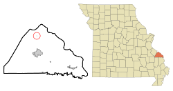 Location of Lithium, Missouri | |
| Coordinates: 37°49′56″N 89°53′2″W | |
| Country | United States |
| State | Missouri |
| County | Perry |
| Township | Saline |
| Incorporated | 1883[1] |
| Area | |
| • Total | 0.78 sq mi (2.01 km2) |
| • Land | 0.77 sq mi (1.99 km2) |
| • Water | 0.01 sq mi (0.02 km2) |
| Elevation | 381 ft (116 m) |
| Population (2020) | |
| • Total | 92 |
| • Density | 119.48/sq mi (46.14/km2) |
| Time zone | UTC-6 (Central (CST)) |
| • Summer (DST) | UTC-5 (CDT) |
| ZIP code | 63775 |
| Area code(s) | 573 |
| FIPS code | 29-43346[3] |
| GNIS feature ID | 0721146[4] |
Lithium had a ZIP Code of 63775, but it has since been declared by the USPS to be "Not Acceptable - Use Perryville."
Etymology
Lithium's location is due to two natural mineral springs; one of the two springs contained lithium salts, giving the town its name.[5]
History
Lithium was first surveyed as a town in 1882. The first settlers were Dr. Henry Clay Fish, Richard P. Dobbs and James G. Christian, who all came to Missouri from Illinois. The town was incorporated in 1883 and the first mayor was Richard C. Lisenby. The location of the town was determined by two mineral springs, which were highly prized on account of their medicinal qualities, which led to the construction of a bath house by Thomas King in 1883. A Baptist church, Lithium Baptist, was organized in 1885 and a Catholic church, St. John the Evangelist, was organized in 1896. By 1912 the town had two general stores, two mills, a brick yard and population of 98.[1]
Geography
Lithium is located at 37°49'56" north, 89°53'1" west (37.832223, -89.883862).[6]
According to the United States Census Bureau, the village has a total area of 0.06 square miles (0.16 km2), all land.[7]
Location of nearby communities

Demographics
| Historical population | |||
|---|---|---|---|
| Census | Pop. | %± | |
| 1900 | 93 | — | |
| 1910 | 98 | 5.4% | |
| 1920 | 94 | −4.1% | |
| 1930 | 61 | −35.1% | |
| 1940 | 91 | 49.2% | |
| 1950 | 57 | −37.4% | |
| 1960 | 54 | −5.3% | |
| 1970 | 56 | 3.7% | |
| 1980 | 81 | 44.6% | |
| 1990 | 9 | −88.9% | |
| 2010 | 89 | — | |
| 2020 | 92 | 3.4% | |
| U.S. Decennial Census[8] 2020[9] | |||
As of the census[3] of 2000, there were no people living in the village.
2010 census
As of the census[10] of 2010, there were 89 people, 28 households, and 22 families residing in the village. The population density was 1,483.3 inhabitants per square mile (572.7/km2). There were 32 housing units at an average density of 533.3 per square mile (205.9/km2). The racial makeup of the village was 98.88% White and 1.12% from other races. Hispanic or Latino of any race were 1.12% of the population.
There were 28 households, of which 53.6% had children under the age of 18 living with them, 64.3% were married couples living together, 7.1% had a female householder with no husband present, 7.1% had a male householder with no wife present, and 21.4% were non-families. 7.1% of all households were made up of individuals, and 3.6% had someone living alone who was 65 years of age or older. The average household size was 3.18 and the average family size was 3.27.
The median age in the village was 27.5 years. 34.8% of residents were under the age of 18; 9% were between the ages of 18 and 24; 25.7% were from 25 to 44; 20.2% were from 45 to 64; and 10.1% were 65 years of age or older. The gender makeup of the village was 57.3% male and 42.7% female.
Gallery
 Lithium Baptist Church
 St. John the Evangelist Catholic Church


References
- History of southeast Missouri : a narrative account of its historical progress, its people and its principal interests https://archive.org/stream/historyofsouthea01doug/historyofsouthea01doug_djvu.txt
- "ArcGIS REST Services Directory". United States Census Bureau. Retrieved August 28, 2022.
- "U.S. Census website". United States Census Bureau. Retrieved 2008-01-31.
- "US Board on Geographic Names". United States Geological Survey. 2007-10-25. Retrieved 2008-01-31.
- State Historical Society of Missouri http://shs.umsystem.edu/manuscripts/ramsay/ramsay_perry.html
- "US Gazetteer files: 2010, 2000, and 1990". United States Census Bureau. 2011-02-12. Retrieved 2011-04-23.
- "US Gazetteer files 2010". United States Census Bureau. Archived from the original on 2012-01-25. Retrieved 2012-07-08.
- United States Census Bureau. "Census of Population and Housing".
- "2020 Census Data". data.census.gov.
- "U.S. Census website". United States Census Bureau. Retrieved 2012-07-08.
Municipalities and communities of Perry County, Missouri, United States | ||
|---|---|---|
County seat: Perryville | ||
| Cities |  | |
| Village | ||
| Townships | ||
| CDPs | ||
| Other communities | ||
| Abandoned villages |
| |
| Footnotes | ‡This populated place also has portions in an adjacent county or counties | |
| ||
На других языках
[de] Lithium (Missouri)
Lithium ist ein Village im Perry County im Bundesstaat Missouri der Vereinigten Staaten. Das Dorf liegt innerhalb des Saline Township und hatte bei der Volkszählung im Jahr 2010 insgesamt 89 Einwohner.- [en] Lithium, Missouri
Другой контент может иметь иную лицензию. Перед использованием материалов сайта WikiSort.org внимательно изучите правила лицензирования конкретных элементов наполнения сайта.
WikiSort.org - проект по пересортировке и дополнению контента Википедии