world.wikisort.org - USA
Brewer is an unincorporated community and census-designated place in Saline Township, Perry County, Missouri, United States, which is located northwest of Perryville.
Brewer, Missouri | |
|---|---|
Unincorporated community and census-designated place | |
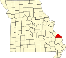 Location of Perry County | |
| Coordinates: 37°46′51″N 89°55′31″W | |
| Country | United States |
| State | Missouri |
| County | Perry |
| Township | Saline |
| Area | |
| • Total | 2.34 sq mi (6.06 km2) |
| • Land | 2.34 sq mi (6.06 km2) |
| • Water | 0.00 sq mi (0.00 km2) |
| Elevation | 584 ft (178 m) |
| Population (2020) | |
| • Total | 361 |
| • Density | 154.34/sq mi (59.58/km2) |
| Time zone | UTC-6 (Central (CST)) |
| • Summer (DST) | UTC-5 (CDT) |
| ZIP code | 63775[2] |
| Area code | 573 |
| FIPS code | 29-08272[3] |
| GNIS feature ID | 714672[3] |
Demographics
| Historical population | |||
|---|---|---|---|
| Census | Pop. | %± | |
| 2020 | 361 | — | |
| U.S. Decennial Census[4] | |||
History
Brewer was named for R. M. Brewer.[5] The Brewer family, originally hailing from Maryland, had settled in Spencer County, Kentucky, before eventually coming to Missouri.
The town was unofficially known as Brewerville before the post office was christened Brewer in 1886.[6]
Photos
 Christ the Savior Catholic Church

References
- "ArcGIS REST Services Directory". United States Census Bureau. Retrieved August 28, 2022.
- Findpincode.com: Postal Code Brewer, MO http://findpincode.com/brazeau-missouri-zip-code-postal-code-63737.html%5B%5D
- "Brewer (Perry County, Missouri [MO]): Miscellaneous Information". www.roadsidethoughts.com. Archived from the original on 2 July 2013. Retrieved 26 January 2022.
- "Census of Population and Housing". Census.gov. Retrieved June 4, 2016.
- Eaton, David Wolfe (1917). How Missouri Counties, Towns and Streams Were Named. The State Historical Society of Missouri. pp. 338.
- The State Historical Society of Missouri: Perry County http://shs.umsystem.edu/manuscripts/ramsay/ramsay_perry.html
Municipalities and communities of Perry County, Missouri, United States | ||
|---|---|---|
County seat: Perryville | ||
| Cities |  | |
| Village | ||
| Townships | ||
| CDPs | ||
| Other communities | ||
| Abandoned villages | ||
| Footnotes | ‡This populated place also has portions in an adjacent county or counties | |
| ||
This Perry County, Missouri state location article is a stub. You can help Wikipedia by expanding it. |
Текст в блоке "Читать" взят с сайта "Википедия" и доступен по лицензии Creative Commons Attribution-ShareAlike; в отдельных случаях могут действовать дополнительные условия.
Другой контент может иметь иную лицензию. Перед использованием материалов сайта WikiSort.org внимательно изучите правила лицензирования конкретных элементов наполнения сайта.
Другой контент может иметь иную лицензию. Перед использованием материалов сайта WikiSort.org внимательно изучите правила лицензирования конкретных элементов наполнения сайта.
2019-2026
WikiSort.org - проект по пересортировке и дополнению контента Википедии
WikiSort.org - проект по пересортировке и дополнению контента Википедии