world.wikisort.org - USA
Lindsay is an unincorporated hamlet in Dawson County, Montana, United States, located on Montana Highway 200S and the Upper Sevenmile Creek, 22.3 miles (35.9 km) west-northwest of Glendive. The community has a post office with ZIP code 59339,[3][4] a public school, and a cooperative.
Lindsay, Montana | |
|---|---|
Unincorporated community | |
 Lindsay  Lindsay | |
| Coordinates: 47°13′08″N 105°09′14″W | |
| Country | United States |
| State | Montana |
| County | Dawson |
| Area | |
| • Total | 0.65 sq mi (1.68 km2) |
| • Land | 0.65 sq mi (1.68 km2) |
| • Water | 0.00 sq mi (0.00 km2) |
| Elevation | 2,680 ft (820 m) |
| Population (2020) | |
| • Total | 12 |
| • Density | 18.52/sq mi (7.15/km2) |
| Time zone | UTC-7 (Mountain (MST)) |
| • Summer (DST) | UTC-6 (MDT) |
| ZIP code | 59339 |
| Area code | 406 |
| GNIS feature ID | 773370[2] |
The town is named for Willam Lindsay, an Ohio-born businessman and the first rancher and freighter in the region.[5] In the 1920s, the town moved from its original site when the Northern Pacific Railway built its branch line to Circle.
Demographics
| Historical population | |||
|---|---|---|---|
| Census | Pop. | %± | |
| 2020 | 12 | — | |
| U.S. Decennial Census[6] | |||
References
- "ArcGIS REST Services Directory". United States Census Bureau. Retrieved September 5, 2022.
- "Lindsay". Geographic Names Information System. United States Geological Survey, United States Department of the Interior.
- United States Postal Service (2012). "USPS - Look Up a ZIP Code". Retrieved 2012-02-15.
- "Postmaster Finder - Post Offices by ZIP Code". United States Postal Service. Retrieved July 8, 2014.
- "Lindsay". Montana Place Names Companion. Montana Historical Society. Retrieved 5 April 2021.
- "Census of Population and Housing". Census.gov. Retrieved June 4, 2016.
Municipalities and communities of Dawson County, Montana, United States | ||
|---|---|---|
County seat: Glendive | ||
| City | 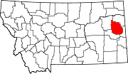 | |
| Town | ||
| CDPs | ||
| ||
This Dawson County, Montana state location article is a stub. You can help Wikipedia by expanding it. |
Текст в блоке "Читать" взят с сайта "Википедия" и доступен по лицензии Creative Commons Attribution-ShareAlike; в отдельных случаях могут действовать дополнительные условия.
Другой контент может иметь иную лицензию. Перед использованием материалов сайта WikiSort.org внимательно изучите правила лицензирования конкретных элементов наполнения сайта.
Другой контент может иметь иную лицензию. Перед использованием материалов сайта WikiSort.org внимательно изучите правила лицензирования конкретных элементов наполнения сайта.
2019-2025
WikiSort.org - проект по пересортировке и дополнению контента Википедии
WikiSort.org - проект по пересортировке и дополнению контента Википедии