world.wikisort.org - USA
Lilydale is a city in Dakota County, Minnesota, United States. The population was 623 at the 2010 census.[4]
Lilydale | |
|---|---|
City | |
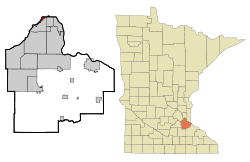 Location of the city of Lilydale within Dakota County, Minnesota | |
| Coordinates: 44°54′2″N 93°8′22″W | |
| Country | United States |
| State | Minnesota |
| County | Dakota |
| Area | |
| • Total | 0.88 sq mi (2.28 km2) |
| • Land | 0.55 sq mi (1.43 km2) |
| • Water | 0.33 sq mi (0.85 km2) |
| Elevation | 702 ft (214 m) |
| Population (2020) | |
| • Total | 809 |
| • Density | 1,462.93/sq mi (564.33/km2) |
| Time zone | UTC-6 (Central (CST)) |
| • Summer (DST) | UTC-5 (CDT) |
| ZIP code | 55118 |
| Area code | 651 |
| FIPS code | 27-37016[2] |
| GNIS feature ID | 0646656[3] |
| Website | lilydale.govoffice.com |
Geography
According to the United States Census Bureau, the city has a total area of 0.87 square miles (2.25 km2), of which 0.58 square miles (1.50 km2) is land and 0.29 square miles (0.75 km2) is water.[5]
State Highway 13 serves as a main route in Lilydale.
Demographics
| Historical population | |||
|---|---|---|---|
| Census | Pop. | %± | |
| 1960 | 116 | — | |
| 1970 | 322 | 177.6% | |
| 1980 | 417 | 29.5% | |
| 1990 | 506 | 21.3% | |
| 2000 | 552 | 9.1% | |
| 2010 | 623 | 12.9% | |
| 2020 | 809 | 29.9% | |
| U.S. Decennial Census[6] | |||
2010 census
As of the census[7] of 2010, there were 623 people, 375 households, and 181 families living in the city. The population density was 1,074.1 inhabitants per square mile (414.7/km2). There were 444 housing units at an average density of 765.5 per square mile (295.6/km2). The racial makeup of the city was 95.5% White, 1.3% African American, 2.2% Asian, 0.3% from other races, and 0.6% from two or more races. Hispanic or Latino of any race were 0.8% of the population.
There were 375 households, of which 6.4% had children under the age of 18 living with them, 43.2% were married couples living together, 3.2% had a female householder with no husband present, 1.9% had a male householder with no wife present, and 51.7% were non-families. 46.1% of all households were made up of individuals, and 28% had someone living alone who was 65 years of age or older. The average household size was 1.66 and the average family size was 2.23.
The median age in the city was 63.3 years. 5.9% of residents were under the age of 18; 3.8% were between the ages of 18 and 24; 13.8% were from 25 to 44; 29.9% were from 45 to 64; and 46.7% were 65 years of age or older. The gender makeup of the city was 41.9% male and 58.1% female.
2000 census
As of the census[2] of 2000, there were 552 people, 338 households, and 154 families living in the city. The population density was 756.4 people per square mile (292.0/km2). There were 383 housing units at an average density of 524.8 per square mile (202.6/km2). The racial makeup of the city was 94.93% White, 0.72% African American, 0.18% Native American, 1.81% Asian, 0.18% Pacific Islander, 1.63% from other races, and 0.54% from two or more races. Hispanic or Latino of any race were 2.17% of the population.
There were 338 households, out of which 5.9% had children under the age of 18 living with them, 41.1% were married couples living together, 3.3% had a female householder with no husband present, and 54.4% were non-families. 49.4% of all households were made up of individuals, and 29.9% had someone living alone who was 65 years of age or older. The average household size was 1.63 and the average family size was 2.25.
In the city, the population was spread out, with 6.0% under the age of 18, 3.8% from 18 to 24, 14.5% from 25 to 44, 29.5% from 45 to 64, and 46.2% who were 65 years of age or older. The median age was 62 years. For every 100 females, there were 70.4 males. For every 100 females age 18 and over, there were 68.5 males.
The median income for a household in the city was $54,792, and the median income for a family was $82,001. Males had a median income of $52,500 versus $40,815 for females. The per capita income for the city was $42,724. None of the families and 2.9% of the population were living below the poverty line, including no under eighteens and 0.8% of those over 64.
References
- "2020 U.S. Gazetteer Files". United States Census Bureau. Retrieved July 24, 2022.
- "U.S. Census website". United States Census Bureau. Retrieved 2008-01-31.
- "US Board on Geographic Names". United States Geological Survey. 2007-10-25. Retrieved 2008-01-31.
- "2010 Census Redistricting Data (Public Law 94-171) Summary File". American FactFinder. United States Census Bureau. Retrieved 27 April 2011.[dead link]
- "US Gazetteer files 2010". United States Census Bureau. Archived from the original on 2012-01-25. Retrieved 2012-11-13.
- "Census of Population and Housing". Census.gov. Retrieved June 4, 2015.
- "U.S. Census website". United States Census Bureau. Retrieved 2012-11-13.
Municipalities and communities of Dakota County, Minnesota, United States | ||
|---|---|---|
County seat: Hastings | ||
| Cities |  | |
| Townships | ||
| Unincorporated communities | ||
| Ghost towns |
| |
| Indian reservation |
| |
| Footnotes | ‡This populated place also has portions in an adjacent county or counties | |
| ||
Authority control | |
|---|---|
| General | |
| National libraries | |
На других языках
- [en] Lilydale, Minnesota
[ru] Лилидейл (город, Миннесота)
Лилидейл (англ. Lilydale) — город в округе Дакота, штат Миннесота, США. На площади 2,4 км² (1,9 км² — суша, 0,5 км² — вода), согласно переписи 2002 года, проживают 552 человека. Плотность населения составляет 292 чел./км².Другой контент может иметь иную лицензию. Перед использованием материалов сайта WikiSort.org внимательно изучите правила лицензирования конкретных элементов наполнения сайта.
WikiSort.org - проект по пересортировке и дополнению контента Википедии