world.wikisort.org - USA
Laton is a ghost town in Corning Township, Rooks County, Kansas, United States.[1]
Laton, Kansas | |
|---|---|
Ghost town | |
 Laton Location within the state of Kansas  Laton Laton (the United States) | |
| Coordinates: 39°17′08″N 99°04′36″W | |
| Country | United States |
| State | Kansas |
| County | Rooks |
| Elevation | 2,073 ft (632 m) |
| Population | |
| • Total | 0 |
| Time zone | UTC-6 (CST) |
| • Summer (DST) | UTC-5 (CDT) |
| Area code | 785 |
| GNIS ID | 484596 [1] |
History
Eagle Creek was issued a post office in 1878. In 1884 the post office name was changed to Laton before being discontinued in 1904.[2] In addition to the post office Laton had a school, store, cream station, garage, blacksmith shop, and telephone office.[3] The population in 1910 was 30.[4]
The Midland Trail (Red Line Highway) passed thru Laton on its initial route in 1914. The creation of U.S Route 40N (US-24) to the north and K-18 highway to the south by-passed Laton.[5]
Laton School District R-5, Rooks County, Kansas was disorganized in 1962.[6] There is nothing left of Laton.
References
- "Laton, Kansas", Geographic Names Information System, United States Geological Survey
- "Kansas Post Offices, 1828-1961". Kansas Historical Society. Retrieved 2017-12-05.
- "Rooks County Historical Society", Plainville Times, 3 July 1975, p.4
- Blackmar, Frank Wilson (1912). Kansas: A Cyclopedia of State History, Volume 2, Chicago: Standard Publishing Company, p. 107
- "THE RED LINE", Plainville Times, 16 July 1914, p.1
- "TO WHOM IT MAY CONCERN", The Natoma Luray Independent, 19 July 1962, p.5
Municipalities and communities of Rooks County, Kansas, United States | ||
|---|---|---|
County seat: Stockton | ||
| Cities | 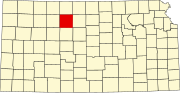 | |
| Unincorporated community |
| |
| Ghost towns | ||
| Townships |
| |
| Footnotes | †This community is designated a Census-Designated Place (CDP) by the United States Census Bureau. | |
| ||
Текст в блоке "Читать" взят с сайта "Википедия" и доступен по лицензии Creative Commons Attribution-ShareAlike; в отдельных случаях могут действовать дополнительные условия.
Другой контент может иметь иную лицензию. Перед использованием материалов сайта WikiSort.org внимательно изучите правила лицензирования конкретных элементов наполнения сайта.
Другой контент может иметь иную лицензию. Перед использованием материалов сайта WikiSort.org внимательно изучите правила лицензирования конкретных элементов наполнения сайта.
2019-2026
WikiSort.org - проект по пересортировке и дополнению контента Википедии
WikiSort.org - проект по пересортировке и дополнению контента Википедии