world.wikisort.org - USA
Lantry is an unincorporated community and a census-designated place (CDP) in Dewey County, South Dakota, United States. Lantry has been assigned the ZIP code of 57636.[3] The population of the CDP was 33 at the 2020 census.[4]
Lantry, South Dakota | |
|---|---|
Unincorporated community | |
 Lantry Location within the state of South Dakota  Lantry Lantry (the United States) | |
| Coordinates: 45°0′52″N 101°25′52″W | |
| Country | United States |
| State | South Dakota |
| County | Dewey |
| Area | |
| • Total | 0.41 sq mi (1.08 km2) |
| • Land | 0.41 sq mi (1.08 km2) |
| • Water | 0.00 sq mi (0.00 km2) |
| Population (2020)[2] | |
| • Total | 33 |
| • Density | 79.52/sq mi (30.68/km2) |
| Time zone | UTC-6 (Central (CST)) |
| • Summer (DST) | UTC-5 (CDT) |
| ZIP codes | 57636 |
| FIPS code | 46-35900 |
According to the Federal Writers' Project, the origin of the name Lantry is obscure.[5]
Demographics
| Historical population | |||
|---|---|---|---|
| Census | Pop. | %± | |
| 2020 | 33 | — | |
| U.S. Decennial Census[6] | |||
Education
It is in the Eagle Butte School District,[7] which jointly operates Cheyenne-Eagle Butte School with the Bureau of Indian Education (BIE).[8]
References
- "ArcGIS REST Services Directory". United States Census Bureau. Retrieved October 15, 2022.
- "Census Population API". United States Census Bureau. Retrieved Oct 15, 2022.
- "Lantry, SD ZIP Codes". SD HomeTownLocator. HTL, Inc. Retrieved 2008-09-12.
- "U.S. Census Bureau: Lantry CDP, South Dakota". www.census.gov. United States Census Bureau. Retrieved 13 February 2022.
- Federal Writers' Project (1940). South Dakota place-names, v.1-3. University of South Dakota. p. 47.
- "Census of Population and Housing". Census.gov. Retrieved June 4, 2016.
- "2020 CENSUS - SCHOOL DISTRICT REFERENCE MAP: Dewey County, SD" (PDF). U.S. Census Bureau. Retrieved 2021-08-06.
- "About". Eagle Butte School District 20-1. Retrieved 2021-08-06.
Municipalities and communities of Dewey County, South Dakota, United States | ||
|---|---|---|
County seat: Timber Lake | ||
| Cities | 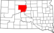 | |
| Town | ||
| CDPs | ||
| Other communities | ||
| Indian reservations |
| |
| Footnotes | ‡This populated place also has portions in an adjacent county or counties | |
| ||
Authority control | |
|---|---|
| General |
|
| National libraries | |
This South Dakota state location article is a stub. You can help Wikipedia by expanding it. |
Текст в блоке "Читать" взят с сайта "Википедия" и доступен по лицензии Creative Commons Attribution-ShareAlike; в отдельных случаях могут действовать дополнительные условия.
Другой контент может иметь иную лицензию. Перед использованием материалов сайта WikiSort.org внимательно изучите правила лицензирования конкретных элементов наполнения сайта.
Другой контент может иметь иную лицензию. Перед использованием материалов сайта WikiSort.org внимательно изучите правила лицензирования конкретных элементов наполнения сайта.
2019-2025
WikiSort.org - проект по пересортировке и дополнению контента Википедии
WikiSort.org - проект по пересортировке и дополнению контента Википедии