world.wikisort.org - USA
Landusky is an unincorporated community and census-designated place (CDP) in Phillips County, Montana, United States, with a population of 22 per the 2020 census. It is in the southwestern part of the county, in the southwestern part of the Little Rocky Mountains. It sits in the valley of Rock Creek, between Mill Gulch to the northeast and Montana Gulch to the northwest. Ore Street dead-ends in Landusky and leads southwest out of the Little Rockies 3.5 miles (5.6 km) to Montana Highway 66. The community is served by the Zortman post office, less than 5 miles (8 km) to the northeast across the Little Rockies but 21 miles (34 km) by road.
Landusky, Montana | |
|---|---|
Census-designated place | |
 Landusky  Landusky | |
| Coordinates: 47°53′51″N 108°37′20″W | |
| Country | United States |
| State | Montana |
| County | Phillips |
| Area | |
| • Total | 0.09 sq mi (0.23 km2) |
| • Land | 0.09 sq mi (0.23 km2) |
| • Water | 0.00 sq mi (0.00 km2) |
| Elevation | 3,992 ft (1,217 m) |
| Population (2020) | |
| • Total | 22 |
| • Density | 252.87/sq mi (97.54/km2) |
| Time zone | UTC-7 (Mountain (MST)) |
| • Summer (DST) | UTC-6 (MDT) |
| ZIP Code | 59546 (Zortman) |
| Area code | 406 |
| FIPS code | 30-42325 |
| GNIS feature ID | 2804314[2] |
Landusky was first listed as a CDP prior to the 2020 census.[2]
Demographics
| Historical population | |||
|---|---|---|---|
| Census | Pop. | %± | |
| 2020 | 22 | — | |
| U.S. Decennial Census[3] | |||
References
- "ArcGIS REST Services Directory". United States Census Bureau. Retrieved September 5, 2022.
- "Landusky Census Designated Place". Geographic Names Information System. United States Geological Survey, United States Department of the Interior.
- "Census of Population and Housing". Census.gov. Retrieved June 4, 2016.
Municipalities and communities of Phillips County, Montana, United States | ||
|---|---|---|
County seat: Malta | ||
| City | 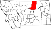 | |
| Towns | ||
| CDPs | ||
| Other communities | ||
| Indian reservations |
| |
| Footnotes | ‡This populated place also has portions in an adjacent county or counties | |
| ||
This Phillips County, Montana state location article is a stub. You can help Wikipedia by expanding it. |
Другой контент может иметь иную лицензию. Перед использованием материалов сайта WikiSort.org внимательно изучите правила лицензирования конкретных элементов наполнения сайта.
WikiSort.org - проект по пересортировке и дополнению контента Википедии