world.wikisort.org - USA
Jasper is a city in and the county seat of[2] Walker County, Alabama, United States. Its population was 14,352 as of the 2010 census.[3] Named in honor of Sergeant William Jasper, an American Revolutionary War hero, Jasper was settled around 1815 and incorporated on August 18, 1886.[3]
Jasper, Alabama | |
|---|---|
City | |
| City of Jasper | |
 | |
| Motto(s): "Experience from the past, knowledge for the future." | |
 Location of Jasper in Walker County, Alabama. | |
| Coordinates: 33°50′32″N 87°16′38″W | |
| Country | United States |
| State | Alabama |
| County | Walker |
| Government | |
| • Mayor | David O’Mary |
| Area | |
| • Total | 29.66 sq mi (76.83 km2) |
| • Land | 29.33 sq mi (75.97 km2) |
| • Water | 0.33 sq mi (0.86 km2) |
| Elevation | 328 ft (100 m) |
| Population (2020) | |
| • Total | 14,572 |
| • Density | 496.81/sq mi (191.82/km2) |
| Time zone | UTC-6 (Central (CST)) |
| • Summer (DST) | UTC-5 (CDT) |
| ZIP codes | 35501-35504 |
| Area code(s) | 205, 659 |
| FIPS code | 01-38416 |
| GNIS feature ID | 0120822 |
| Website | http://www.jaspercity.com/ |
The first significant growth of the area was in 1886, when the Kansas City, Memphis and Birmingham Railroad and the Sheffield & Birmingham Railroads were completed through Jasper. The population grew from 200 people in 1886 to more than 3,000 in 1890.[3] In a special edition in 1891, the Mountain Eagle stated there were six coal mines, two sandstone quarries, 400 coke ovens, one foundry and machine shop, two saw mills, one brick works, four hotels, and two banks.
Historic sites
Jasper has several sites listed on the National Register of Historic Places. These include the John Hollis Bankhead House, First United Methodist Church, Jasper Downtown Historic District, and Walker County Hospital.[4]
Geography
Jasper is located at 33°50′32″N 87°16′38″W (33.842347, -87.277174).[5] According to the U.S. Census Bureau, the city has a total area of 26.9 square miles (70 km2), of which 26.9 square miles (70 km2) is land and 0.04% is water.
Demographics
| Historical population | |||
|---|---|---|---|
| Census | Pop. | %± | |
| 1880 | 269 | — | |
| 1890 | 780 | 190.0% | |
| 1900 | 1,661 | 112.9% | |
| 1910 | 2,509 | 51.1% | |
| 1920 | 3,246 | 29.4% | |
| 1930 | 5,313 | 63.7% | |
| 1940 | 6,847 | 28.9% | |
| 1950 | 8,589 | 25.4% | |
| 1960 | 10,799 | 25.7% | |
| 1970 | 10,798 | 0.0% | |
| 1980 | 11,894 | 10.2% | |
| 1990 | 13,553 | 13.9% | |
| 2000 | 14,052 | 3.7% | |
| 2010 | 14,352 | 2.1% | |
| 2020 | 14,572 | 1.5% | |
| U.S. Decennial Census[6] | |||
2000 census
At the 2000 census, there were 14,052 people, 5,728 households, and 3,809 families living in the city. The population density was 523.0 inhabitants per square mile (201.9/km2). There were 6,473 housing units at an average density of 240.9 per square mile (93.0/km2). The racial makeup of the city was 84.15% White, 13.98% Black or African American, 0.21% Native American, 0.53% Asian, 0.02% Pacific Islander, 2.7% some other race, and 1.4% two or more races. 4.4% of the population was Hispanic.
Of the 5,728 households 26.1% had children under the age of 18 living with them, 47.4% were married couples living together, 14.4% had a female householder with no husband present, and 33.5% were non-families. 29.7% of households were one person and 13.2% were one person aged 65 or older. The average household size was 2.38, and the average family size was 2.93.
The age distribution was 21.5% under the age of 18, 8.1% from 18 to 24, 24.4% from 25 to 44, 27.7% from 45 to 64, and 18.3% 65 or older. The median age was 41.5 years. For every 100 females, there were 90.3 males. For every 100 females age 18 and over, there were 95.3 males.
The median household income was $41,586 and the median family income was $54,059. Males had a median income of $51,548 versus $35,248 for females. The per capita income for the city was $27,927. About 14.8% of families and 16.7% of the population were below the poverty line, including 29.5% of those under age 18 and 11.1% of those age 65 or over.
2010 census
At the 2010 census, there were 14,352 people, 5,760 households, and 3,831 families living in the city. The population density was 533.5 inhabitants per square mile (206.0/km2). There were 6,478 housing units at an average density of 241 per square mile (93/km2). The racial makeup of the city was 81.3% White, 13.4% Black or African American, 0.3% Native American, 0.7% Asian, 0.2% Pacific Islander, 0.l.
Of the 5,760 households 27.3% had children under the age of 18 living with them, 49.2% were married couples living together, 13.9% had a female householder with no husband present, and 33.5% were non-families. 31.1% of households were one person and 14.6% were one person aged 65 or older. The average household size was 2.33, and the average family size was 2.91.
The age distribution was 21.9% under the age of 18, 8.6% from 18 to 24, 25.8% from 25 to 44, 24.0% from 45 to 64, and 19.7% 65 or older. The median age was 41 years. For every 100 females, there were 86.6 males. For every 100 females age 18 and over, there were 82.5 males.
The median household income was $33,044 and the median family income was $43,674. Males had a median income of $35,182 versus $22,868 for females. The per capita income for the city was $19,491. About 10.2% of families and 13.8% of the population were below the poverty line, including 18.3% of those under age 18 and 13.2% of those age 65 or over.
2020 census

| Race | Num. | Perc. |
|---|---|---|
| White (non-Hispanic) | 10,924 | 74.97% |
| Black or African American (non-Hispanic) | 1,889 | 12.96% |
| Native American | 32 | 0.22% |
| Asian | 162 | 1.11% |
| Other/Mixed | 539 | 3.7% |
| Hispanic or Latino | 1,026 | 7.04% |
As of the 2020 United States census, there were 14,572 people, 5,269 households, and 3,176 families residing in the city.
Arts and culture
Jasper is the location of the SyFy Channel's documentary show "Town of the Living Dead".[8] The city is also home to the annual "Foothills Festival" that happens every year in "Historic Downtown Jasper Square." They hold live music and food vendors all around the Famous Downtown Jasper Square. In 2017 the dates for the "Foothills Festival" have been announced for September 15 and September 16.[9] In the TV series Lost, Jasper is the hometown of James "Sawyer" Ford.
The 2020 documentary film Jasper Mall centers around the economically distressed Jasper Mall.[10]
Schools
- Elementary
T.R. Simmons Elementary School (PreK-1), Memorial Park Elementary School (2-3)
- Intermediate
Maddox Intermediate School (4-6)
- Junior High
Jasper Junior High (7-8)
- High School
Jasper High School (9-12) (formerly Walker High School) (Originally Walker County High School, WCHS)
- North Highlands School
School for students with disabilities of all grades
- Former Schools
West Jasper Elementary School (Closed 2017)
Media
Newspaper
- The Daily Mountain Eagle (daily)
Radio
- WJLX/1240 kHz (Oldies)
- WIXI/1360 kHz (Spanish)
- WQJJ-LP/101.9 MHz (Adult Contemporary/Oldies)
- W268BM/101.5 MHz: rebroadcasts WJLX.
Television
- W25FC-D/25
Notable people
This article's list of residents may not follow Wikipedia's verifiability policy. (June 2019) |
- Jason Aaron, comic writer
- John H. Bankhead II, United States Senator
- Tallulah Bankhead, actress
- Walter W. Bankhead, member of the 77th United States Congress
- William Brockman Bankhead, Speaker of the United States House of Representatives
- Tom Bevill, member, United States Congress
- Ronnie Coleman, NFL player[11]
- Eric Dover, musician
- Violet Edwards, member of the Madison County Commission, representing the 6th District
- Eric Esch, professional boxer, MMA fighter and kick boxer
- Raymond D. Fowler, psychologist and Professor Emeritus at the University of Alabama
- James Shepherd Freeman, admiral, United States Navy
- James Stanley Freeman, businessman
- Polly Holliday, actress
- Steven Jack Land, renewal theologian within the Pentecostal movement
- George Lindsey, actor
- Carter Manasco, U.S. Representative from Alabama
- Terry Owens, NFL player
- Sandy Posey, singer
- Jim Pyburn, professional baseball player
- Greg Reed, member of the Alabama Senate, representing the 5th District
- Michael Rooker, actor
- Leigh Sherer, Miss Alabama 1995
References
- "2020 U.S. Gazetteer Files". United States Census Bureau. Retrieved October 29, 2021.
- "Find a County". National Association of Counties. Archived from the original on 2011-05-31. Retrieved 2011-06-07.
- Kaetz, James P. "Encyclopedia of Alabama: Jasper". encyclopediaofalabama.org. Retrieved 16 May 2010.
- "National Register Information System". National Register of Historic Places. National Park Service. July 9, 2010.
- "US Gazetteer files: 2010, 2000, and 1990". United States Census Bureau. 2011-02-12. Archived from the original on 2002-05-27. Retrieved 2011-04-23.
- United States Census Bureau. "Census of Population and Housing". Archived from the original on April 26, 2015. Retrieved February 2, 2014.
- "Explore Census Data". data.census.gov. Retrieved 2021-12-11.
- "Town of the Living Dead - about". Archived from the original on 2014-10-14. Retrieved 2014-10-08.
- "Home - Foothills Festival | Jasper Alabama". Foothillsjasper.com. Retrieved 2022-03-19.
- "Alabama shopping mall subject of new documentary film". AL.com. Retrieved 2020-11-17.
- "Ronnie Coleman". NFL.com.
External links
![]() Media related to Jasper, Alabama at Wikimedia Commons
Media related to Jasper, Alabama at Wikimedia Commons
- City of Jasper
- Institute of Southern Jewish Life, History of Jasper
- http://www.encyclopediaofalabama.org/article/h-2536
Municipalities and communities of Walker County, Alabama, United States | ||
|---|---|---|
County seat: Jasper | ||
| Cities | 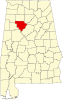 | |
| Towns | ||
| Unincorporated communities | ||
| Footnotes | ‡This populated place also has portions in an adjacent county or counties | |
| ||
Authority control | |
|---|---|
| General | |
| National libraries | |
| Other |
|
На других языках
[de] Jasper (Alabama)
Jasper ist eine City und County Seat des Walker County im US-Bundesstaat Alabama. 2019 hatte Jasper 13.431 Einwohner. Benannt ist sie nach William Jasper, einem Helden des amerikanischen Revolutionskrieges.- [en] Jasper, Alabama
[ru] Джаспер (Алабама)
Джа́спер[1][2] (англ. Jasper) — город и окружной центр Уолкера (Алабама, США)[3]. Назван в честь сержанта Уильяма Джаспера, героя Войны за независимость. Заселение произошло приблизительно в 1815 году, а зарегистрирован город был 18 августа 1886 года[4].Другой контент может иметь иную лицензию. Перед использованием материалов сайта WikiSort.org внимательно изучите правила лицензирования конкретных элементов наполнения сайта.
WikiSort.org - проект по пересортировке и дополнению контента Википедии