world.wikisort.org - USA
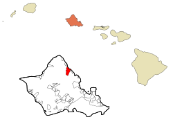
Hauʻula (Hawaiian pronunciation: [hɐwˈʔulə]) is a census-designated place and rural community in the Koʻolauloa District on the island of Oʻahu, City & County of Honolulu. In Hawaiian, hauʻula means "red hau" (hau is a type of tree: Hibiscus tiliaceus). There is a small commercial center. As of the 2020 census, the CDP population was 4,018.
Hauʻula
Hauula | |
|---|---|
Census-designated place | |
 Hauʻula Elementary | |
 Location in Honolulu County and the state of Hawaii | |
| Coordinates: 21°36′50″N 157°54′49″W | |
| Country | United States |
| State | Hawaii |
| Area | |
| • Total | 1.93 sq mi (5.00 km2) |
| • Land | 1.16 sq mi (3.00 km2) |
| • Water | 0.77 sq mi (2.00 km2) |
| Elevation | 7 ft (2 m) |
| Population (2020) | |
| • Total | 4,018 |
| • Density | 3,469.78/sq mi (1,340.02/km2) |
| Time zone | UTC-10 (Hawaii-Aleutian) |
| ZIP code | 96717 |
| Area code | 808 |
| FIPS code | 15-12400 |
| GNIS feature ID | 0359116 |
A fringing reef extends off the shoreline. There are several beaches and beach parks in Hauʻula, including Hauʻula Beach Park, ʻAukai Beach Park, Kokololio Beach Park, and Mahakea Beach. Sugarcane was once grown along the narrow coastal plain inland from the highway.
The U.S. postal code for Hauʻula is 96717. There is a two-bay fire station located on Kamehameha Highway.
Geography
Hauʻula is located at 21°36′50″N 157°54′49″W (21.613850, -157.913543).[2] The town is located north of Punaluʻu and south of Lāʻie along Kamehameha Highway (State Rte. 83).
According to the United States Census Bureau, Hauʻula has a total area of 1.9 square miles (5.0 km2). 1.2 square miles (3.0 km2) of it is land, and 0.77 square miles (2.0 km2) of it, or 40.56%, is water, referring to a part of the Pacific Ocean included in the census tract.[3]
There are also hiking trails in Hauʻula. The 2.5 mile Hauʻula Loop trail that wraps along the side of the mountain, providing views of the coast and protecting reef.[4] The trail head is also shared with the Ma'akau Gulch and the Ma'akau Ridge hikes.[5]
Climate
| Climate data for Hauʻula, Hawaii (1991–2020) | |||||||||||||
|---|---|---|---|---|---|---|---|---|---|---|---|---|---|
| Month | Jan | Feb | Mar | Apr | May | Jun | Jul | Aug | Sep | Oct | Nov | Dec | Year |
| Average high °F (°C) | 78.7 (25.9) |
78.5 (25.8) |
78.4 (25.8) |
79.7 (26.5) |
81.7 (27.6) |
82.9 (28.3) |
84.1 (28.9) |
84.5 (29.2) |
85.0 (29.4) |
83.9 (28.8) |
81.2 (27.3) |
79.7 (26.5) |
81.5 (27.5) |
| Daily mean °F (°C) | 72.5 (22.5) |
72.7 (22.6) |
72.8 (22.7) |
74.6 (23.7) |
76.0 (24.4) |
78.2 (25.7) |
79.0 (26.1) |
79.7 (26.5) |
79.8 (26.6) |
78.7 (25.9) |
76.4 (24.7) |
73.9 (23.3) |
76.2 (24.6) |
| Average low °F (°C) | 66.2 (19.0) |
66.8 (19.3) |
67.1 (19.5) |
69.4 (20.8) |
70.3 (21.3) |
73.4 (23.0) |
73.9 (23.3) |
74.9 (23.8) |
74.5 (23.6) |
73.5 (23.1) |
71.5 (21.9) |
68.1 (20.1) |
70.8 (21.6) |
| Average rainfall inches (mm) | 4.54 (115) |
5.31 (135) |
5.55 (141) |
3.57 (91) |
3.35 (85) |
2.47 (63) |
3.27 (83) |
3.25 (83) |
3.78 (96) |
3.82 (97) |
5.97 (152) |
5.90 (150) |
50.78 (1,291) |
| Source: NOAA[6] | |||||||||||||
Demographics
| Historical population | |||
|---|---|---|---|
| Census | Pop. | %± | |
| 2020 | 4,018 | — | |
| U.S. Decennial Census[7] | |||
As of the census of 2020, there were 4,018 people and 789 households residing in the CDP.[8] The racial makeup of the CDP was 16.82% White, 0.77% African American, 0.36% Native American, 5.72% Asian, 37.44% Pacific Islander, 0.96% from other races, and 37.93% from two or more races. Hispanic or Latino of any race were 9.81% of the population. In 2010 the population density was 605.9 inhabitants per square mile (233.9/km2). There were 1,020 housing units at an average density of 169.3 per square mile (65.4/km2).[9]
Education
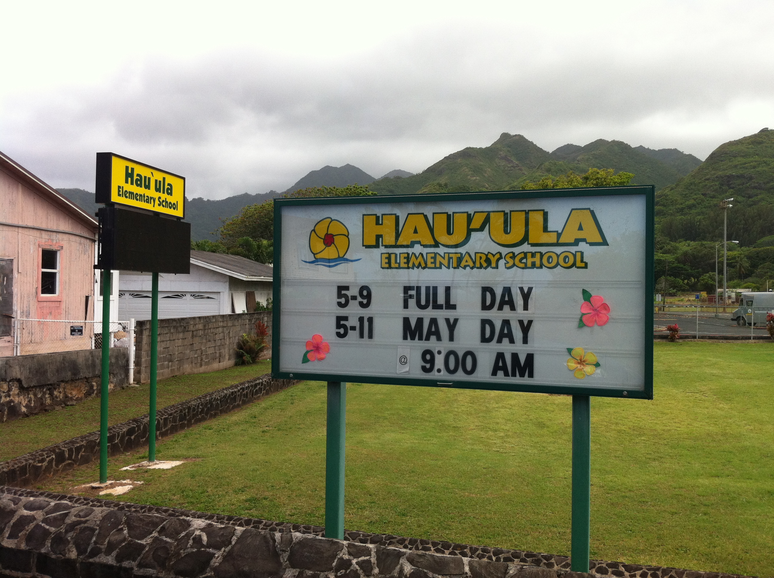
Hawaii Department of Education operates public schools. Hauula Elementary School is in the CDP.[10] Asia Pacific International School Hawaii Campus offers private education from Kindergarten to 12th grade, with boarding option from 5th Grade onwards.[11]
References
- "2020 U.S. Gazetteer Files". United States Census Bureau. Retrieved December 18, 2021.
- "US Gazetteer files: 2010, 2000, and 1990". United States Census Bureau. 2011-02-12. Retrieved 2011-04-23.
- "Geographic Identifiers: 2010 Demographic Profile Data (G001): Hauula CDP, Hawaii". United States Census Bureau. Retrieved May 18, 2012.
- "Hau'ula Loop Trail". Retrieved September 5, 2022.
- "Hauula Trail system" (PDF). Retrieved September 5, 2022.
- "NOAA NCEI U.S. Climate Normals Quick Access". NOAA. Retrieved July 6, 2022.
- "Census of Population and Housing". Census.gov. Retrieved June 4, 2016.
- "Explore Census Data". data.census.gov. Retrieved 2022-09-05.
- "U.S. Census website". United States Census Bureau. Retrieved 2008-01-31.
- "Hawaii DOE | Hau'ula Elementary". www.hawaiipublicschools.org. Retrieved 2022-09-05.
- "Asia Pacific International School Hawaii Campus". Retrieved 2018-07-05.
Islands, municipalities, and communities of Honolulu County, Hawaii, United States | |||||
|---|---|---|---|---|---|
County seat: Honolulu | |||||
| CDPs |
|  | |||
| Other communities |
| ||||
| Government |
| ||||
| |||||
| Authority control |
|
|---|
На других языках
[de] Hauʻula
Hauʻula ist ein Census-designated place an der Ostküste der Hawaii-Insel Oʻahu mit rund 3550 Einwohnern. Er liegt im Koʻolauloa District, einen Kilometer südlich von Lāʻie. Der hawaiische Ortsname bedeutet „roter Hibiskus-Baum“.[1]- [en] Hauʻula, Hawaii
Другой контент может иметь иную лицензию. Перед использованием материалов сайта WikiSort.org внимательно изучите правила лицензирования конкретных элементов наполнения сайта.
WikiSort.org - проект по пересортировке и дополнению контента Википедии