world.wikisort.org - USA
Royal Kunia is a census-designated place (CDP) on the island of Oʻahu in the City & County of Honolulu, Hawaiʻi, United States. As of the 2020 census,the population of the CDP was 14,896. The area was recorded as the Village Park CDP in prior censuses.
Royal Kunia | |
|---|---|
Census-designated place | |
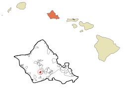 Location in Honolulu County and the state of Hawaii | |
| Coordinates: 21°24′18″N 158°1′54″W | |
| Country | United States |
| State | Hawaii |
| County | Honolulu |
| Area | |
| • Total | 3.01 sq mi (7.80 km2) |
| • Land | 3.01 sq mi (7.80 km2) |
| • Water | 0.00 sq mi (0.00 km2) |
| Elevation | 440 ft (130 m) |
| Population (2020) | |
| • Total | 14,896 |
| • Density | 4,947.19/sq mi (1,910.28/km2) |
| Time zone | UTC-10 (Hawaii-Aleutian) |
| ZIP code | 96797 |
| Area code(s) | 808 |
| FIPS code | 15-68815 |
Geography
Royal Kunia is located just north of Waipahu at 21°24′18″N 158°1′54″W (21.4052, -158.0318). It is bounded on the south by Interstate H-1 and on the west by Kunia Road (State Route 750).
According to the United States Census Bureau, the CDP has a total area of 3.0 square miles (7.8 km2), all of it land.[2]
Demographics
| Historical population | |||
|---|---|---|---|
| Census | Pop. | %± | |
| 2020 | 14,896 | — | |
As of the census[4] of 2010, there were 14,525 people, 4,014 households, and 3,524 families residing in the CDP. The racial makeup of the CDP was 12.5% White, 2.5% African American, 0% Native American, 51.7% Asian, 11.3% Pacific Islander, 0.7% from other races, and 21.7% from two or more races. Hispanic or Latino of any race were 9.5% of the population.
The median income for a household in the CDP was $103,649, and the median income for a family was $91,230. The per capita income for the CDP was $26,900. About 4.8% of families and 2.6% of the population were below the poverty line, including 8% of those under age 18 and 4.3% of those age 65 or over.
Education
Hawaii Department of Education operates public schools. Kale'iopu'u Elementary School is in Royal Kunia CDP.[5][6]
References
- "2020 U.S. Gazetteer Files". United States Census Bureau. Retrieved December 18, 2021.
- "Geographic Identifiers: 2010 Demographic Profile Data (G001): Royal Kunia CDP, Hawaii". United States Census Bureau. Retrieved May 25, 2012.
- "Census of Population and Housing". Census.gov. Retrieved June 4, 2016.
- "U.S. Census website". United States Census Bureau. Retrieved 2008-01-31.
- "Home". Kale'iopu'u Elementary School. Retrieved 2020-10-09.
94-665 Kaaholo St. Waipahu, HI 96797
- Royal Kunia CDP (2010): "2010 CENSUS - CENSUS BLOCK MAP: Royal Kunia CDP, HI" (PDF). U.S. Census Bureau. Retrieved 2020-10-09.
Village Park CDP (2000): "CENSUS 2000 BLOCK MAP: VILLAGE PARK CDP" (PDF). U.S. Census Bureau. Retrieved 2020-10-09.
| Wikimedia Commons has media related to Royal Kunia, Hawaii. |
Islands, municipalities, and communities of Honolulu County, Hawaii, United States | |||||
|---|---|---|---|---|---|
County seat: Honolulu | |||||
| CDPs |
|  | |||
| Other communities |
| ||||
| Government |
| ||||
| |||||
This Hawaiʻi state location article is a stub. You can help Wikipedia by expanding it. |
Другой контент может иметь иную лицензию. Перед использованием материалов сайта WikiSort.org внимательно изучите правила лицензирования конкретных элементов наполнения сайта.
WikiSort.org - проект по пересортировке и дополнению контента Википедии