world.wikisort.org - USA
Fruitville is a census-designated place (CDP) in Sarasota County, Florida, United States. The population was 15,484 at the 2020 census.[4] It is part of the North Port–Sarasota–Bradenton Metropolitan Statistical Area.
Fruitville, Florida | |
|---|---|
Census-designated place | |
 Location in Sarasota County and the state of Florida | |
| Coordinates: 27°19′50″N 82°27′42″W[1] | |
| Country | |
| State | |
| County | Sarasota |
| Area | |
| • Total | 7.13 sq mi (18.46 km2) |
| • Land | 6.82 sq mi (17.68 km2) |
| • Water | 0.30 sq mi (0.78 km2) 4.21% |
| Elevation | 30 ft (9 m) |
| Population (2020) | |
| • Total | 15,484 |
| • Density | 2,269.05/sq mi (876.04/km2) |
| Time zone | UTC−05:00 (Eastern Time Zone) |
| • Summer (DST) | UTC−04:00 (EDT) |
| ZIP code | 34232 |
| Area code(s) | 941 |
| FIPS code | 12-25000 |
| GNIS feature ID | 0282846[3] |
History

| Historical population | |||
|---|---|---|---|
| Census | Pop. | %± | |
| 1960 | 2,131 | — | |
| 1970 | 1,531 | −28.2% | |
| 1980 | 3,070 | 100.5% | |
| 1990 | 9,808 | 219.5% | |
| 2000 | 12,741 | 29.9% | |
| 2010 | 13,224 | 3.8% | |
| 2020 | 15,484 | 17.1% | |
| source:[5] | |||
In the late 1870s, a new wave of pioneers began to settle in Florida thanks to a growing orange industry.[6] In 1876, a man by the name of Charles Reaves settled in what is now considered Fruitville. According to some sources, he was the one who named the area Fruitville after the abundance of fruit in the area.[7] Reaves would go on to become the postmaster for the area's 115 residents. The first church in Sarasota County was the Friendship Baptist Church. The church was chartered in 1875 and a small pine log structure was used for the congregation until a new church was erected in 1876, using some of the original lumber from the first church.[8] In 1887, the Florida Mortgage and Investment Company of Scotland donated land to the church for the establishment of the community's first cemetery.[9]
Also in 1887, Charles and his wife Martha Tatum Reaves converted their corncrib into Fruitville's first school for their three children and seven neighbors. They went on to hire Miss Josie Clower as the first teacher in the area.[10] After citizens petitioned for a modern school building, funding was granted from the Works Progress Administration to build Fruitville Elementary in 1941. Rural schools in the nearby villages of Tatum Ridge and Old Myakka were closed, with their students bussed to the new school in Fruitville.[11]
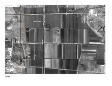
A map from 1902 shows Fruitville on the map as a community.[12]
In May 1918, Franklin Field (named after then-mayor George Franklin) began operating as a military airfield during World War I. The Franklin airfield was located north of Fruitville Road and east of what is now Tuttle road. The airfield was an auxiliary landing station for the U.S. Army Air Service and housed, at the least, several Curtiss JN "Jenny" planes.[13] With the war over, the airfield saw less and less traffic and was likely unused by 1920. In 1924 the land was developed for a new subdivision.[14]
Throughout the 1960s and 70s, there was a migrant camp called Sababo in Fruitville that supplied much of the labor force for area's farm industry. A major crop in the area was celery.[15][16] In 1966, there was an estimated 2,000 migrant workers in Sarasota County. To provide healthcare and education to this population, on December 5, 1966 the Fruitville Area Medical and Educational (FAME) Center was opened.[17]
In November 1990, Litchfield's Cinema 10 opened in the Sarasota Commons, the community's first modern movie theater. As a promotion, the theater offered tickets for only 50 cents during its opening. Some of the films shown for its pre-opening weekend were Pretty Woman and Back to the Future III.[18]
On December 8, 2001, the Fruitville Public Library was opened to serve the Fruitville community as a part of the Sarasota County Library System. The library was initially called East County Library throughout its land-use planning process before the Sarasota County Commission renamed the library a month prior to its opening.[19][20]
Geography
According to the United States Census Bureau, the CDP has a total area of 7.13 square miles (18.46 km2), of which 6.83 square miles (17.68 km2) is land and 0.30 square miles (0.78 km2), or 4.21%, is water.[21]
Demographics
As of the 2020 United States Census,[22] there was a population of 15,484 people and 6,043 households. There were 2.32 persons per household.
In terms of age, 4% were under 5 years old, 15% were 18 years or younger, 45% were between 18 and 64, and %26 were 65 years or older. 91% of the population was white, 2.1% was black or African American, 2.4% was Asian, and 12.5% was Hispanic or Latino. There were 1,172 veterans living in Fruitville and 12.9% of the population was Foreign born.
The median value of owner-occupied housing units was $275,600 and the median gross rent was $1,639. Median household income was $72,512. 7.6% of the population lived below the poverty threshold. 92.6% of households had a computer and 88.1% had a broadband internet subscription.
Of the population 25 years and older, 91.0% had a high school degree or higher and 33.0% of that same population had a Bachelor's degree or higher.
Of the population under 65 years old, 6.8% lived with a disability and 17.2% did not have health insurance.
In 2010, the latest year for this data, there was a population of 1,945.6 per square mile.
Education
Fruitville is home to several public and private schools including:
- Fruitville Elementary
- Julie Rohr Academy
- McIntosh Middle School
- Sarasota Christian School
References
- "US Gazetteer files: 2010, 2000, and 1990". United States Census Bureau. February 12, 2011. Retrieved April 23, 2011.
- "2020 U.S. Gazetteer Files". United States Census Bureau. Retrieved October 31, 2021.
- "US Board on Geographic Names". United States Geological Survey. October 25, 2007. Retrieved January 31, 2008.
- U.S. Census Bureau (2020). Total Population in Fruitville CDP, Florida. Retrieved from https://data.census.gov/cedsci/all?q=Fruitville%20Florida
- "Census of Population and Housing". U.S. Census Bureau. Retrieved January 15, 2019.
- History & Preservation Coalition, http://historicpreservationsarasota.org/sarasotahistory/
- "Land of Sarasota A Settlement in the Wilderness". Venice Museum and Archives. Retrieved June 4, 2022.
- State Archives of Florida/Works Progress Administration. Retrieved from https://www.floridamemory.com/items/show/251255
- The Genealogical Society of Sarasota (2007). Cemeteries of Sarasota County Florida A Record of Births, Deaths, and Burials. Retrieved from http://sites.rootsweb.com/~flgss/CemeteryFiles/FriendshipBaptistCemetery.pdf 12/17/2021
- "Overview / About Fruitville".
- "Sarasota's Journey from Depression to War | Sarasota History Alive!".
- "Cram's Florida, 1902" (Map). State Archives of Florida, Florida Memory. George F. Cram. 1902. Retrieved November 30, 2021.
- "Army "Jenny" planes and observers at Franklin Field in Sarasota". State Archives of Florida, Florida Memory. 1918. Retrieved November 30, 2021.
- Sunday Favorites: The Intrigue of Aviation, The Bradenton Times. Retrieved from https://thebradentontimes.com/sunday-favorites-the-intrigue-of-aviation-p21183-133.htm
- "Migrant Options There to Pick". Sarasota Journal. January 27, 1977. Retrieved May 26, 2022.
- "The Celery Fields". Sarasota Audubon Society. Sarasota County Fair and Sarasota County Historical Commission. Retrieved June 4, 2022.
- Florida Migrant Health Project. Fourth Annual Progress Report, 1966-1967. Florida State Board of Health. Retrieved from https://files.eric.ed.gov/fulltext/ED013699.pdf on 5/26/2022. p. 252
- "Sarasota Crossings 10 in Sarasota, FL". Cinema Treasures. Retrieved November 30, 2021.
- "About Us". Friends of the Fruitville Public Library. Retrieved November 30, 2021.
- "Commission votes to rename library". Sarasota Herald-Tribune. November 8, 2001. Retrieved November 30, 2021 – via NewsBank.
- "Geographic Identifiers: 2010 Demographic Profile Data (G001): Fruitville CDP, Florida". U.S. Census Bureau, American Factfinder. Archived from the original on February 12, 2020. Retrieved April 11, 2013.
- United States Census Bureau. "Quick Facts: Fruitville CDP, Florida; United States". Retrieved April 15, 2022.
Municipalities and communities of Sarasota County, Florida, United States | ||
|---|---|---|
County seat: Sarasota | ||
| Cities |  | |
| Town |
| |
| CDPs |
| |
| Unincorporated communities |
| |
| Footnotes | ‡This populated place also has portions in an adjacent county or counties, †This populated place also has portions in the City of North Port | |
| ||
На других языках
- [en] Fruitville, Florida
[ru] Фрутвилл (Флорида)
Фрутвилл (англ. Fruitville) — статистически обособленная местность, расположенная в округе Сарасота (штат Флорида, США) с населением в 12 741 человек по статистическим данным переписи 2000 года.Другой контент может иметь иную лицензию. Перед использованием материалов сайта WikiSort.org внимательно изучите правила лицензирования конкретных элементов наполнения сайта.
WikiSort.org - проект по пересортировке и дополнению контента Википедии