world.wikisort.org - USA
Forsyth is a city in Taney County, Missouri, United States. The population was 2,730 at the 2020 census.[5] It is the county seat of Taney County.[6] The town is part of the Branson, Missouri Micropolitan Statistical Area. Forsyth is located on Lake Taneycomo on U.S. Route 160.[7]
Forsyth, Missouri | |
|---|---|
City | |
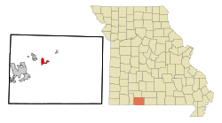 Location of Forsyth, Missouri | |
| Coordinates: 36°41′12″N 93°6′46″W | |
| Country | United States |
| State | Missouri |
| County | Taney |
| Government | |
| • Mayor | Kelly Dougherty[1] |
| Area | |
| • Total | 3.39 sq mi (8.78 km2) |
| • Land | 3.37 sq mi (8.72 km2) |
| • Water | 0.02 sq mi (0.06 km2) |
| Elevation | 938 ft (286 m) |
| Population (2020) | |
| • Total | 2,730 |
| • Density | 811.05/sq mi (313.17/km2) |
| Time zone | UTC-6 (Central (CST)) |
| • Summer (DST) | UTC-5 (CDT) |
| ZIP code | 65653 |
| Area code | 417 |
| FIPS code | 29-25192[4] |
| GNIS feature ID | 0749958[3] |
| Website | http://cityofforsythmo.com/ |
History
A post office called Forsyth has been in operation since 1837.[8] The community has the name of John Forsyth, 13th United States Secretary of State.[9]
Geography
Forsyth is located at 36°41′12″N 93°6′46″W.[10] According to the United States Census Bureau, the city has a total area of 2.25 square miles (5.83 km2), of which 2.24 square miles (5.80 km2) is land and 0.01 square miles (0.03 km2) is water.[11]
Demographics
| Historical population | |||
|---|---|---|---|
| Census | Pop. | %± | |
| 1860 | 88 | — | |
| 1870 | 87 | −1.1% | |
| 1910 | 478 | — | |
| 1920 | 200 | −58.2% | |
| 1930 | 281 | 40.5% | |
| 1940 | 290 | 3.2% | |
| 1950 | 354 | 22.1% | |
| 1960 | 489 | 38.1% | |
| 1970 | 803 | 64.2% | |
| 1980 | 1,010 | 25.8% | |
| 1990 | 1,175 | 16.3% | |
| 2000 | 1,686 | 43.5% | |
| 2010 | 2,255 | 33.7% | |
| 2020 | 2,730 | 21.1% | |
| U.S. Decennial Census | |||
2010 census
As of the census[12] of 2010, there were 2,255 people, 967 households, and 590 families living in the city. The population density was 1,006.7 inhabitants per square mile (388.7/km2). There were 1,164 housing units at an average density of 519.6 per square mile (200.6/km2). The racial makeup of the city was 96.1% White, 0.3% African American, 0.9% Native American, 0.4% Asian, 0.5% from other races, and 1.8% from two or more races. Hispanic or Latino of any race were 3.0% of the population.
There were 967 households, of which 21.4% had children under the age of 18 living with them, 49.3% were married couples living together, 7.8% had a female householder with no husband present, 3.9% had a male householder with no wife present, and 39.0% were non-families. 34.7% of all households were made up of individuals, and 22.1% had someone living alone who was 65 years of age or older. The average household size was 2.11 and the average family size was 2.68.
The median age in the city was 51.7 years. 16.4% of residents were under the age of 18; 6% were between the ages of 18 and 24; 20% were from 25 to 44; 24.9% were from 45 to 64; and 32.6% were 65 years of age or older. The gender makeup of the city was 47.6% male and 52.4% female.
2000 census
As of the census[4] of 2000, there were 1,686 people, 788 households, and 487 families living in the city. The population density was 824.9 people per square mile (319.1/km2). There were 918 housing units at an average density of 449.2 per square mile (173.7/km2). The racial makeup of the city was 98.58% White, 0.06% African American, 0.30% Native American, 0.18% Asian, 0.42% from other races, and 0.47% from two or more races. Hispanic or Latino of any race were 1.01% of the population.
There were 788 households, out of which 18.4% had children under the age of 18 living with them, 53.7% were married couples living together, 6.5% had a female householder with no husband present, and 38.1% were non-families. 34.8% of all households were made up of individuals, and 20.6% had someone living alone who was 65 years of age or older. The average household size was 2.04 and the average family size was 2.59.
In the city, the population was spread out, with 16.9% under the age of 18, 4.7% from 18 to 24, 20.6% from 25 to 44, 24.3% from 45 to 64, and 33.5% who were 65 years of age or older. The median age was 53 years. For every 100 females, there were 84.9 males. For every 100 females age 18 and over, there were 79.8 males.
The median income for a household in the city was $31,801, and the median income for a family was $39,625. Males had a median income of $30,882 versus $19,183 for females. The per capita income for the city was $21,436. About 5.4% of families and 9.7% of the population were below the poverty line, including 17.3% of those under age 18 and 8.1% of those age 65 or over.
Education
Forsyth R-III School District operates one elementary school, one middle school and Forsyth High School.[13]
Forsyth has a lending library, the Forsyth Public Library.[14]
References
- "Aldermen appoint Kelly Dougherty as new Forsyth mayor".
- "ArcGIS REST Services Directory". United States Census Bureau. Retrieved August 28, 2022.
- U.S. Geological Survey Geographic Names Information System: Forsyth, Missouri
- "U.S. Census website". United States Census Bureau. Retrieved 2008-01-31.
- "Explore Census Data". data.census.gov. Retrieved 2021-12-06.
- "Find a County". National Association of Counties. Archived from the original on 2011-05-31. Retrieved 2011-06-07.
- Missouri Atlas & Gazetteer, DeLorme, 1998, First edition, p. 62, ISBN 0-89933-224-2
- "Post Offices". Jim Forte Postal History. Retrieved 27 December 2016.
- "Taney County Place Names, 1928–1945". The State Historical Society of Missouri. Archived from the original on June 24, 2016. Retrieved December 27, 2016.
- "US Gazetteer files: 2010, 2000, and 1990". United States Census Bureau. 2011-02-12. Retrieved 2011-04-23.
- "US Gazetteer files 2010". United States Census Bureau. Archived from the original on 2012-07-02. Retrieved 2012-07-08.
- "U.S. Census website". United States Census Bureau. Retrieved 2012-07-08.
- "Forsyth R-Iii School District". Great Schools. Retrieved 1 June 2019.
- "Missouri Public Libraries". Public Libraries. Retrieved 2019-12-21.
External links
Municipalities and communities of Taney County, Missouri, United States | ||
|---|---|---|
County seat: Forsyth | ||
| Cities |  | |
| Villages | ||
| Townships |
| |
| CDP |
| |
| Other unincorporated communities |
| |
| Ghost towns |
| |
| Footnotes | ‡This populated place also has portions in an adjacent county or counties | |
| ||
Authority control | |
|---|---|
| General |
|
| National libraries | |
На других языках
[de] Forsyth (Missouri)
Forsyth ist eine Kleinstadt im Taney County, Missouri, Vereinigte Staaten, die am Ufer des Lake Taneycomo und Bull Shoals Lake liegt. Im Jahr 2000 wurden 1.686 Einwohner gezählt. Die Stadt hat eine Fläche von 5,3 km².- [en] Forsyth, Missouri
Другой контент может иметь иную лицензию. Перед использованием материалов сайта WikiSort.org внимательно изучите правила лицензирования конкретных элементов наполнения сайта.
WikiSort.org - проект по пересортировке и дополнению контента Википедии