world.wikisort.org - USA
The Fairbanks North Star Borough is a borough located in the state of Alaska. As of the 2020 census, the population was 95,665, down from 97,581 in 2010.[2][3] The borough seat is Fairbanks.[4] The borough's land area is slightly smaller than that of the state of New Jersey.
Fairbanks North Star Borough | |
|---|---|
Borough | |
 Fairbanks North Star Borough Administrative Center | |
 Seal | |
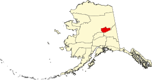 Location within the U.S. state of Alaska | |
 Alaska's location within the U.S. | |
| Coordinates: 64°50′N 146°25′W | |
| Country | |
| State | |
| Incorporated | January 1, 1964[1] |
| Named for | Fairbanks and Polaris, the North Star |
| Seat | Fairbanks |
| Largest city | Fairbanks |
| Area | |
| • Total | 7,444 sq mi (19,280 km2) |
| • Land | 7,338 sq mi (19,010 km2) |
| • Water | 105 sq mi (270 km2) 1.4%% |
| Population (2020) | |
| • Total | 95,665 |
| • Density | 13/sq mi (5.0/km2) |
| Time zone | UTC−9 (Alaska) |
| • Summer (DST) | UTC−8 (ADT) |
| Congressional district | At-large |
| Website | www |
Fairbanks North Star Borough comprises the Fairbanks, AK, Metropolitan Statistical Area, which is one of only two metropolitan areas in Alaska.
The borough is home to the University of Alaska Fairbanks, Fort Wainwright and Eielson Air Force Base.
Geography
The borough has a total area of 7,444 square miles (19,280 km2), of which 7,338 square miles (19,010 km2) is land and 105 square miles (270 km2) (1.4%) is water.[5]
Adjacent boroughs and census areas
- Yukon-Koyukuk Census Area, Alaska – north
- Southeast Fairbanks Census Area, Alaska – southeast
- Denali Borough, Alaska – southwest
Government and politics
This section is missing information about something. (November 2011) |
The assembly is the borough's governing body, or legislative branch. The assembly consists of nine members who are elected at-large (borough-wide), serving three-year terms. The borough operates under a "strong mayor" system. The mayor, along with his chief of staff, performs many of the job duties normally associated with a city manager.
- Mayor
- Bryce Ward (term ends October 2024)
- Assembly members
October 2018 – October 2019; the year term expires is in parenthesis next to name
- Seat A – Marna Sanford (2021)
- Seat B – Frank Tomaszewski (2022)
- Seat C – Mindy O'Neall (2022)
- Seat D – Christopher Quist (2020)
- Seat E – Jimi Cash (2020)
- Seat F – Liz Lyke (2021)
- Seat G – Leah Berman Williams (2021)
- Seat H – Aaron Lojewski (2020)
- Seat I – Matt Cooper (2022)
The borough operates a public library system; the main library is the Noel Wien Public Library.
| Year | Republican | Democratic | Third party | |||
|---|---|---|---|---|---|---|
| No. | % | No. | % | No. | % | |
| 2020 | 24,917 | 55.10% | 18,138 | 40.11% | 2,165 | 4.79% |
| 2016 | 22,012 | 53.86% | 13,494 | 33.02% | 5,364 | 13.12% |
| 2012 | 23,755 | 58.60% | 14,716 | 36.30% | 2,068 | 5.10% |
| 2008 | 27,302 | 61.50% | 15,893 | 35.80% | 1,198 | 2.70% |
| 2004 | 20,268 | 64.40% | 10,103 | 32.10% | 1,101 | 3.50% |
| 2000 | 25,526 | 61.50% | 10,201 | 24.58% | 5,780 | 13.93% |
| 1996 | 18,521 | 52.40% | 10,816 | 30.60% | 6,009 | 17.00% |
| 1992 | 15,224 | 39.60% | 10,880 | 28.30% | 12,341 | 32.10% |
| 1988 | 18,728 | 60.50% | 10,587 | 34.20% | 1,640 | 5.30% |
| 1984 | 18,806 | 66.30% | 8,112 | 28.60% | 1,447 | 5.10% |
| 1980 | 11,601 | 50.70% | 5,285 | 23.10% | 5,995 | 26.20% |
| 1976 | 10,279 | 54.00% | 6,681 | 35.10% | 2,075 | 10.90% |
| 1972 | 7,706 | 53.70% | 5,539 | 38.60% | 1,106 | 7.71% |
| 1968 | 4,270 | 47.00% | 3,435 | 37.81% | 1,381 | 15.20% |
| 1964 | 3,526 | 42.30% | 4,810 | 57.70% | 0 | 0.00% |
| 1960 | 3,818 | 48.40% | 4,070 | 51.60% | 0 | 0.00% |
Demographics
| Historical population | |||
|---|---|---|---|
| Census | Pop. | %± | |
| 1960 | 43,412 | — | |
| 1970 | 45,864 | 5.6% | |
| 1980 | 53,983 | 17.7% | |
| 1990 | 77,720 | 44.0% | |
| 2000 | 82,840 | 6.6% | |
| 2010 | 97,581 | 17.8% | |
| 2020 | 95,655 | −2.0% | |
| U.S. Decennial Census[7] 1790–1960[8] 1900–1990[9] 1990–2000[10] 2010–2018[3] | |||
As of the 2000 census,[11] 82,840 people, 29,777 households, and 20,516 families were residing in the borough. The population density was 11 people per square mile (4/km2). There were 33,291 housing units at an average density of 4 per square mile (2/km2). The racial makeup of the borough was 77.79% White, 5.6% Black or African American, 6.90% Native American, 2.08% Asian, 0.30% Pacific Islander, 1.71% from other races, and 5.39% from two or more races. 4.15% of the population were Hispanic or Latino of any race.
Of the 29,777 households, 41.30% had children under the age of 18 living with them, 54.70% were married couples living together, 9.30% had a female householder with no husband present, and 31.10% were non-families. 23.60% of households were one person, and 3.60% were one person aged 65 or older. The average household size was 2.68 and the average family size was 3.20.
In the borough the population was spread out, with 30.10% under the age of 18, 12.20% from 18 to 24, 33.30% from 25 to 44, 19.80% from 45 to 64, and 4.60% 65 or older. The median age was 30 years. For every 100 females, there were 109.10 males. For every 100 females age 18 and over, there were 110.90 males.
Communities
This section is missing information about something. (November 2011) |
Cities
- Fairbanks
- Fort Wainwright
- North Pole
Census-designated places
Other unincorporated communities
Education
The entire borough is zoned to Fairbanks North Star Borough School District.[12]
Sister cities
See also
- List of airports in Fairbanks North Star Borough
- National Register of Historic Places listings in Fairbanks North Star Borough, Alaska
References
- 1996 Alaska Municipal Officials Directory. Juneau: Alaska Municipal League/Alaska Department of Community and Regional Affairs. January 1996. p. 5.
- "2020 Census Data - Cities and Census Designated Places" (Web). State of Alaska, Department of Labor and Workforce Development. Retrieved October 31, 2021.
- "State & County QuickFacts". United States Census Bureau. Archived from the original on June 29, 2011. Retrieved May 18, 2014.
- "Find a County". National Association of Counties. Archived from the original on May 31, 2011. Retrieved June 7, 2011.
- "US Gazetteer files: 2010, 2000, and 1990". United States Census Bureau. February 12, 2011. Retrieved April 23, 2011.
- Elections, RRH. "RRH Elections". rrhelections.com. Retrieved January 12, 2020.
- "U.S. Decennial Census". United States Census Bureau. Retrieved May 18, 2014.
- "Historical Census Browser". University of Virginia Library. Retrieved May 18, 2014.
- "Population of Counties by Decennial Census: 1900 to 1990". United States Census Bureau. Retrieved May 18, 2014.
- "Census 2000 PHC-T-4. Ranking Tables for Counties: 1990 and 2000" (PDF). United States Census Bureau. Archived (PDF) from the original on October 9, 2022. Retrieved May 18, 2014.
- "U.S. Census website". United States Census Bureau. Retrieved May 14, 2011.
- "2020 CENSUS - SCHOOL DISTRICT REFERENCE MAP: Fairbanks North Star Borough, AK" (PDF). U.S. Census Bureau. Archived (PDF) from the original on October 9, 2022. Retrieved July 22, 2022. - Text list
- Archived March 3, 2012, at the Wayback Machine
- Archived February 5, 2012, at the Wayback Machine
External links
Places adjacent to Fairbanks North Star Borough, Alaska | ||||||||||||||||
|---|---|---|---|---|---|---|---|---|---|---|---|---|---|---|---|---|
| ||||||||||||||||
Municipalities and communities of Fairbanks North Star Borough, Alaska, United States | ||
|---|---|---|
Borough seat: Fairbanks | ||
| Cities |  | |
| CDPs | ||
| Unincorporated communities | ||
| Ghost town | ||
| ||
State of Alaska | |
|---|---|
Juneau (capital) | |
| Topics |
|
| Society |
|
| Regions |
|
| Largest cities pop. over 25,000 | |
| Smaller cities pop. over 2,000 | |
| Boroughs | |
| Native Corporations |
|
| Census Areas | |
Authority control | |
|---|---|
| General | |
| National libraries | |
На других языках
[de] Fairbanks North Star Borough
Fairbanks North Star Borough (deutsch: Fairbanks Nord-Stern-Bezirk) ist ein Borough im US-Bundesstaat Alaska in den Vereinigten Staaten von Amerika. Der Borough ist Teil der alaskischen Metropolregion Fairbanks, sog. Fairbanks, Alaska Metropolitan Statistical Area, die sich über das gesamte Gebiet des Boroughs erstreckt und nur wenig kleiner als der gesamte US-Bundesstaat New Jersey ist. Bei der Volkszählung im Jahr 2020 wurden 95.655 Einwohner gezählt.[1]- [en] Fairbanks North Star Borough, Alaska
[ru] Фэрбанкс-Норт-Стар
Фэрбанкс-Норт-Стар (англ. Fairbanks North Star Borough; широко используется Фэрбенкс-Норт-Стар) — боро в штате Аляска, США. Население по данным переписи 2010 года составляет 97 581 человек[1]. Административный центр — Фэрбанкс[2].Другой контент может иметь иную лицензию. Перед использованием материалов сайта WikiSort.org внимательно изучите правила лицензирования конкретных элементов наполнения сайта.
WikiSort.org - проект по пересортировке и дополнению контента Википедии