world.wikisort.org - USA
Elliott is an unincorporated community and census-designated place (CDP) in Dorchester County, Maryland, United States.[2] The population was 52 at the 2010 census.[3]
Elliott, Maryland | |
|---|---|
Census-designated place | |
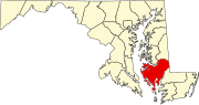
 Elliott Location in Maryland  Elliott Elliott (the United States) | |
| Coordinates: 38°18′36″N 75°59′47″W | |
| Country | |
| State | |
| County | |
| Area | |
| • Total | 0.35 sq mi (0.92 km2) |
| • Land | 0.35 sq mi (0.91 km2) |
| • Water | 0.00 sq mi (0.01 km2) |
| Elevation | 4 ft (1 m) |
| Population (2020) | |
| • Total | 43 |
| • Density | 122.51/sq mi (47.31/km2) |
| Time zone | UTC−5 (Eastern (EST)) |
| • Summer (DST) | UTC−4 (EDT) |
| ZIP code | 21869 |
| Area code(s) | 410, 443, and 667 |
| FIPS code | 24-26026 |
| GNIS feature ID | 590196 |
Geography
Elliott is located in southern Dorchester County on Elliott Island, on the east side of Fishing Bay. Elliott Island Road is the only road access to the town, leading 19 miles (31 km) northeast to U.S. Route 50 at Vienna.
According to the United States Census Bureau, the Elliott CDP has a total area of 0.36 square miles (0.92 km2), of which 73,250 square feet (6,805 m2), or 0.74%, is water.[3]
Demographics
| Historical population | |||
|---|---|---|---|
| Census | Pop. | %± | |
| 2020 | 43 | — | |
| U.S. Decennial Census[4] | |||
References
- "2020 U.S. Gazetteer Files". United States Census Bureau. Retrieved April 26, 2022.
- U.S. Geological Survey Geographic Names Information System: Elliott, Maryland
- "Geographic Identifiers: 2010 Demographic Profile Data (G001): Elliott CDP, Maryland". U.S. Census Bureau, American Factfinder. Retrieved October 29, 2015.[dead link]
- "Census of Population and Housing". Census.gov. Retrieved June 4, 2016.
Municipalities and communities of Dorchester County, Maryland, United States | ||
|---|---|---|
County seat: Cambridge | ||
| City |
|  |
| Towns |
| |
| CDPs |
| |
| Other communities |
| |
| Footnotes | ‡This populated place also has portions in an adjacent county or counties | |
| ||
Текст в блоке "Читать" взят с сайта "Википедия" и доступен по лицензии Creative Commons Attribution-ShareAlike; в отдельных случаях могут действовать дополнительные условия.
Другой контент может иметь иную лицензию. Перед использованием материалов сайта WikiSort.org внимательно изучите правила лицензирования конкретных элементов наполнения сайта.
Другой контент может иметь иную лицензию. Перед использованием материалов сайта WikiSort.org внимательно изучите правила лицензирования конкретных элементов наполнения сайта.
2019-2026
WikiSort.org - проект по пересортировке и дополнению контента Википедии
WikiSort.org - проект по пересортировке и дополнению контента Википедии