world.wikisort.org - USA
Taylors Island is an unincorporated community and census-designated place in Dorchester County, Maryland, United States,[2] in the state's Eastern Shore region. The population was 173 at the 2010 census.[3] It is known for hunting, crabbing and fishing. Ridgeton Farm was listed on the National Register of Historic Places in 1977.[4] Bethlehem Methodist Episcopal Church and Grace Episcopal Church Complex were listed in 1979.[4]
Taylors Island, Maryland | |
|---|---|
Census-designated place | |
 | |
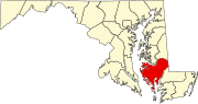
 Taylors Island Location in Maryland  Taylors Island Taylors Island (the United States) | |
| Coordinates: 38°28′8″N 76°17′56″W | |
| Country | |
| State | |
| County | |
| Area | |
| • Total | 4.16 sq mi (10.78 km2) |
| • Land | 4.14 sq mi (10.73 km2) |
| • Water | 0.02 sq mi (0.05 km2) |
| Elevation | 3.0 ft (0.9 m) |
| Population (2020) | |
| • Total | 125 |
| • Density | 30.17/sq mi (11.65/km2) |
| Time zone | UTC−5 (Eastern (EST)) |
| • Summer (DST) | UTC−4 (EDT) |
| ZIP code | 21669 |
| Area code(s) | 410, 443, and 667 |
| FIPS code | 24-76925 |
| GNIS feature ID | 591395[2] |
Geography
Taylors Island is in western Dorchester County on the eastern shore of Chesapeake Bay. It is separated from the mainland on the east by Slaughter Creek. Maryland Route 16 leads northeast from Taylors Island 16 miles (26 km) to Cambridge, the Dorchester County seat.
According to the United States Census Bureau, the Taylors Island CDP occupies the central, northern, and western parts of the island. The CDP has a total area of 4.2 square miles (10.8 km2), of which 0.02 square miles (0.05 km2), or 0.47%, is water.[3]
Demographics
| Historical population | |||
|---|---|---|---|
| Census | Pop. | %± | |
| 2020 | 125 | — | |
| U.S. Decennial Census[5] | |||
See also
- Taylors Island Wildlife Management Area
References
- "2020 U.S. Gazetteer Files". United States Census Bureau. Retrieved April 26, 2022.
- "Taylors Island". Geographic Names Information System. United States Geological Survey.
- "Geographic Identifiers: 2010 Demographic Profile Data (G001): Taylors Island CDP, Maryland". U.S. Census Bureau, American Factfinder. Retrieved October 29, 2015.[dead link]
- "National Register Information System". National Register of Historic Places. National Park Service. April 15, 2008.
- "Census of Population and Housing". Census.gov. Retrieved June 4, 2016.
External links
Municipalities and communities of Dorchester County, Maryland, United States | ||
|---|---|---|
County seat: Cambridge | ||
| City |
|  |
| Towns | ||
| CDPs |
| |
| Other communities |
| |
| Footnotes | ‡This populated place also has portions in an adjacent county or counties | |
| ||
На других языках
- [en] Taylors Island, Maryland
[fr] Taylors Island
Taylors Island (île de Taylor) est une île de la baie de Chesapeake, secteur non constitué en municipalité qui fait partie du comté de Dorchester dans la région de l'Eastern Shore du Maryland, (Maryland-États-Unis).Другой контент может иметь иную лицензию. Перед использованием материалов сайта WikiSort.org внимательно изучите правила лицензирования конкретных элементов наполнения сайта.
WikiSort.org - проект по пересортировке и дополнению контента Википедии