world.wikisort.org - USA
Elizabethtown is a town in Bladen County, North Carolina, United States. The population was 3,583 at the 2010 census.[4] It is the county seat of Bladen County.[5]
Elizabethtown, North Carolina | |
|---|---|
Town | |
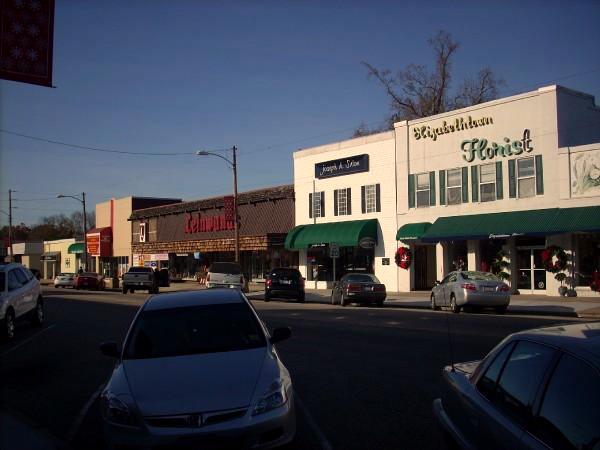 A view of Broad Street | |
 Seal | |
 Location in Bladen County and the state of North Carolina. | |
| Coordinates: 34°37′32″N 78°36′44″W | |
| Country | United States |
| State | North Carolina |
| County | Bladen |
| Government | |
| • Mayor | Sylvia Campbell |
| Area | |
| • Total | 5.11 sq mi (13.24 km2) |
| • Land | 5.07 sq mi (13.13 km2) |
| • Water | 0.04 sq mi (0.11 km2) |
| Elevation | 108 ft (33 m) |
| Population (2020) | |
| • Total | 3,296 |
| • Density | 650.23/sq mi (251.05/km2) |
| Time zone | UTC-5 (Eastern (EST)) |
| • Summer (DST) | UTC-4 (EDT) |
| ZIP code | 28337 |
| Area code | 910 |
| FIPS code | 37-20600[2] |
| GNIS feature ID | 1025308[3] |
| Website | www |
History
Some hold Elizabethtown is named for Elizabeth, the wife of George Carteret,[6] while others believe it was named for the love interest of a local landowner.[7]
In the 1970s Elizabethtown more than doubled its size through annexation, increasing from about 1400 square feet to 3700 square feet in area.[8]
The Mt. Horeb Presbyterian Church and Cemetery and Trinity Methodist Church are listed on the National Register of Historic Places.[9]
Geography
Elizabethtown is located at 34°37′32″N 78°36′44″W (34.625691, −78.612270).[10]
According to the United States Census Bureau, the town has a total area of 4.7 square miles (12.1 km2), of which 4.6 square miles (12.0 km2) is land and 0.039 square miles (0.1 km2), or 0.73%, is water.[4]
Browns Creek, a tributary to the Cape Fear River, drains the south side of Elizabethtown.
| Climate data for ELIZABETHTOWN, NC (1991-2020 normals) | |||||||||||||
|---|---|---|---|---|---|---|---|---|---|---|---|---|---|
| Month | Jan | Feb | Mar | Apr | May | Jun | Jul | Aug | Sep | Oct | Nov | Dec | Year |
| Average high °F (°C) | 54.4 (12.4) |
58.7 (14.8) |
66.2 (19.0) |
74.6 (23.7) |
81.5 (27.5) |
87.4 (30.8) |
91.0 (32.8) |
88.5 (31.4) |
83.6 (28.7) |
74.8 (23.8) |
64.7 (18.2) |
57.7 (14.3) |
73.6 (23.1) |
| Daily mean °F (°C) | 43.0 (6.1) |
46.2 (7.9) |
53.2 (11.8) |
61.7 (16.5) |
69.7 (20.9) |
76.8 (24.9) |
80.8 (27.1) |
78.8 (26.0) |
73.6 (23.1) |
63.1 (17.3) |
52.5 (11.4) |
46.3 (7.9) |
62.1 (16.7) |
| Average low °F (°C) | 31.6 (−0.2) |
33.7 (0.9) |
40.2 (4.6) |
48.8 (9.3) |
57.8 (14.3) |
66.3 (19.1) |
70.5 (21.4) |
69.0 (20.6) |
63.6 (17.6) |
51.5 (10.8) |
40.3 (4.6) |
35.0 (1.7) |
50.7 (10.4) |
| Average precipitation inches (mm) | 3.73 (95) |
3.48 (88) |
3.91 (99) |
3.55 (90) |
4.05 (103) |
5.08 (129) |
5.33 (135) |
6.56 (167) |
6.89 (175) |
3.70 (94) |
3.62 (92) |
3.38 (86) |
53.28 (1,353) |
| Average precipitation days (≥ 0.01 in) | 0.0 | 0.0 | 0.0 | 0.0 | 0.0 | 0.0 | 0.0 | 0.0 | 0.0 | 0.0 | 0.0 | 0.0 | 0.0 |
| Source: NOAA[11][12] | |||||||||||||
Demographics
| Historical population | |||
|---|---|---|---|
| Census | Pop. | %± | |
| 1870 | 62 | — | |
| 1880 | 212 | 241.9% | |
| 1900 | 144 | — | |
| 1910 | 117 | −18.7% | |
| 1920 | 335 | 186.3% | |
| 1930 | 765 | 128.4% | |
| 1940 | 1,123 | 46.8% | |
| 1950 | 1,611 | 43.5% | |
| 1960 | 1,625 | 0.9% | |
| 1970 | 1,418 | −12.7% | |
| 1980 | 3,551 | 150.4% | |
| 1990 | 3,704 | 4.3% | |
| 2000 | 3,698 | −0.2% | |
| 2010 | 3,583 | −3.1% | |
| 2020 | 3,296 | −8.0% | |
| U.S. Decennial Census[13] | |||
2020 census
| Race | Num. | Perc. |
|---|---|---|
| White | 1,488 | 45.15% |
| Black or African American | 1,530 | 46.42% |
| Native American | 25 | 0.76% |
| Asian | 10 | 0.3% |
| Pacific Islander | 6 | 0.03% |
| Other/Mixed | 104 | 3.16% |
| Hispanic or Latino | 139 | 4.22% |
As of the 2020 United States Census, there were 3,296 people, 1,482 households, and 750 families residing in the town.
2000 census
As of the census[2] of 2000, there were 3,698 people, 1,536 households, and 907 families residing in the town. The population density was 805.9 people per square mile (311.1/km2). There were 1,688 housing units at an average density of 367.9 per square mile (142.0/km2). The racial makeup of the town was 48.05% White, 48.97% African American, 0.43% Native American, 0.30% Asian, 0.03% Pacific Islander, 1.30% from other races, and 0.92% from two or more races. Hispanic or Latino of any race were 2.54% of the population.
There were 1,536 households, out of which 26.6% had children under the age of 18 living with them, 36.4% were married couples living together, 19.2% had a female householder with no husband present, and 40.9% were non-families. 38.6% of all households were made up of individuals, and 16.6% had someone living alone who was 65 years of age or older. The average household size was 2.21 and the average family size was 2.93.
In the town, the population was spread out, with 22.4% under the age of 18, 7.7% from 18 to 24, 23.8% from 25 to 44, 24.4% from 45 to 64, and 21.7% who were 65 years of age or older. The median age was 42 years. For every 100 females, there were 79.9 males. For every 100 females age 18 and over, there were 72.5 males.
The median income for a household in the town was $21,944, and the median income for a family was $38,750. Males had a median income of $36,133 versus $25,417 for females. The per capita income for the town was $15,303. About 24.6% of families and 31.1% of the population were below the poverty line, including 47.3% of those under age 18 and 27.8% of those age 65 or over.
References
- "ArcGIS REST Services Directory". United States Census Bureau. Retrieved September 20, 2022.
- "U.S. Census website". United States Census Bureau. Retrieved 2008-01-31.
- "US Board on Geographic Names". United States Geological Survey. 2007-10-25. Retrieved 2008-01-31.
- "Geographic Identifiers: 2010 Demographic Profile Data (G001): Elizabethtown town, North Carolina". U.S. Census Bureau, American Factfinder. Archived from the original on February 12, 2020. Retrieved February 6, 2014.
- "Find a County". National Association of Counties. Archived from the original on 2011-05-31. Retrieved 2011-06-07.
- Gannett, Henry (1905). The Origin of Certain Place Names in the United States. Govt. Print. Off. pp. 116.
- Proffitt, Martie (Apr 17, 1983). "Local history offers tasty tidbits". Star-News. pp. 1C. Retrieved 1 November 2015.
- "If you build it…?". Bladen Journal. March 31, 2017. Retrieved July 21, 2022.
- "National Register Information System". National Register of Historic Places. National Park Service. July 9, 2010.
- "US Gazetteer files: 2010, 2000, and 1990". United States Census Bureau. 2011-02-12. Retrieved 2011-04-23.
- "NOWData - NOAA Online Weather Data". National Oceanic and Atmospheric Administration.
{{cite web}}: Missing or empty|url=(help) - "Monthly Normals 1991-2020". National Oceanic and Atmospheric Administration. Retrieved March 31, 2022.
- "Census of Population and Housing". Census.gov. Retrieved June 4, 2015.
- "Explore Census Data". data.census.gov. Retrieved 2021-12-07.
External links
- Town of Elizabethtown official website
- Bladen Journal, Google news archive. —PDFs of 2,696 issues, dating from 1929 to 1985.
Municipalities and communities of Bladen County, North Carolina, United States | ||
|---|---|---|
County seat: Elizabethtown | ||
| Towns |  | |
| CDPs | ||
| Unincorporated communities | ||
| ||
Authority control | |
|---|---|
| General | |
| National libraries | |
| Other | |
Другой контент может иметь иную лицензию. Перед использованием материалов сайта WikiSort.org внимательно изучите правила лицензирования конкретных элементов наполнения сайта.
WikiSort.org - проект по пересортировке и дополнению контента Википедии