world.wikisort.org - USA
Earle is a city in Crittenden County, Arkansas, United States. Per the 2020 census, the population was 1,831.[3]
Earle, Arkansas | |
|---|---|
City | |
 Clockwise from top: Crittenden County Historical Museum, Earle welcome sign, downtown Earle along US 64B, "Home of the Bulldogs" water tower | |
 Location of Earle in Crittenden County, Arkansas. | |
| Coordinates: 35°16′13″N 90°27′53″W | |
| Country | United States |
| State | Arkansas |
| County | Crittenden |
| Area | |
| • Total | 3.25 sq mi (8.41 km2) |
| • Land | 3.25 sq mi (8.41 km2) |
| • Water | 0.00 sq mi (0.00 km2) |
| Elevation | 207 ft (63 m) |
| Population (2020) | |
| • Total | 1,831 |
| • Density | 563.91/sq mi (217.70/km2) |
| Time zone | UTC-6 (Central (CST)) |
| • Summer (DST) | UTC-5 (CDT) |
| ZIP code | 72331 |
| Area code | 870 |
| FIPS code | 05-20320 |
| GNIS feature ID | 0048738[2] |
Geography
Earle is located in western Crittenden County at 35°16′13″N 90°27′53″W (35.270405, -90.464841).[4] U.S. Route 64 passes through the northern part of the city, bypassing the downtown area. US 64 leads west 19 miles (31 km) to Wynne and 28 miles (45 km) east to Memphis, Tennessee.
According to the United States Census Bureau, Earle has a total area of 3.2 square miles (8.4 km2), all land.[5]
History
This section needs expansion. You can help by adding to it. (May 2017) |
In 1918, an African-American man called Elton Mitchell was eviscerated with a knife and hanged from a tree after he refused to work for a white landowner for free.[6]
Demographics
| Historical population | |||
|---|---|---|---|
| Census | Pop. | %± | |
| 1910 | 1,542 | — | |
| 1920 | 2,091 | 35.6% | |
| 1930 | 2,062 | −1.4% | |
| 1940 | 1,872 | −9.2% | |
| 1950 | 2,375 | 26.9% | |
| 1960 | 2,391 | 0.7% | |
| 1970 | 3,146 | 31.6% | |
| 1980 | 3,517 | 11.8% | |
| 1990 | 3,393 | −3.5% | |
| 2000 | 3,036 | −10.5% | |
| 2010 | 2,414 | −20.5% | |
| 2020 | 1,831 | −24.2% | |
| U.S. Decennial Census[7] 2010[8] 2020[9] | |||

2020 census
| Race / Ethnicity | Pop 2010[8] | Pop 2020[9] | % 2010 | % 2020 |
|---|---|---|---|---|
| White alone (NH) | 396 | 195 | 16.40% | 10.65% |
| Black or African American alone (NH) | 1,975 | 1,570 | 81.81% | 85.75% |
| Native American or Alaska Native alone (NH) | 1 | 1 | 0.04% | 0.05% |
| Asian alone (NH) | 9 | 5 | 0.37% | 0.27% |
| Pacific Islander alone (NH) | 0 | 1 | 0.00% | 0.05% |
| Some Other Race alone (NH) | 0 | 0 | 0.00% | 0.00% |
| Mixed Race/Multi-Racial (NH) | 17 | 32 | 0.70% | 1.75% |
| Hispanic or Latino (any race) | 16 | 27 | 0.66% | 1.47% |
| Total | 2,414 | 1,831 | 100.00% | 100.00% |
Note: the US Census treats Hispanic/Latino as an ethnic category. This table excludes Latinos from the racial categories and assigns them to a separate category. Hispanics/Latinos can be of any race.
2000 Census
As of the census[10] of 2000, there were 3,036 people, 1,074 households, and 727 families living in the city. The population density was 932.9 inhabitants per square mile (360.2/km2). There were 1,247 housing units at an average density of 383.2 per square mile (148.0/km2). The racial makeup of the city was 23.45% White, 75.23% Black or African American, 0.20% Native American, 0.43% Asian, 0.10% from other races, and 0.59% from two or more races. 0.53% of the population were Hispanic or Latino of any race.
There were 1,074 households, out of which 36.1% had children under the age of 18 living with them, 35.0% were married couples living together, 27.7% had a female householder with no husband present, and 32.3% were non-families. 29.7% of all households were made up of individuals, and 13.5% had someone living alone who was 65 years of age or older. The average household size was 2.83 and the average family size was 3.54.
In the city, the population was spread out, with 36.6% under the age of 18, 9.4% from 18 to 24, 24.0% from 25 to 44, 17.0% from 45 to 64, and 13.0% who were 65 years of age or older. The median age was 29 years. For every 100 females, there were 82.6 males. For every 100 females age 18 and over, there were 74.6 males.
The median income for a household in the city was $20,344, and the median income for a family was $22,775. Males had a median income of $26,510 versus $18,011 for females. The per capita income for the city was $13,260. About 40.2% of families and 45.4% of the population were below the poverty line, including 58.7% of those under age 18 and 36.6% of those age 65 or over.
Education
Public education for early childhood, elementary and secondary school students is primarily provided by the Earle School District, which leads to graduation from Earle High School. The Old Earle High School with its Mission/Spanish Revival style served as the city's high school from 1919 to 1978 and is listed on the National Register of Historic Places.
May 2, 2008 tornado
On May 2, 2008, WMC-TV reported that a tornado which was reported to be large and very dangerous affected the Earle area causing major damage in parts of the town and some injuries. There were also reports of people missing or unaccounted for. Homes were reportedly destroyed, while businesses and the high school were also damaged. The tornado was later confirmed on the same day as an EF3 on the Enhanced Fujita Scale with winds near 150 to 160 mph.[11][12]
Notable people
- Charles T. Bernard (born 1927), businessman and Republican politician
- Carroll Cloar (1913-1993), surrealist painter and Guggenheim Fellowship recipient.
- Shakey Jake Harris (born 1921), Chicago blues singer, harmonicist and songwriter
- George Berry Washington (born 1864), a former slave who became one of Crittenden County's largest landowners[13]
- Wilson Douglas Watson (1922-1994), recipient of the Congressional Medal of Honor for actions on Iwo Jima[14]
References
- "2020 U.S. Gazetteer Files". United States Census Bureau. Retrieved October 29, 2021.
- U.S. Geological Survey Geographic Names Information System: Earle, Arkansas
- "Earle city, Arkansas". United States Census Bureau. Retrieved April 15, 2022.
- "US Gazetteer files: 2010, 2000, and 1990". United States Census Bureau. 2011-02-12. Retrieved 2011-04-23.
- "Geographic Identifiers: 2010 Demographic Profile Data (G001): Earle city, Arkansas". U.S. Census Bureau, American Factfinder. Archived from the original on February 12, 2020. Retrieved June 19, 2014.
- Lynching in America: Confronting the Legacy of Racial Terror: Second Edition: Report Summary (PDF). Montgomery, Alabama: Equal Justice Initiative. 2015. p. 14.
In 1918, when Elton Mitchell of Earle, Arkansas, refused to work on a white-owned farm without pay, “prominent” white citizens of the city cut him into pieces with butcher knives and hung his remains from a tree.
- "Decennial Census of Population and Housing by Decades". US Census Bureau.
- "P2 HISPANIC OR LATINO, AND NOT HISPANIC OR LATINO BY RACE – 2010: DEC Redistricting Data (PL 94-171) – Earle city, Arkansas". United States Census Bureau.
- "P2 HISPANIC OR LATINO, AND NOT HISPANIC OR LATINO BY RACE – 2020: DEC Redistricting Data (PL 94-171) – Earle city, Arkansas". United States Census Bureau.
- "U.S. Census website". United States Census Bureau. Retrieved 2008-01-31.
- "Tornados, damage reported in eastern Arkansas - WMC Action News 5 - Memphis, Tennessee". Wmctv.com. Retrieved 2016-06-04.
- Posted 7:10 pm, November 4, 2013, by Mike Suriani (2013-11-04). "Story Of Survival During Halloween Tornado In Caraway, AR". WREG.com. Retrieved 2016-06-04.
{{cite web}}: CS1 maint: multiple names: authors list (link) - "George Berry Washington Memorial". Retrieved 11 November 2018.
- "Encyclopedia of Arkansas". Encyclopedia of Arkansas. Retrieved 2022-02-12.
Municipalities and communities of Crittenden County, Arkansas, United States | ||
|---|---|---|
County seat: Marion | ||
| Cities | 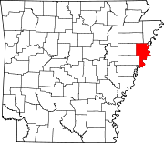 | |
| Towns | ||
| Unincorporated communities | ||
| ||
| Topics |
| ||||||
|---|---|---|---|---|---|---|---|
| Districts |
| ||||||
| Neighborhoods |
| ||||||
Metro area landmarks |
| ||||||
Metro area suburbs |
| ||||||
Metro area counties |
| ||||||
See also: Memphis, Tennessee sports venues | |||||||


Authority control | |
|---|---|
| General | |
| National libraries | |
| Other |
|
На других языках
[de] Earle (Arkansas)
Earle ist ein im Crittenden County im US-Bundesstaat Arkansas gelegener Ort mit dem Status City mit 2321 Einwohnern (2014).- [en] Earle, Arkansas
[ru] Эрл (Арканзас)
Эрл (англ. Earle, Arkansas) — город, расположенный в округе Криттенден (штат Арканзас, США) с населением в 3036 человек по статистическим данным переписи 2000 года.Другой контент может иметь иную лицензию. Перед использованием материалов сайта WikiSort.org внимательно изучите правила лицензирования конкретных элементов наполнения сайта.
WikiSort.org - проект по пересортировке и дополнению контента Википедии