world.wikisort.org - USA
Dawson Township is located in McLean County, Illinois. As of the 2010 census, its population was 590 and it contained 253 housing units.[2]
Dawson Township | |
|---|---|
Township | |
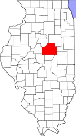
 Location in McLean County | |
 McLean County's location in Illinois | |
| Country | United States |
| State | Illinois |
| County | McLean |
| Established | After 1920 |
| Area | |
| • Total | 37.52 sq mi (97.2 km2) |
| • Land | 37.26 sq mi (96.5 km2) |
| • Water | 0.26 sq mi (0.7 km2) 0.69% |
| Population (2010) | |
| • Estimate (2016)[1] | 590 |
| • Density | 15.8/sq mi (6.1/km2) |
| Time zone | UTC-6 (CST) |
| • Summer (DST) | UTC-5 (CDT) |
| FIPS code | 17-113-18732 |
History
Dawson Township was originally named Lee Township, but changed to Padua Township on May 17, 1858, and then to Dawson on an unknown date. Dawson Township was named for John Wells Dawson, a pioneer settler.[3][4]
Geography
According to the 2010 census, the township has a total area of 37.52 square miles (97.2 km2), of which 37.26 square miles (96.5 km2) (or 99.31%) is land and 0.26 square miles (0.67 km2) (or 0.69%) is water.[2]
Demographics
| Historical population | |||
|---|---|---|---|
| Census | Pop. | %± | |
| 2016 (est.) | 590 | [1] | |
| U.S. Decennial Census[5] | |||
References
- "Population and Housing Unit Estimates". Retrieved June 9, 2017.
- "Population, Housing Units, Area, and Density: 2010 - County -- County Subdivision and Place -- 2010 Census Summary File 1". United States Census. Archived from the original on 2020-02-12. Retrieved 2013-05-28.
- Callary, Edward (29 September 2008). Place Names of Illinois. University of Illinois Press. p. 88. ISBN 978-0-252-09070-7.
- Gannett, Henry (1905). "The Origin of Certain Place Names in the United States". US Geological Survey. Govt. Print. Off.: 258.
Mclean county.
- "Census of Population and Housing". Census.gov. Retrieved June 4, 2016.
External links
Municipalities and communities of McLean County, Illinois, United States | ||
|---|---|---|
County seat: Bloomington | ||
| Cities |
|  |
| Town |
| |
| Villages |
| |
| Townships |
| |
| CDPs |
| |
| Other communities |
| |
| Ghost towns |
| |
| ||
Springfield (capital) | ||
| Topics |
|  Seal of Illinois |
| Regions |
| |
| Municipalities |
| |
| Counties |
| |
This McLean County, Illinois location article is a stub. You can help Wikipedia by expanding it. |
Текст в блоке "Читать" взят с сайта "Википедия" и доступен по лицензии Creative Commons Attribution-ShareAlike; в отдельных случаях могут действовать дополнительные условия.
Другой контент может иметь иную лицензию. Перед использованием материалов сайта WikiSort.org внимательно изучите правила лицензирования конкретных элементов наполнения сайта.
Другой контент может иметь иную лицензию. Перед использованием материалов сайта WikiSort.org внимательно изучите правила лицензирования конкретных элементов наполнения сайта.
2019-2025
WikiSort.org - проект по пересортировке и дополнению контента Википедии
WikiSort.org - проект по пересортировке и дополнению контента Википедии