world.wikisort.org - USA
Cudjoe Key is a census-designated place and unincorporated community in Monroe County, Florida, United States, on an island of the same name in the lower Florida Keys. As of the 2000 census, the CDP had a total population of 1,695.
Cudjoe Key, Florida | |
|---|---|
Census-designated place (CDP) & Unincorporated community | |
 An aerial view of the Venture Out resort, on the southeast side of Cudjoe Key, in 1983 | |
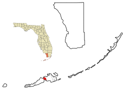 Location in Monroe County and the state of Florida | |
 U.S. Census Bureau map showing CDP boundaries | |
| Coordinates: 24°39′51″N 81°28′56″W | |
| Country | |
| State | |
| County | Monroe |
| Area | |
| • Total | 10.45 sq mi (27.07 km2) |
| • Land | 5.17 sq mi (13.40 km2) |
| • Water | 5.28 sq mi (13.67 km2) |
| Elevation | 0 ft (0 m) |
| Population (2020) | |
| • Total | 2,019 |
| • Density | 390.22/sq mi (150.66/km2) |
| Time zone | UTC-5 (Eastern (EST)) |
| • Summer (DST) | UTC-4 (EDT) |
| ZIP code | 33042 |
| Area code(s) | 305 |
| FIPS code | 12-15862[2] |
| GNIS feature ID | 1867131[3] |
History
Toponymy
The island was called Littleton Island in 1772. The name changed to Cudjoe's by 1849, later shortened to Cudjoe. It may have been named for the Joewood or Cudjoe wood tree (Jacquinia keyensis) which grows on the island. John Viele notes that "Cudjoe" is an Akan name, and may have been the name of an escaped slave who lived on the island early in the 19th century.[4][5]
20th century
The United States Army activated Cudjoe Key Air Force Station in 1959 to track missiles traveling through the Eglin Gulf Test Range. The Air Force took over operations the following year,[6] and it subsequently became a detached installation of Homestead Joint Air Reserve Base.[7]
21st century
The air force station flies a white radar aerostat, known locally as "Fat Albert", which is used for drug interdiction missions by the Drug Enforcement Administration. On April 20, 2007, a Cessna 182 crashed after its left wing struck the tether anchoring "Fat Albert".[8][9] The aerostat is marked on air navigation charts inside a restricted area that contains the warning, "Caution: Unmarked balloon on cable to 14,000 [feet]."
On September 10, 2017, Cudjoe Key suffered a direct hit from Hurricane Irma which made landfall as a Category 4 hurricane.[10]
Geography
Cudjoe Key is located at 24°39′51″N 81°28′56″W (24.664298, -81.482339).[11] Cudjoe Key is 110 mi (180 km) southwest of Miami[12] and 20 mi (32 km) east of Key West.[13]
U.S. 1 (or the Overseas Highway) crosses the key at about mile markers 20.5 – 23, between Summerland and Sugarloaf Keys.
According to the United States Census Bureau, the CDP has a total area of 14.6 km2 (5.6 sq mi), of which 13.6 km2 (5.3 sq mi) is land and 1 km2 (0.39 sq mi) (6.93%) is water.
Demographics
| Historical population | |||
|---|---|---|---|
| Census | Pop. | %± | |
| 2020 | 2,019 | — | |
| U.S. Decennial Census[14] | |||
As of the census[2] of 2000, there were 1,695 people, 799 households, and 541 families residing in the CDP. The population density was 124.9/km2 (323.6/mi2). There were 1,482 housing units at an average density of 109.2/km2 (282.9/mi2). The racial makeup of the CDP was 96.22% White, 0.88% African American, 0.47% Native American, 0.88% Asian, 0.12% Pacific Islander, 0.71% from other races, and 0.71% from two or more races. Hispanic or Latino of any race were 5.66% of the population.
There were 799 households, out of which 15.6% had children under the age of 18 living with them, 62.0% were married couples living together, 3.4% had a female householder with no husband present, and 32.2% were non-families. 21.7% of all households were made up of individuals, and 7.8% had someone living alone who was 65 years of age or older. The average household size was 2.12 and the average family size was 2.43.
In the CDP, the population was spread out, with 12.2% under the age of 18, 3.7% from 18 to 24, 27.1% from 25 to 44, 38.8% from 45 to 64, and 18.2% who were 65 years of age or older. The median age was 48 years. For every 100 females, there were 108.2 males. For every 100 females age 18 and over, there were 109.4 males.
The median income for a household in the CDP was $57,500, and the median income for a family was $59,883. Males had a median income of $36,094 versus $31,250 for females. The per capita income for the CDP was $27,085. About 4.4% of families and 5.8% of the population were below the poverty line, including 5.7% of those under age 18 and 5.4% of those age 65 or over.
References
- "2020 U.S. Gazetteer Files". United States Census Bureau. Retrieved October 31, 2021.
- "U.S. Census website". United States Census Bureau. Retrieved 2008-01-31.
- "US Board on Geographic Names". United States Geological Survey. 2007-10-25. Retrieved 2008-01-31.
- "A small tree for tough landscapes: joewood". Fairchild Tropical Botanic Garden. August 25, 2013. Retrieved May 19, 2019.
- Culper, Jim. "Cudjoe Key". Archived from the original on July 20, 2008. Retrieved May 19, 2019.
- "History of Cudjoe Key AFS, FL". Online Air Defense Radar Museum. Radomes, Inc. Retrieved 2009-12-12.
- Mueller, Roger (1989). Air Force Bases. Diane Publishing. pp. 253–255. ISBN 978-1-4289-9316-7.
- Dellert, Christine (17 May 2007). "NTSB: Pilot was warned before crash". Orlando Sentinel. Retrieved 10 September 2017.
- "NTSB Identification: MIA07FA083". NTSB. Archived from the original on 29 September 2007.
- Padró Ocasio, Bianca (10 September 2017). "Hurricane Irma makes landfall in Cudjoe Key". Orlando Sentinel. Retrieved 10 September 2017.
- "US Gazetteer files: 2010, 2000, and 1990". United States Census Bureau. 12 February 2011. Retrieved 23 April 2011.
- "Coordinate Distance Calculator". boulter.com. Retrieved 10 September 2017.
- "Coordinate Distance Calculator". boulter.com. Retrieved 10 September 2017.
- "Census of Population and Housing". Census.gov. Retrieved June 4, 2016.
| Wikimedia Commons has media related to Cudjoe Key. |
Municipalities and communities of Monroe County, Florida, United States | ||
|---|---|---|
County seat: Key West | ||
| Cities |
|  |
| Village |
| |
| CDPs |
| |
| Unincorporated communities |
| |
| Ghost towns |
| |
| ||
На других языках
[de] Cudjoe Key
Cudjoe Key ist ein census-designated place (CDP) im Monroe County im US-Bundesstaat Florida mit 1763 Einwohnern (Stand: 2010).- [en] Cudjoe Key, Florida
[fr] Cudjoe Key
Cudjoe Key est une île des Keys, archipel des États-Unis d'Amérique situé dans l'océan Atlantique au sud de la péninsule de Floride. Elle est située dans les Lower Keys.[ru] Куджо-Ки (Флорида)
Статистически обособленная местностьКуджо-КиCudjoe Key, Florida 24°39′51″ с. ш. 81°28′56″ з. д. HGЯOL Страна США Штат Флорида Округ Монро История и география Площадь 14,5 км² Высота центра 0 м Часовой пояс UTC−5:00, летом UTC−4:00 Население Население 1695 человек (2000) Плотность 116,9 чел./км² Цифровые идентификаторы Телефонный код +1 305 Почтовые индексы 33042 FIPS 12-15862 GNIS 2402389 и 1867131 Показать/скрыть карты Куджо-Ки Куджо-Ки Медиафайлы на ВикискладеДругой контент может иметь иную лицензию. Перед использованием материалов сайта WikiSort.org внимательно изучите правила лицензирования конкретных элементов наполнения сайта.
WikiSort.org - проект по пересортировке и дополнению контента Википедии