world.wikisort.org - USA
Collegeville Township is a township in Stearns County, Minnesota, United States. The population was 3,343 at the 2010 census.[2]
Collegeville Township, Minnesota | |
|---|---|
Township | |
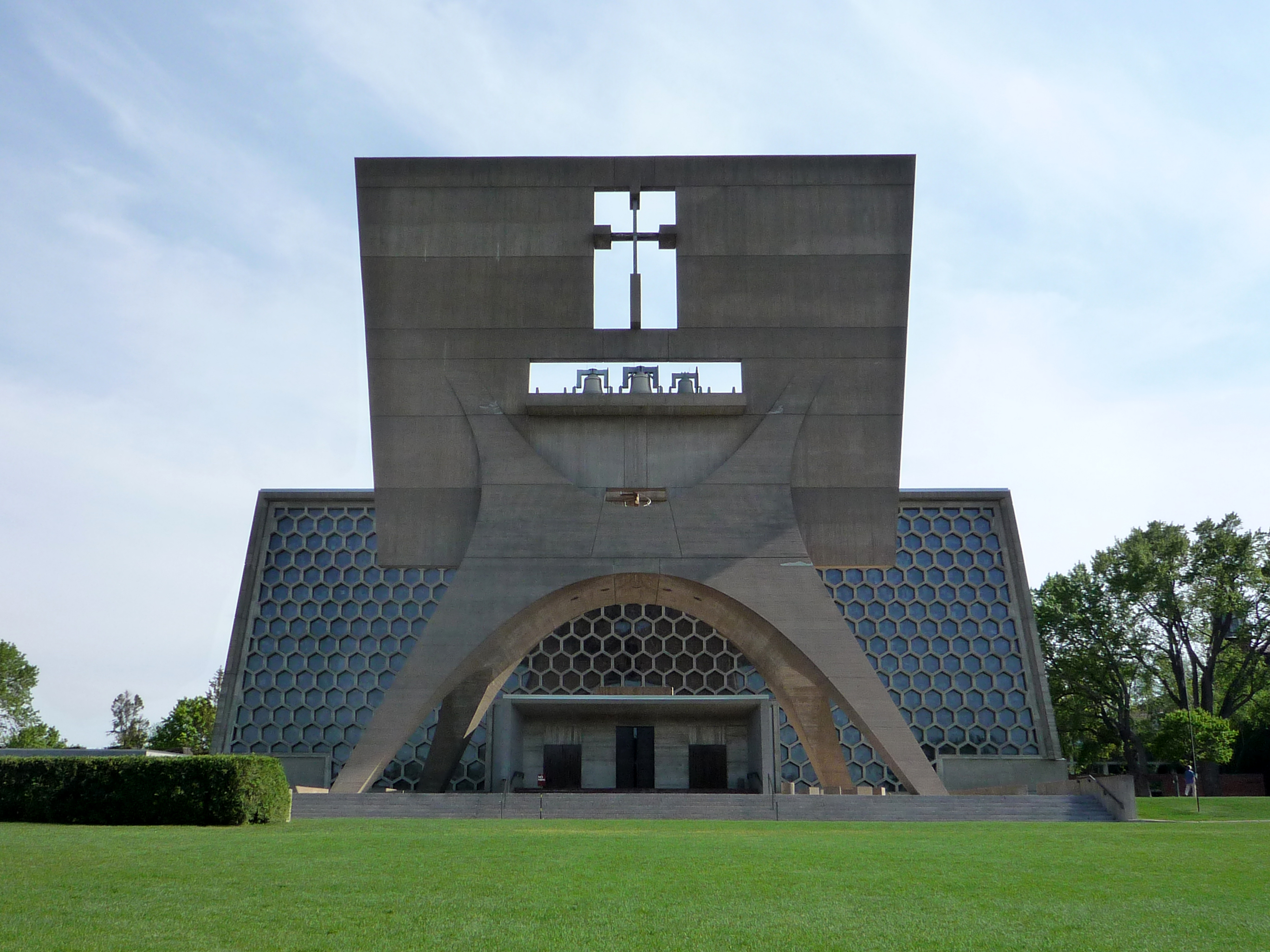 Saint John's Abbey Church on the campus of SJU | |
| Motto(s): "In the heart Of Stearns County"[1] | |
 Collegeville Township, Minnesota Location within the state of Minnesota  Collegeville Township, Minnesota Collegeville Township, Minnesota (the United States) | |
| Coordinates: 45°33′N 94°27′W | |
| Country | United States |
| State | Minnesota |
| County | Stearns |
| Area | |
| • Total | 35.1 sq mi (90.9 km2) |
| • Land | 31.6 sq mi (82.0 km2) |
| • Water | 3.5 sq mi (8.9 km2) |
| Elevation | 1,171 ft (357 m) |
| Population (2010)[2] | |
| • Total | 3,343 |
| • Density | 111.1/sq mi (42.9/km2) |
| Time zone | UTC-6 (Central (CST)) |
| • Summer (DST) | UTC-5 (CDT) |
| ZIP code | 56321 |
| Area code(s) | 320 |
| FIPS code | 27-12592[3] |
| GNIS feature ID | 0663847[4] |
| Website | http://www.collegevilletownship.com/ |
History
Collegeville Township was organized in 1880, and named after Saint John's College.[5]
Geography
According to the United States Census Bureau, the township has a total area of 35.1 square miles (91 km2), of which 31.6 square miles (82 km2) is land and 3.5 square miles (9.1 km2) (9.83%) is water.
Collegeville Township is located in Township 124 North of the Arkansas Base Line and Range 30 West of the 5th Principal Meridian.
Demographics
| Historical population | |||
|---|---|---|---|
| Census | Pop. | %± | |
| 1880 | 318 | — | |
| 1890 | 506 | 59.1% | |
| 1900 | 655 | 29.4% | |
| 1910 | 606 | −7.5% | |
| 1920 | 777 | 28.2% | |
| 1930 | 869 | 11.8% | |
| 1940 | 892 | 2.6% | |
| 1950 | 1,457 | 63.3% | |
| 1960 | 1,812 | 24.4% | |
| 1970 | 2,371 | 30.8% | |
| 1980 | 3,075 | 29.7% | |
| 1990 | 1,624 | −47.2% | |
| 2000 | 3,516 | 116.5% | |
| 2010 | 3,343 | −4.9% | |
| U.S. Decennial Census | |||
As of the census[3] of 2000, there were 3,516 people, 29% of those being Monks at the present Abbey and Monastery. 569 households, and 397 families residing in the township. The population density was 111.1 people per square mile (42.9/km2). There were 721 housing units at an average density of 22.8/sq mi (8.8/km2). The racial makeup of the township was 97.07% White, 0.63% African American, 0.06% Native American, 1.56% Asian, 0.03% Pacific Islander, 0.34% from other races, and 0.31% from two or more races. Hispanics and Latinos of any race were 0.85% of the population.
There were 669 households, out of which 39.6% had children under the age of 18 living with them, 78.0% were married couples living together, 2.7% had a female householder with no husband present, and 16.4% were non-families. 12.3% of all households were made up of individuals, and 2.4% had someone living alone who was 65 years of age or older. The average household size was 2.85 and the average family size was 3.11.
The age distribution was 16.7% under the age of 18, 41.6% from 18 to 24, 16.8% from 25 to 44, 18.2% from 45 to 64, and 6.6% who were 65 years of age or older. The median age was 22 years. For every 100 females, there were 261.0 males. For every 100 females age 18 and over, there were 320.8 males.
The median income for a household in the township was $61,146, and the median income for a family was $62,750. Males had a median income of $36,926 versus $27,391 for females. The per capita income for the township was $18,348. About 0.6% of families and 6.0% of the population were below the poverty line, including 1.1% of those under age 18 and 2.3% of those age 65 or over.
Arts and culture
Museums and other points of interest
Education
The township is home to Saint John's Abbey and Saint John's University, a Catholic school all-male university.
Infrastructure
Transportation
Main routes in the community include Stearns County Roads 50, 51, 159 and 160.
Notable people
This section needs additional citations for verification. (October 2012) |
- Fr.Celestine Kapsner, OSB, Catholic priest and exorcist
- J. F. Powers, National Book Award for Fiction-winning novelist[8]
- Marcel Breuer, a famous Architect from New York, here to design the new St. John's Abbey and University Church.
References
- "Collegeville Township Minnesota". Collegeville Township Minnesota. Retrieved October 14, 2012.
- "2010 Census Redistricting Data (Public Law 94-171) Summary File - County Subdivision". American FactFinder. United States Census Bureau. Retrieved 1 May 2011.[dead link]
- "U.S. Census website". United States Census Bureau. Retrieved 2008-01-31.
- "US Board on Geographic Names". United States Geological Survey. 2007-10-25. Retrieved 2008-01-31.
- Upham, Warren (1920). Minnesota Geographic Names: Their Origin and Historic Significance. Minnesota Historical Society. p. 523.
- "St.John's Arboreteum". St.John’s University. Archived from the original on October 15, 2012. Retrieved October 14, 2012.
- "St.John's University". St.John’s University. Retrieved October 14, 2012.
- "The Gospel according to J. F. Powers". Portland magazin. Retrieved October 14, 2012.
External links

| Authority control |
|
|---|
На других языках
- [en] Collegeville Township, Minnesota
[ru] Колледжвилл (тауншип, Миннесота)
Колледжвилл (англ. Collegeville) — тауншип в округе Стернс, Миннесота, США. На 2000 год его население составило 3516 человек.Другой контент может иметь иную лицензию. Перед использованием материалов сайта WikiSort.org внимательно изучите правила лицензирования конкретных элементов наполнения сайта.
WikiSort.org - проект по пересортировке и дополнению контента Википедии