world.wikisort.org - USA
Coal Bluff is an unincorporated community in northern Nevins Township, Vigo County, in the U.S. state of Indiana.[2]
Coal Bluff, Indiana | |
|---|---|
Unincorporated community | |
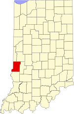 Vigo County's location in Indiana | |
 Coal Bluff location in Vigo County, Indiana | |
| Coordinates: 39°34′58″N 87°13′12″W | |
| Country | United States |
| State | Indiana |
| County | Vigo |
| Township | Nevins |
| Elevation | 551 ft (168 m) |
| Time zone | UTC-5 (Eastern (EST)) |
| • Summer (DST) | UTC-4 (EDT) |
| ZIP code | 47874 |
| Area code(s) | 812 |
| GNIS feature ID | 449640 |
It is part of the Terre Haute metropolitan area.
History
Coal Bluff grew to be a hamlet in consequence of Webster's coal mine, one of the first in the county being opened. Webster sold the mine to the Coal Bluff Mining Company, and hence the name of the place. In 1890 it was exclusively a mining town with a post office and a railroad station on the Indianapolis and St. Louis Railroad. At that time it had a population of approximately 176. Since the Coal Mines closed, Coal Bluff has now become a residential community. The post comes from Rosedale, Indiana, and the telephone numbers are from Clay County. There are farms in the area and a few prominent families.[3]
A post office was established at Coal Bluff in 1876, and remained in operation until it was discontinued in 1969.[4]
Geography
Coal Bluff is located at 39°34′58″N 87°13′12″W at an elevation of 554 feet.
References
- "US Board on Geographic Names". United States Geological Survey. October 25, 2007. Retrieved 2016-07-14.
- "Coal Bluff, Indiana". Geographic Names Information System. United States Geological Survey. Retrieved August 7, 2017.
- Bradsby, H.C. (1891). History of Vigo County, Indiana, with Biographical Selections. Chicago: S. B. Nelson & Co. pp. 481.
- "Vigo County". Jim Forte Postal History. Retrieved December 21, 2016.

This Vigo County, Indiana location article is a stub. You can help Wikipedia by expanding it. |
Другой контент может иметь иную лицензию. Перед использованием материалов сайта WikiSort.org внимательно изучите правила лицензирования конкретных элементов наполнения сайта.
WikiSort.org - проект по пересортировке и дополнению контента Википедии