world.wikisort.org - USA
Libertyville is an unincorporated community in Vermillion and Vigo counties, in the U.S. state of Indiana.[3] The county is in the Terre Haute Metropolitan Statistical Area.
Libertyville, Indiana | |
|---|---|
Unincorporated community | |
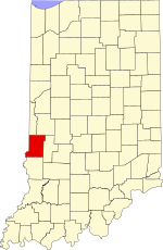 Vigo County's location in Indiana | |
 Libertyville Location in Vigo County, Indiana | |
| Coordinates: 39°36′10″N 87°31′07″W | |
| Country | United States |
| State | Indiana |
| County | Vigo |
| Township | Fayette |
| Elevation | 614 ft (187 m) |
| Time zone | UTC-5 (Eastern (EST)) |
| • Summer (DST) | UTC-4 (EDT) |
| ZIP code | 47885 |
| FIPS code | 18-43632[2] |
| GNIS feature ID | 437848 |
History
A post office was established at Libertyville in 1871, and remained in operation until it was discontinued in 1904.[4]
Geography
Libertyville is located along U.S. Highway 150, at 39°36′10″N 87°31′07″W.
References
- "US Board on Geographic Names". United States Geological Survey. October 25, 2007. Retrieved 2016-07-14.
- "U.S. Census website". United States Census Bureau. Retrieved 2008-01-31.
- "Libertyville, Indiana". Geographic Names Information System. United States Geological Survey. Retrieved July 31, 2017.
- "Vigo County". Jim Forte Postal History. Retrieved July 14, 2016.
Municipalities and communities of Vermillion County, Indiana, United States | ||
|---|---|---|
County seat: Newport | ||
| City |
|  |
| Towns |
| |
| Townships |
| |
| CDPs |
| |
| Other unincorporated communities |
| |
| Ghost towns |
| |
| Footnotes | ‡This populated place also has portions in an adjacent county or counties | |
| ||
Municipalities and communities of Vigo County, Indiana, United States | ||
|---|---|---|
County seat: Terre Haute | ||
| City |
|  |
| Towns |
| |
| Townships |
| |
| CDPs |
| |
| Other unincorporated communities |
| |
| Footnotes | ‡This populated place also has portions in an adjacent county or counties | |
| ||
This Vermillion County, Indiana location article is a stub. You can help Wikipedia by expanding it. |
This Vigo County, Indiana location article is a stub. You can help Wikipedia by expanding it. |
Текст в блоке "Читать" взят с сайта "Википедия" и доступен по лицензии Creative Commons Attribution-ShareAlike; в отдельных случаях могут действовать дополнительные условия.
Другой контент может иметь иную лицензию. Перед использованием материалов сайта WikiSort.org внимательно изучите правила лицензирования конкретных элементов наполнения сайта.
Другой контент может иметь иную лицензию. Перед использованием материалов сайта WikiSort.org внимательно изучите правила лицензирования конкретных элементов наполнения сайта.
2019-2025
WikiSort.org - проект по пересортировке и дополнению контента Википедии
WikiSort.org - проект по пересортировке и дополнению контента Википедии