world.wikisort.org - USA
Clearfield Colony is a Hutterite colony[4] and census-designated place (CDP) within the Yankton Indian Reservation in Charles Mix County, South Dakota, United States. It was first listed as a CDP prior to the 2020 census.[3] The population of the CDP was 99 at the 2020 census.[5]
Clearfield Colony, South Dakota | |
|---|---|
Census-designated place | |
 Clearfield Colony  Clearfield Colony | |
| Coordinates: 43°8′47″N 98°8′19″W | |
| Country | United States |
| State | South Dakota |
| County | Charles Mix |
| Area | |
| • Total | 0.30 sq mi (0.78 km2) |
| • Land | 0.30 sq mi (0.78 km2) |
| • Water | 0.00 sq mi (0.00 km2) |
| Elevation | 1,740 ft (530 m) |
| Population (2020)[2] | |
| • Total | 99 |
| • Density | 326.73/sq mi (126.29/km2) |
| Time zone | UTC-6 (Central (CST)) |
| • Summer (DST) | UTC-5 (CDT) |
| ZIP Code | 57330 (Delmont) |
| Area code | 605 |
| FIPS code | 46-12508 |
| GNIS feature ID | 2813005[3] |
It is in the eastern part of the county, 10 miles (16 km) south of Delmont and 12 miles (19 km) northeast of Wagner.
Demographics
| Historical population | |||
|---|---|---|---|
| Census | Pop. | %± | |
| 2020 | 99 | — | |
| U.S. Decennial Census[6] | |||
References
- "ArcGIS REST Services Directory". United States Census Bureau. Retrieved October 15, 2022.
- "Census Population API". United States Census Bureau. Retrieved Oct 15, 2022.
- "Clearfield Colony Census Designated Place". Geographic Names Information System. United States Geological Survey, United States Department of the Interior.
- Friesen, Bert (May 2021). "Clearfield Hutterite Colony (Wagner, South Dakota, USA)". Global Anabaptist Mennonite Encyclopedia Online. Retrieved September 10, 2021.
- "U.S. Census Bureau: Clearfield Colony CDP, South Dakota". www.census.gov. United States Census Bureau. Retrieved 5 February 2022.
- "Census of Population and Housing". Census.gov. Retrieved June 4, 2016.
Municipalities and communities of Charles Mix County, South Dakota, United States | ||
|---|---|---|
County seat: Lake Andes | ||
| Cities | 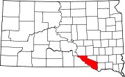 | |
| Towns | ||
| CDPs | ||
| Other communities |
| |
| Indian reservation |
| |
| ||
This South Dakota state location article is a stub. You can help Wikipedia by expanding it. |
Текст в блоке "Читать" взят с сайта "Википедия" и доступен по лицензии Creative Commons Attribution-ShareAlike; в отдельных случаях могут действовать дополнительные условия.
Другой контент может иметь иную лицензию. Перед использованием материалов сайта WikiSort.org внимательно изучите правила лицензирования конкретных элементов наполнения сайта.
Другой контент может иметь иную лицензию. Перед использованием материалов сайта WikiSort.org внимательно изучите правила лицензирования конкретных элементов наполнения сайта.
2019-2025
WikiSort.org - проект по пересортировке и дополнению контента Википедии
WikiSort.org - проект по пересортировке и дополнению контента Википедии