world.wikisort.org - USA
Clay Township is one of eleven townships in Howard County, Indiana, United States. As of the 2010 census, its population was 3,885 and it contained 1,565 housing units.[2] This township also contains a small portion of Kokomo. The population of the Kokomo portion, however, is zero.
Clay Township | |
|---|---|
Township | |
 Henry W. Smith House, a historic site in the township | |
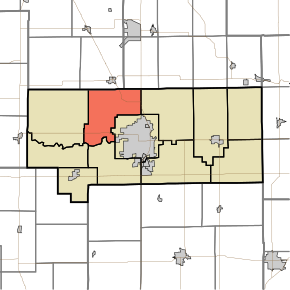 Location in Howard County | |
| Coordinates: 40°31′22″N 86°11′37″W | |
| Country | United States |
| State | Indiana |
| County | Howard |
| Government | |
| • Type | Indiana township |
| Area | |
| • Total | 28.74 sq mi (74.4 km2) |
| • Land | 28.7 sq mi (74 km2) |
| • Water | 0.04 sq mi (0.1 km2) 0.14% |
| Elevation | 820 ft (250 m) |
| Population (2010) | |
| • Total | 3,885 |
| • Estimate (2012[1]) | 3,894 |
| • Density | 135.4/sq mi (52.3/km2) |
| GNIS feature ID | 0453211 |
History
Clay Township was named for Henry Clay, a politician and statesman from Kentucky.[3]
The Henry W. Smith House was listed on the National Register of Historic Places in 1979.[4]
Geography
| Historical population | |||
|---|---|---|---|
| Census | Pop. | %± | |
| 2000 | 4,042 | — | |
| 2010 | 3,885 | −3.9% | |
| 2012 (est.) | 3,894 | 0.2% | |
| U.S. Census[5] | |||
According to the 2010 census, the township has a total area of 28.74 square miles (74.4 km2), of which 28.7 square miles (74 km2) (or 99.86%) is land and 0.04 square miles (0.10 km2) (or 0.14%) is water.[2] The stream of Villa Run runs through this township.
Former Settlements
- Jewell Station
Adjacent townships
- Jackson Township, Cass County (north)
- Deer Creek Township, Miami County (northeast)
- Howard Township (east)
- Center Township (southeast)
- Harrison Township (south)
- Monroe Township (southwest)
- Ervin Township (west)
Major highways
 US 31
US 31 US 35
US 35 SR 22
SR 22
Airports and landing strips
- Hartman Farms Field
References
- "Clay Township, Howard County, Indiana". Geographic Names Information System. United States Geological Survey. Retrieved 2009-09-24.
- United States Census Bureau cartographic boundary files
- "Population Estimates". United States Census Bureau. Archived from the original on 2013-06-11. Retrieved 2013-06-25.
- "Population, Housing Units, Area, and Density: 2010 - County -- County Subdivision and Place -- 2010 Census Summary File 1". United States Census. Archived from the original on 2020-02-12. Retrieved 2013-05-10.
- "Howard County's Townships and Their Early Settlements and Towns". Kokomo-Howard County Public Library. Archived from the original on 22 December 2013. Retrieved 2 June 2014.
- "National Register Information System". National Register of Historic Places. National Park Service. July 9, 2010.
- "US Census Data". US Government Census Agency. Archived from the original on 8 October 2014. Retrieved 26 February 2014.
- "Early Settlements". KHPL Genealogy. Archived from the original on 2013-12-22.
External links
Municipalities and communities of Howard County, Indiana, United States | ||
|---|---|---|
County seat: Kokomo | ||
| City |
|  |
| Towns |
| |
| Townships | ||
| Other unincorporated communities |
| |
| ||
Текст в блоке "Читать" взят с сайта "Википедия" и доступен по лицензии Creative Commons Attribution-ShareAlike; в отдельных случаях могут действовать дополнительные условия.
Другой контент может иметь иную лицензию. Перед использованием материалов сайта WikiSort.org внимательно изучите правила лицензирования конкретных элементов наполнения сайта.
Другой контент может иметь иную лицензию. Перед использованием материалов сайта WikiSort.org внимательно изучите правила лицензирования конкретных элементов наполнения сайта.
2019-2026
WikiSort.org - проект по пересортировке и дополнению контента Википедии
WikiSort.org - проект по пересортировке и дополнению контента Википедии