world.wikisort.org - USA
Cassia County is a county in the U.S. state of Idaho. As of the 2020 Census the county had a population of 24,655.[1] The county seat and largest city is Burley.[2] Cassia County is included in the Burley, ID Micropolitan Statistical Area.
Cassia County | |
|---|---|
U.S. county | |
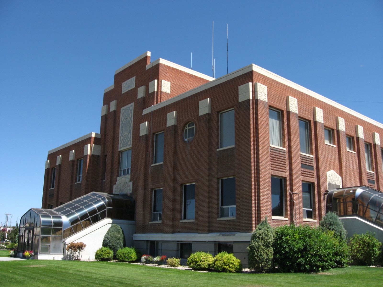 Cassia County Courthouse | |
 Seal | |
 Location within the U.S. state of Idaho | |
 Idaho's location within the U.S. | |
| Coordinates: 42°16′N 113°37′W | |
| Country | |
| State | |
| Founded | February 20, 1879 |
| Named for | Cassia Creek |
| Seat | Burley |
| Largest city | Burley |
| Area | |
| • Total | 2,580 sq mi (6,700 km2) |
| • Land | 2,565 sq mi (6,640 km2) |
| • Water | 15 sq mi (40 km2) 0.6% |
| Population (2020) | |
| • Total | 24,655 |
| • Density | 9.6/sq mi (3.7/km2) |
| Time zone | UTC−7 (Mountain) |
| • Summer (DST) | UTC−6 (MDT) |
| Congressional district | 2nd |
| Website | www |
History
The first Europeans explored the Milner area in Cassia County in 1811. It was trappers who initially developed the Oregon Trail, which ran on the county's northern border. The Raft River's junction with the Oregon Trail marked the split for the California Trail.
While the Oregon and California trails brought hundreds of thousands of emigrants through Cassia County, it also brought settlers. A stage line through the county was established between Kelton, Utah and Boise, Idaho in 1869. A stage station existed at City of Rocks. Additional stations were spaced at increments of 10–12 miles between stations to include one at Oakley Meadows, in the Goose Creek valley two miles west of the present settlement of Oakley.
William Oakley settled at the Oakley Meadows station in 1870. Cattle operations also developed starting in 1872. Settlement began at nearby Albion in 1873 with significant Mormon settlement in 1875. By 1880, Albion had a population of 257. Mormon settlement at Oakley also began on June 1, 1878, when four Mormon men each staked out 160 acres for their settlement. Settlements remained primarily agricultural with more than 38,000 head of cattle in the area by 1885. Settlement at Malta occurred prior to 1890, as the Malta precinct had 172 residents at the 1890 census.
Albion State Normal School was established at Albion in 1893. The school was focused on training Idaho teachers until 1951 when its programs were transferred to Idaho State College (now Idaho State University) in Pocatello.[3][4][5][6]
Burley was platted and settled in 1905 after a branch of the Oregon Shortline was constructed through the town. Declo was settled under the name of Marshfield by 1909.[7]
Cassia County was created from Owyhee County on February 20, 1879, with Albion becoming the county seat.[8] A western portion became Twin Falls County in 1907. The county assumed its present boundaries when an eastern portion became Power County on January 30, 1913. The county seat was moved to Burley in 1918. The county was named for Cassia Creek, which in turn was named either for John Cazier, a member of the Mormon Battalion and an emigrant train captain, or for a plant found in the area.
Government
Elected Officials
Similar to other Idaho counties, an elected three-member county commission heads the county government. Other elected officials include clerk, treasurer, sheriff, assessor, coroner, and prosecutor.
County Commission
- District 1: Leonard Beck (chair)
- District 2: Robert Kunau
- District 3: Kent Searle
Other Elected Officials
- Clerk: Joseph Larsen
- Treasurer: Laura Greener
- Sheriff: George Warrell
- Assessor: Dwight Davis
- Coroner: Craig Rinehart
- Prosecuting Attorney: McCord Larsen
Cassia County is in Idaho's 2nd congressional district and represented by Congressman Mike Simpson. At the state level, Cassia County is in Legislative District 27, represented by Senator Kelly Anthon of Declo, Speaker Scott Bedke of Oakley and Fred Wood of Burley.
Politics
At every level, Cassia County is a Republican Party stronghold. All county-level offices are held by Republicans and have been for decades. Republican primaries are tantamount to election to office, as Democrats rarely field challenges for county or state legislative office. Cassia County is one of the most consistently Republican counties in the state, and in the gubernatorial election of 2010 Republican Butch Otter carried Cassia County with 76.54% to Democrat Keith Allred's 16.73%.[9] In the presidential election of 2012, Mitt Romney, whose father lived for a few years in his youth in Oakley, carried Cassia County with 85.2% while Barack Obama received 13.1%.[10] The last Democratic presidential candidate to carry Cassia County was Franklin Roosevelt in the election of 1940 edging out Wendell Willkie by around 100 votes.
State legislators from Cassia County traditionally hold their seats for long periods of time. Two of the longest serving legislators in Idaho history were from Cassia County: Vard Chatburn of Albion who served in the House of Representatives from 1957 to 1986 and Denton Darrington in the Senate who served from 1982 to 2012. Because legislators rarely lose their seats, legislators representing Cassia County are often in leadership or chair committees. Since 2012, Representative Bedke has served as Speaker of the House. Bruce Newcomb of Burley also served as Speaker from 1998 to 2006.
Though born in Burley, Congressman Simpson now lives in Idaho Falls. The only other member of congress with ties to the county is Henry Dworshak who represented Idaho's 2nd congressional district and later served in the Senate. He lived in Burley and was the publisher of the Burley Bulletin. A Burley elementary school is named after him.
| Year | Republican | Democratic | Third party | |||
|---|---|---|---|---|---|---|
| No. | % | No. | % | No. | % | |
| 2020 | 7,907 | 82.09% | 1,464 | 15.20% | 261 | 2.71% |
| 2016 | 5,949 | 72.74% | 1,036 | 12.67% | 1,193 | 14.59% |
| 2012 | 7,154 | 84.84% | 1,098 | 13.02% | 180 | 2.13% |
| 2008 | 6,309 | 79.93% | 1,332 | 16.88% | 252 | 3.19% |
| 2004 | 6,562 | 83.90% | 1,153 | 14.74% | 106 | 1.36% |
| 2000 | 5,983 | 82.20% | 1,087 | 14.93% | 209 | 2.87% |
| 1996 | 4,663 | 63.65% | 1,596 | 21.79% | 1,067 | 14.56% |
| 1992 | 4,052 | 53.16% | 1,351 | 17.73% | 2,219 | 29.11% |
| 1988 | 5,345 | 73.34% | 1,833 | 25.15% | 110 | 1.51% |
| 1984 | 6,503 | 85.60% | 1,036 | 13.64% | 58 | 0.76% |
| 1980 | 6,511 | 78.84% | 1,369 | 16.58% | 379 | 4.59% |
| 1976 | 4,575 | 66.38% | 1,881 | 27.29% | 436 | 6.33% |
| 1972 | 4,576 | 74.26% | 1,080 | 17.53% | 506 | 8.21% |
| 1968 | 4,187 | 64.17% | 1,350 | 20.69% | 988 | 15.14% |
| 1964 | 4,009 | 60.59% | 2,608 | 39.41% | 0 | 0.00% |
| 1960 | 4,297 | 63.73% | 2,445 | 36.27% | 0 | 0.00% |
| 1956 | 3,944 | 68.79% | 1,789 | 31.21% | 0 | 0.00% |
| 1952 | 4,481 | 72.76% | 1,676 | 27.21% | 2 | 0.03% |
| 1948 | 2,424 | 51.89% | 2,178 | 46.63% | 69 | 1.48% |
| 1944 | 2,563 | 52.35% | 2,325 | 47.49% | 8 | 0.16% |
| 1940 | 2,748 | 48.30% | 2,930 | 51.50% | 11 | 0.19% |
| 1936 | 1,629 | 33.96% | 3,100 | 64.62% | 68 | 1.42% |
| 1932 | 2,032 | 43.48% | 2,598 | 55.60% | 43 | 0.92% |
| 1928 | 2,388 | 70.19% | 994 | 29.22% | 20 | 0.59% |
| 1924 | 2,031 | 52.01% | 1,336 | 34.21% | 538 | 13.78% |
| 1920 | 2,690 | 69.54% | 1,178 | 30.46% | 0 | 0.00% |
| 1916 | 1,320 | 40.55% | 1,629 | 50.05% | 306 | 9.40% |
| 1912 | 1,489 | 46.66% | 846 | 26.51% | 856 | 26.83% |
| 1908 | 1,049 | 58.87% | 600 | 33.67% | 133 | 7.46% |
| 1904 | 1,185 | 73.88% | 346 | 21.57% | 73 | 4.55% |
| 1900 | 674 | 51.93% | 624 | 48.07% | 0 | 0.00% |
Geography
According to the U.S. Census Bureau, the county has a total area of 2,580 square miles (6,700 km2), of which 2,565 square miles (6,640 km2) is land and 15 square miles (39 km2) (0.6%) is water.[12] The county's highest point is Cache Peak at an elevation of 10,339 feet (3,151 m) above sea level in the Albion Mountains, and the lowest is Milner Lake, a reservoir on the Snake River, at 4,134 feet (1,260 m).
The northern half of the county is part of the Magic Valley region of the Snake River Plain, and numerous mountain ranges extend north from the southern boundary and diminish as they approach the river, which flows from east to west.
The Silent City of Rocks National Reserve, containing exposed granitic batholith as old as 2.5 billion years, is located in the southern part of the county.
Adjacent Counties
- Minidoka County - north
- Blaine County - north
- Power County - northeast
- Oneida County - east
- Box Elder County, Utah - southeast
- Elko County, Nevada - southwest/Pacific Time Border
- Twin Falls County - west
- Jerome County - northwest
Highways
 Interstate 84
 Interstate 86
 US 30
US 30 SH-27
SH-27 SH-77
SH-77 SH-81
SH-81
National protected areas
- City of Rocks National Reserve
- Minidoka National Wildlife Refuge (part)
- Sawtooth National Forest (part)
Demographics
| Historical population | |||
|---|---|---|---|
| Census | Pop. | %± | |
| 1880 | 1,312 | — | |
| 1890 | 3,143 | 139.6% | |
| 1900 | 3,951 | 25.7% | |
| 1910 | 7,197 | 82.2% | |
| 1920 | 15,659 | 117.6% | |
| 1930 | 13,116 | −16.2% | |
| 1940 | 14,430 | 10.0% | |
| 1950 | 14,629 | 1.4% | |
| 1960 | 16,121 | 10.2% | |
| 1970 | 17,017 | 5.6% | |
| 1980 | 19,427 | 14.2% | |
| 1990 | 19,532 | 0.5% | |
| 2000 | 21,416 | 9.6% | |
| 2010 | 22,952 | 7.2% | |
| 2020 | 24,655 | 7.4% | |
| 2021 (est.) | 25,164 | [13] | 2.1% |
| U.S. Decennial Census[14] 1790-1960[15] 1900-1990[16] 1990-2000[17] 2010-2020[1] 2020[18] | |||
2000 census
As of the census[19] of 2000, there were 21,416 people, 7,060 households, and 5,485 families living in the county. The population density was 8 people per square mile (3/km2). There were 7,862 housing units at an average density of 3 per square mile (1/km2). The racial makeup of the county was 84.69% White, 0.17% Black or African American, 0.80% Native American, 0.37% Asian, 0.05% Pacific Islander, 12.06% from other races, and 1.87% from two or more races. 18.74% of the population were Hispanic or Latino of any race. 23.1% were of English, 13.8% American and 12.9% German ancestry.
There were 7,060 households, out of which 42.40% had children under the age of 18 living with them, 65.20% were married couples living together, 8.80% had a female householder with no husband present, and 22.30% were non-families. 19.50% of all households were made up of individuals, and 9.50% had someone living alone who was 65 years of age or older. The average household size was 2.99 and the average family size was 3.46.
In the county, the population was spread out, with 34.10% under the age of 18, 9.00% from 18 to 24, 24.50% from 25 to 44, 19.60% from 45 to 64, and 12.70% who were 65 years of age or older. The median age was 31 years. For every 100 females, there were 101.20 males. For every 100 females age 18 and over, there were 98.70 males.
The median income for a household in the county was $33,322, and the median income for a family was $38,162. Males had a median income of $29,132 versus $19,851 for females. The per capita income for the county was $14,087. About 11.10% of families and 13.60% of the population were below the poverty line, including 17.60% of those under age 18 and 8.00% of those age 65 or over.
2010 census
As of the 2010 United States Census, there were 22,952 people, 7,666 households, and 5,758 families living in the county.[20] The population density was 8.9 inhabitants per square mile (3.4/km2). There were 8,372 housing units at an average density of 3.3 per square mile (1.3/km2).[21] The racial makeup of the county was 81.8% white, 0.8% American Indian, 0.5% Asian, 0.3% black or African American, 0.1% Pacific islander, 14.2% from other races, and 2.3% from two or more races. Those of Hispanic or Latino origin made up 24.9% of the population.[20] In terms of ancestry, 22.3% were English, 11.8% were German, 10.6% were American, and 5.1% were Irish.[22]
Of the 7,666 households, 41.9% had children under the age of 18 living with them, 60.8% were married couples living together, 9.1% had a female householder with no husband present, 24.9% were non-families, and 21.5% of all households were made up of individuals. The average household size was 2.96 and the average family size was 3.46. The median age was 32.0 years.[20]
The median income for a household in the county was $39,866 and the median income for a family was $47,995. Males had a median income of $36,402 versus $22,156 for females. The per capita income for the county was $17,782. About 12.4% of families and 15.4% of the population were below the poverty line, including 18.7% of those under age 18 and 8.1% of those age 65 or over.[23]
Education
Cassia County is served primarily by one school district, Cassia Joint School District #151, which was consolidated in the 1950s.
Schools Located in Cassia County
High Schools
- Burley High School in Burley
- Cassia Alternative High School in Burley
- Declo High School in Declo
- Oakley High School in Oakley
- Raft River High School in Malta
Jr. High Schools
- Burley Jr. High School in Burley
- Declo Jr. High School in Declo
- Oakley Jr. High School in Oakley
- Raft River Jr. High School in Malta
Elementary Schools
- Albion Elementary School in Albion
- Almo Elementary School in Almo
- Declo Elementary in Declo
- Dworshak Elementary School in Burley
- Evans Elementary School in Burley
- Mountain View Elementary School in Burley
- Raft River Elementary School in Malta
- White Pine Elementary School in Burley
Communities
Cities
Unincorporated communities
- Almo
- Basin
- Connor
- Elba
- Idahome
- Jackson
- Marion
- Pella
- Raft River
- Springdale
- Sublett
- View
See also
- National Register of Historic Places listings in Cassia County, Idaho
- USS Cassia County (LST-527) - U.S. Navy ship - 1944-56
- County Parcel Map
References
- "State & County QuickFacts". United States Census Bureau. Retrieved September 17, 2022.
- "Find a County". National Association of Counties. Archived from the original on May 31, 2011. Retrieved June 7, 2011.
- Boothe, Wayne (1963). A History of the Latter-Day Saint Settlement of Oakley. Provo: Brigham Young University. pp. 7–8, 14–16, 22–25. Retrieved February 7, 2017.
- Encyclopedic history of the Church of Jesus Christ of latter-day Saints. Salt Lake City: Deseret News. 1941. p. 10. Retrieved February 7, 2017.
- Report on the Population of the United States at the Eleventh Census: 1890. Washington: Government Printing Office. 1895. pp. 99.
- "Albion State Normal School History". Albion Campus Retreat. Retrieved February 7, 2017.
- Encyclopedic History of the Church of Jesus Christ of Latter-Day Saints. Salt Lake City: Deseret News. 1941. pp. 98, 176. Retrieved February 7, 2017.
- Idaho.gov - Cassia County Archived August 3, 2009, at the Wayback Machine accessed May 29, 2009
- "2010 General Results Governor and Lt Governor". Archived from the original on July 12, 2011. Retrieved August 5, 2011.
- "2008 General Results US President". Archived from the original on July 12, 2011. Retrieved July 24, 2011.
- Leip, David. "Dave Leip's Atlas of U.S. Presidential Elections". uselectionatlas.org. Retrieved April 4, 2018.
- "US Gazetteer files: 2010, 2000, and 1990". United States Census Bureau. February 12, 2011. Retrieved April 23, 2011.
- "County Population Totals: 2020-2021". Retrieved September 17, 2022.
- "U.S. Decennial Census". United States Census Bureau. Retrieved June 28, 2014.
- "Historical Census Browser". University of Virginia Library. Retrieved June 28, 2014.
- "Population of Counties by Decennial Census: 1900 to 1990". United States Census Bureau. Retrieved June 28, 2014.
- "Census 2000 PHC-T-4. Ranking Tables for Counties: 1990 and 2000" (PDF). United States Census Bureau. Retrieved June 28, 2014.
- 2020 Population and Housing State Data | Utah
- "U.S. Census website". United States Census Bureau. Retrieved January 31, 2008.
- "DP-1 Profile of General Population and Housing Characteristics: 2010 Demographic Profile Data". United States Census Bureau. Archived from the original on February 13, 2020. Retrieved January 9, 2016.
- "Population, Housing Units, Area, and Density: 2010 - County". United States Census Bureau. Archived from the original on February 13, 2020. Retrieved January 9, 2016.
- "DP02 SELECTED SOCIAL CHARACTERISTICS IN THE UNITED STATES – 2006-2010 American Community Survey 5-Year Estimates". United States Census Bureau. Archived from the original on February 13, 2020. Retrieved January 9, 2016.
- "DP03 SELECTED ECONOMIC CHARACTERISTICS – 2006-2010 American Community Survey 5-Year Estimates". United States Census Bureau. Archived from the original on February 13, 2020. Retrieved January 9, 2016.
External links
Places adjacent to Cassia County, Idaho | ||||||||||||||||
|---|---|---|---|---|---|---|---|---|---|---|---|---|---|---|---|---|
| ||||||||||||||||
Municipalities and communities of Cassia County, Idaho, United States | ||
|---|---|---|
County seat: Burley | ||
| Cities |  | |
| Unincorporated communities |
| |
| Footnotes | ‡This populated place also has portions in an adjacent county or counties | |
| ||
Boise (capital) | |
| Topics |
|
| Society |
|
| Regions |
|
| Larger cities |
|
| Smaller cities | |
| Counties |
|
На других языках
[de] Cassia County
Cassia County[1] ist ein County im Bundesstaat Idaho der Vereinigten Staaten. Der Verwaltungssitz (County Seat) ist Burley.- [en] Cassia County, Idaho
[ru] Каша (округ)
Ка́ша[1] (англ. Cassia) — округ в штате Айдахо. Административным центром является город Бёрли[2].Другой контент может иметь иную лицензию. Перед использованием материалов сайта WikiSort.org внимательно изучите правила лицензирования конкретных элементов наполнения сайта.
WikiSort.org - проект по пересортировке и дополнению контента Википедии