world.wikisort.org - USA
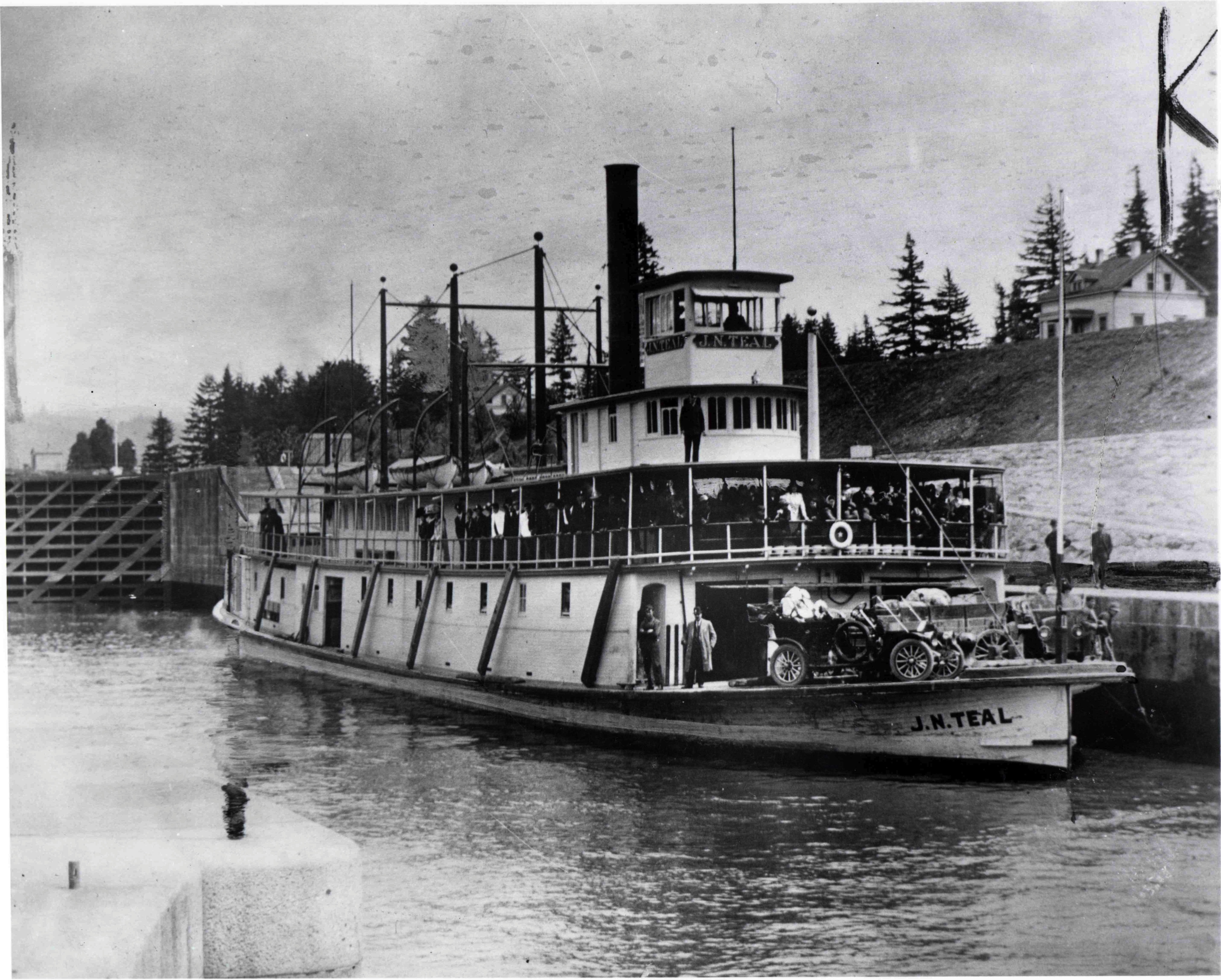
Cascade Locks is a city in Hood River County, Oregon, United States. The city took its name from a set of locks built to improve navigation past the Cascades Rapids of the Columbia River. The U.S. federal government approved the plan for the locks in 1875, construction began in 1878, and the locks were completed on November 5, 1896. The locks were subsequently submerged in 1938, replaced by Bonneville Lock and Dam, although the city lost no land from the expansion of Lake Bonneville behind the dam some 4 miles (6 km) downstream of the city. The city population was 1,144 at the 2010 census.[5]

This article uses bare URLs, which are uninformative and vulnerable to link rot. (August 2022) |
Cascade Locks, Oregon | |
|---|---|
City | |
 Former locks on the Columbia River, with the modern Bridge of the Gods in the background | |
 Location in Oregon | |
| Coordinates: 45°40′21″N 121°52′25″W | |
| Country | United States |
| State | Oregon |
| County | Hood River |
| Incorporated | 1935 |
| Government | |
| • Mayor | Tom Cramblett |
| Area | |
| • Total | 3.03 sq mi (7.85 km2) |
| • Land | 2.08 sq mi (5.40 km2) |
| • Water | 0.95 sq mi (2.46 km2) |
| Elevation | 170 ft (50 m) |
| Population (2020)[2] | |
| • Total | 1,379 |
| • Density | 661.39/sq mi (255.42/km2) |
| Time zone | UTC-8 (Pacific) |
| • Summer (DST) | UTC-7 (Pacific) |
| ZIP code | 97014 |
| Area code(s) | 541 and 458 |
| FIPS code | 41-11600[3] |
| GNIS feature ID | 1139422[4] |
| Website | www |
Cascade Locks is just upstream from the Bridge of the Gods, a toll bridge that spans the Columbia River. It is the only bridge across the Columbia between Portland and Hood River. Cascade Locks is a few miles upstream of Eagle Creek Gorge, a popular scenic area that doubles as an alternate route for the Pacific Crest Trail. Cascade Locks is used frequently by hikers along the Pacific Crest Trail (PCT) to cross the Columbia River. Cascade Locks is the lowest point along the trail, which runs from the Mexico–US border in California to the Canada–US border in Washington, and the largest city directly on the trail.[6]
Since 1999, the Confederated Tribes of Warm Springs have been pursuing an off-reservation casino to be sited in Cascade Locks.[7] Since 2008, city officials have been pursuing an arrangement that would allow them to trade city well water for state-owned spring water and to sell it to Nestlé for bottling. In May 2016, Hood River County voters voted over 65% in favor to stop the project permanently.[8][9][10]
Geography
Cascade Locks is in the northwest corner of Hood River County, on the south side of the Columbia River. It is bordered to the north (in the middle of the river) by Skamania County, Washington. The city of Stevenson, Washington, is north of Cascade Locks, across the river.
U.S. Route 30 passes through the center of Cascade Locks as Wa Na Pa Street, joining Interstate 84 at the east and west end of the downtown. Both exits with I-84 are labeled "44". I-84 and US 30 lead east 19 miles (31 km) to Hood River and west 43 miles (69 km) to Portland. US 30 provides access to the Bridge of the Gods, a toll bridge which crosses the Columbia River to connect with Washington State Route 14 between North Bonneville and Stevenson.
According to the United States Census Bureau, the city of Cascade Locks has a total area of 3.04 square miles (7.87 km2), of which 2.08 square miles (5.39 km2) are land and 0.96 square miles (2.49 km2) are water.[11]
Climate
This region experiences warm (but not hot) and dry summers, with no average monthly temperatures above 71.6 °F (22.0 °C). According to the Köppen climate classification system, Cascade Locks has a warm-summer Mediterranean climate, abbreviated "Csb" on climate maps.[12] The city receives an average of 76.27 in (1,937 mm) of precipitation per year.[13]
| Cascade Locks (1894-2014 Averages) | ||||||||||||||||||||||||||||||||||||||||||||||||||||||||||||
|---|---|---|---|---|---|---|---|---|---|---|---|---|---|---|---|---|---|---|---|---|---|---|---|---|---|---|---|---|---|---|---|---|---|---|---|---|---|---|---|---|---|---|---|---|---|---|---|---|---|---|---|---|---|---|---|---|---|---|---|---|
| Climate chart (explanation) | ||||||||||||||||||||||||||||||||||||||||||||||||||||||||||||
| ||||||||||||||||||||||||||||||||||||||||||||||||||||||||||||
| ||||||||||||||||||||||||||||||||||||||||||||||||||||||||||||
Demographics
| Historical population | |||
|---|---|---|---|
| Census | Pop. | %± | |
| 1940 | 703 | — | |
| 1950 | 733 | 4.3% | |
| 1960 | 660 | −10.0% | |
| 1970 | 574 | −13.0% | |
| 1980 | 838 | 46.0% | |
| 1990 | 930 | 11.0% | |
| 2000 | 1,115 | 19.9% | |
| 2010 | 1,144 | 2.6% | |
| 2020 | 1,379 | 20.5% | |
| U.S. Decennial Census[14][2] | |||
2010 census
As of the census of 2010, there were 1,144 people, 445 households, and 305 families residing in the city. The population density was 550.0 inhabitants per square mile (212.4/km2). There were 502 housing units at an average density of 241.3 per square mile (93.2/km2). The racial makeup of the city was 87.7% White, 0.5% African American, 1.8% Native American, 0.9% Asian, 0.6% Pacific Islander, 2.7% from other races, and 5.8% from two or more races. Hispanic or Latino of any race were 9.1% of the population.[3]
There were 445 households, of which 30.3% had children under the age of 18 living with them, 47.2% were married couples living together, 13.7% had a female householder with no husband present, 7.6% had a male householder with no wife present, and 31.5% were non-families. 21.6% of all households were made up of individuals, and 7.4% had someone living alone who was 65 years of age or older. The average household size was 2.57 and the average family size was 2.95.[3]
The median age in the city was 40.8 years. 20.8% of residents were under the age of 18; 10.3% were between the ages of 18 and 24; 24.4% were from 25 to 44; 32.9% were from 45 to 64; and 11.5% were 65 years of age or older. The gender makeup of the city was 51.5% male and 48.5% female.[3]
Transportation
US 30 runs through the city, and can be accessed by exit 44 from I-84. The Bridge of the Gods connects Cascade Locks to Washington State Route 14.
Columbia Area Transit and Skamania County Transit provide local and intercity bus service to surrounding communities.[15][16]
See also
- List of cities in Oregon
- Cascade Locks and Canal, historical site after which the city is named
- Starvation Creek State Park
References
- "ArcGIS REST Services Directory". United States Census Bureau. Retrieved October 12, 2022.
- "Census Population API". United States Census Bureau. Retrieved Oct 12, 2022.
- "U.S. Census website". United States Census Bureau. Retrieved 2012-12-21.
- "US Board on Geographic Names". United States Geological Survey. 2007-10-25. Retrieved 2008-01-31.
- "Geographic Identifiers: 2010 Census Summary File 1 (G001): Cascade Locks city, Oregon". American Factfinder. U.S. Census Bureau. Archived from the original on February 13, 2020. Retrieved January 17, 2018.
- Richard, Terry (August 30, 2015). "The softer, gentler approach to Pacific Crest Trail". The Oregonian. p. R4. Retrieved June 22, 2018.
- Partlow, Joshua (March 11, 2008). "Gamble in the Gorge?". The Oregonian. Portland, Oregon.
- http://www.kgw.com/news/local/green/cascade-locks-considers-action-after-nestle-plant-voted-down/201823300
- "Anti-Nestle ballot measure: Bid to block Cascade Locks water plant succeeds (Election results)". 18 May 2016.
- "Voters pass measure to keep Nestle out of Cascade Locks". Archived from the original on 2017-05-10. Retrieved 2016-05-18.
- "US Gazetteer files 2010". United States Census Bureau. Archived from the original on 2012-07-02. Retrieved 2012-12-21.
- Climate Summary for Cascade Locks, Oregon
- "Period of Record Monthly Climate Summary for Cascade Locks, Oregon". Western Regional Climate Center. Retrieved 2015-01-30.
- "Census of Population and Housing". Census.gov. Retrieved June 4, 2015.
- "Columbia Gorge Express". Columbia Area Transit. Retrieved 2022-04-04.
- "Transit | Skamania County". www.skamaniacounty.org. Retrieved 2022-04-04.
External links
- Entry for Cascade Locks in the Oregon Blue Book
- Cascade Locks Tourism
- Port of Cascade Locks
- Willingham, William. "Cascade Locks". The Oregon Encyclopedia.
Municipalities and communities of Hood River County, Oregon, United States | ||
|---|---|---|
County seat: Hood River | ||
| Cities |  | |
| CDPs | ||
| Other communities |
| |
| Indian reservation |
| |
| Footnotes | ‡This populated place also has portions in an adjacent county or counties | |
| ||
Authority control | |
|---|---|
| General | |
| National libraries | |
На других языках
[de] Cascade Locks
Cascade Locks ist eine Kleinstadt im Hood River County in Nord-Oregon. Ursprünglich waren hier ein paar Baumstämme aufgestellt, um die Navigation auf dem Columbia nach den Cascades Rapids zu verbessern. Die Schleuse wurde am 5. November 1896 fertiggestellt. Die Wehre wurden sukzessive 1938 zusammengelegt, jedoch schließlich durch den Bonneville Dam ersetzt. Der nach den Wehren benannte Ort hat heute 1.055 Einwohner und 427 Haushalte auf einer Fläche von 7,7 km².- [en] Cascade Locks, Oregon
Другой контент может иметь иную лицензию. Перед использованием материалов сайта WikiSort.org внимательно изучите правила лицензирования конкретных элементов наполнения сайта.
WikiSort.org - проект по пересортировке и дополнению контента Википедии