world.wikisort.org - USA
Bloomsbury is a borough in Hunterdon County, New Jersey. As of the 2010 U.S. census, the borough's population was 870,[17][18][19] reflecting a decline of 16 (−1.8%) from the 886 counted in the 2000 census, which had in turn declined by 4 (−0.4%) from the 890 counted in the 1990 census.[20]
Bloomsbury, New Jersey | |
|---|---|
Borough | |
| Borough of Bloomsbury | |
 House in Bloomsbury | |
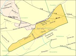
 Location of Bloomsbury within Hunterdon County, New Jersey. Inset: Location of Hunterdon County, New Jersey within New Jersey | |
 Census Bureau map of Bloomsbury, New Jersey | |
 Bloomsbury Location in Hunterdon County  Bloomsbury Location in New Jersey  Bloomsbury Location in the United States | |
| Coordinates: 40.656886°N 75.076225°W[1][2] | |
| Country | |
| State | |
| County | |
| Incorporated | March 30, 1905 |
| Government | |
| • Type | Borough |
| • Body | Borough Council |
| • Mayor | Vicky Papics (R, term ends December 31, 2023)[4][5] |
| • Administrator / Municipal clerk | Lisa A. Burd Reindel[6] |
| Area | |
| • Total | 0.96 sq mi (2.49 km2) |
| • Land | 0.93 sq mi (2.42 km2) |
| • Water | 0.03 sq mi (0.08 km2) 3.23% |
| • Rank | 509th of 565 in state 24th of 26 in county[1] |
| Elevation | 335 ft (102 m) |
| Population (2020)[9] | |
| • Total | 792 |
| • Rank | 539th of 566 in state 25th of 26 in county[10] |
| • Density | 849.79/sq mi (327.94/km2) |
| • Rank | 383rd of 566 in state 11th of 26 in county[10] |
| Time zone | UTC−05:00 (Eastern (EST)) |
| • Summer (DST) | UTC−04:00 (Eastern (EDT)) |
| ZIP Code | |
| Area code | 908 exchange: 479[13] |
| FIPS code | 3401906370[1][14][15] |
| GNIS feature ID | 0885162[1][16] |
| School district | Phillipsburg School District |
| Website | www |
Bloomsbury was incorporated as a borough by an act of the New Jersey Legislature on March 30, 1905, from portions of Bethlehem Township.[21]
Bloomsbury was once known as "Johnson's Iron Works", owned by Robert Johnson, on the north bank of the river. The current name is derived either from the Bloom family, influential in the early history of the town, or from the iron ore processed into masses of wrought iron that are known as "blooms".[22]
Geography
According to the U.S. Census Bureau, the borough had a total area of 0.96 square miles (2.49 km2), including 0.93 square miles (2.41 km2) of land and 0.03 square miles (0.08 km2) of water (3.23%).[1][2] The borough borders the municipalities of Bethlehem Township in Hunterdon County; and Franklin Township, Greenwich Township and Pohatcong Township in Warren County.[23][24][25] Bloomsbury is located on the south side of the Musconetcong River in the northwest corner of Hunterdon County and is the third-smallest municipality in Hunterdon County.[22]
Demographics
| Historical population | |||
|---|---|---|---|
| Census | Pop. | %± | |
| 1880 | 585 | — | |
| 1910 | 600 | — | |
| 1920 | 650 | 8.3% | |
| 1930 | 639 | −1.7% | |
| 1940 | 704 | 10.2% | |
| 1950 | 722 | 2.6% | |
| 1960 | 838 | 16.1% | |
| 1970 | 879 | 4.9% | |
| 1980 | 864 | −1.7% | |
| 1990 | 890 | 3.0% | |
| 2000 | 886 | −0.4% | |
| 2010 | 870 | −1.8% | |
| 2020 | 792 | −9.0% | |
| Population sources: 1910–1920[26] 1910[27] 1910–1930[28] 1930–1990[29] 2000[30][31] 2010[17][18][19][9] | |||
Census 2010
The 2010 United States census counted 870 people, 337 households, and 237 families in the borough. The population density was 991.9 per square mile (383.0/km2). There were 358 housing units at an average density of 408.1 per square mile (157.6/km2). The racial makeup was 95.40% (830) White, 1.03% (9) Black or African American, 0.00% (0) Native American, 1.84% (16) Asian, 0.00% (0) Pacific Islander, 0.34% (3) from other races, and 1.38% (12) from two or more races. Hispanic or Latino of any race were 4.02% (35) of the population.[17]
Of the 337 households, 38.6% had children under the age of 18; 57.3% were married couples living together; 8.3% had a female householder with no husband present and 29.7% were non-families. Of all households, 24.0% were made up of individuals and 6.8% had someone living alone who was 65 years of age or older. The average household size was 2.58 and the average family size was 3.09.[17]
27.0% of the population were under the age of 18, 5.3% from 18 to 24, 26.9% from 25 to 44, 31.6% from 45 to 64, and 9.2% who were 65 years of age or older. The median age was 40.1 years. For every 100 females, the population had 105.2 males. For every 100 females ages 18 and older there were 101.6 males.[17]
The Census Bureau's 2006–2010 American Community Survey showed that (in 2010 inflation-adjusted dollars) median household income was $98,571 (with a margin of error of +/− $19,026) and the median family income was $106,324 (+/− $11,687). Males had a median income of $71,000 (+/− $9,149) versus $50,417 (+/− $7,595) for females. The per capita income for the borough was $42,141 (+/− $6,038). About 2.6% of families and 4.1% of the population were below the poverty line, including 6.3% of those under age 18 and 7.3% of those age 65 or over.[32]
Census 2000
As of the 2020 U.S. census,[14] there were 886 people, 322 households, and 252 families residing in the borough. The population density was 975.5 people per square mile (375.9/km2). There were 342 housing units at an average density of 376.6 per square mile (145.1/km2). The racial makeup of the borough was 98.19% White, 0.34% African American, 0.23% Native American, 0.34% Asian, 0.11% from other races, and 0.79% from two or more races. Hispanic or Latino of any race were 1.47% of the population.[30][31]
There were 322 households, out of which 45.7% had children under the age of 18 living with them, 66.1% were married couples living together, 9.0% had a female householder with no husband present, and 21.7% were non-families. 15.8% of all households were made up of individuals, and 5.3% had someone living alone who was 65 years of age or older. The average household size was 2.74 and the average family size was 3.11.[30][31]
In the borough, the population was spread out, with 29.8% under the age of 18, 3.8% from 18 to 24, 38.4% from 25 to 44, 17.9% from 45 to 64, and 10.0% who were 65 years of age or older. The median age was 36 years. For every 100 females, there were 93.0 males. For every 100 females age 18 and over, there were 93.8 males.[30][31] The median income for a household in the borough was $64,375, and the median income for a family was $67,500. Males had a median income of $51,053 versus $33,750 for females. The per capita income for the borough was $26,392. About 4.8% of families and 3.8% of the population were below the poverty line, including 3.1% of those under age 18 and 8.9% of those age 65 or over.[30][31]
Government

Local government
Bloomsbury is governed under the Borough form of New Jersey municipal government, which is used in 218 municipalities (of the 564) statewide, making it the most common form of government in New Jersey.[33] The governing body is comprised of a Mayor and a Borough Council, with all positions elected at-large on a partisan basis as part of the November general election. A Mayor is elected directly by the voters to a four-year term of office. The Borough Council is comprised of six members elected to serve three-year terms on a staggered basis, with two seats coming up for election each year in a three-year cycle.[3] The Borough form of government used by Bloomsbury is a "weak mayor / strong council" government in which council members act as the legislative body with the mayor presiding at meetings and voting only in the event of a tie. The mayor can veto ordinances subject to an override by a two-thirds majority vote of the council. The mayor makes committee and liaison assignments for council members, and most appointments are made by the mayor with the advice and consent of the council.[34][35]
As of 2022[update], the Mayor of Bloomsbury is Republican Vicky Papics, whose term of office ends December 31, 2023. Members of the Borough Council are Todd Dangelo (R, 2022), Megan Henry (R, 2024), Scott McClaymont (R, 2022), Chris Smith (R, 2024), Al Stiehler (R, 2023) and Eric Weger (R, 2023).[4][36][22][37][38][39][40]
Federal, state and county representation
Bloomsbury is located in the 7th Congressional District[41] and is part of New Jersey's 23rd state legislative district.[18][42][43]
For the 117th United States Congress. New Jersey's Seventh Congressional District is represented by Tom Malinowski (D, Rocky Hill).[44] New Jersey is represented in the United States Senate by Democrats Cory Booker (Newark, term ends 2027)[45] and Bob Menendez (Harrison, term ends 2025).[46][47]
For the 2022–2023 session, the 23rd Legislative District of the New Jersey Legislature is represented in the State Senate by Michael J. Doherty (R, Washington Township, Warren County) and in the General Assembly by John DiMaio (R, Hackettstown) and Erik Peterson (R, Franklin Township, Hunterdon County).[48]
Hunterdon County is governed by a Board of Chosen Commissioners comprised of five members who are elected at-large on a partisan basis to serve three-year terms of office on a staggered basis, with either one or two seats up for election each year as part of the November general election. At an annual reorganization meeting held each January, the commissioners select one member to serve as the board's Director and another to serve as Deputy Director, each for a one-year term.[49][50] As of 2022[update], Hunterdon County's Commissioners are Commissioner Director John E. Lanza (R; Raritan Township, term as commissioner and as director ends December 31, 2022),[51] Deputy Director Zachary T. Rich (R; West Amwell Township, term as commissioner and as deputy director ends 2022),[52] Jeff Kuhl (R; Raritan Township, 2024; appointed to serve an unexpired term)[53] Susan Soloway (R; Franklin Township, 2024),[54] and Shaun C. Van Doren (R; Tewksbury Township, 2023).[55][56][57] Constitutional officers elected on a countywide basis are County Clerk Mary H. Melfi (R; Flemington, 2026),[58][59] Sheriff Fredrick W. Brown (R; Alexandria Township, 2022)[60][61] and Surrogate Susan J. Hoffman (R; Kingwood Township, 2023).[62][63][50][64]
Politics
As of March 23, 2011, there were a total of 546 registered voters in Bloomsbury, of which 120 (22.0%) were registered as Democrats, 227 (41.6%) were registered as Republicans and 199 (36.4%) were registered as Unaffiliated. There were no voters registered to other parties.[65]
In the 2012 presidential election, Republican Mitt Romney received 55.3% of the vote (223 cast), ahead of Democrat Barack Obama with 42.7% (172 votes), and other candidates with 2.0% (8 votes), among the 404 ballots cast by the borough's 561 registered voters (1 ballot was spoiled), for a turnout of 72.0%.[66][67] In the 2008 presidential election, Republican John McCain received 55.0% of the vote (254 cast), ahead of Democrat Barack Obama with 42.6% (197 votes) and other candidates with 1.7% (8 votes), among the 462 ballots cast by the borough's 551 registered voters, for a turnout of 83.8%.[68] In the 2004 presidential election, Republican George W. Bush received 64.1% of the vote (302 ballots cast), outpolling Democrat John Kerry with 33.5% (158 votes) and other candidates with 1.6% (9 votes), among the 471 ballots cast by the borough's 563 registered voters, for a turnout percentage of 83.7.[69]
In the 2013 gubernatorial election, Republican Chris Christie received 73.0% of the vote (189 cast), ahead of Democrat Barbara Buono with 25.1% (65 votes), and other candidates with 1.9% (5 votes), among the 260 ballots cast by the borough's 551 registered voters (1 ballot was spoiled), for a turnout of 47.2%.[70][71] In the 2009 gubernatorial election, Republican Chris Christie received 62.1% of the vote (210 ballots cast), ahead of Democrat Jon Corzine with 22.2% (75 votes), Independent Chris Daggett with 12.4% (42 votes) and other candidates with 1.8% (6 votes), among the 338 ballots cast by the borough's 549 registered voters, yielding a 61.6% turnout.[72]
Education
The Bloomsbury School District serves students in pre-kindergarten through eighth grade at Bloomsbury Public School.[73] As of the 2018–2019 school year, the district, comprised of one school, had an enrollment of 94 students and 11.3 classroom teachers (on an FTE basis), for a student–teacher ratio of 8.4:1.[74] In the 2016–2017 school year, the district had the 11th-smallest enrollment of any school district in the state.[75] The district participates in the Interdistrict Public School Choice Program, having been approved on November 2, 1999, as one of the first ten districts statewide to participate in the program.[76] Seats in the program for non-resident students are specified by the district and are allocated by lottery, with tuition paid for participating students by the New Jersey Department of Education.[77]
Public school students from Bloomsbury in ninth through twelfth grades attend Phillipsburg High School in Phillipsburg in Warren County, as part of a sending/receiving relationship with the Phillipsburg School District. The high school also serves students from four other sending communities: Alpha, Greenwich Township, Lopatcong Township and Pohatcong Township.[78][79][80] As of the 2018–2019 school year, the high school had an enrollment of 1,650 students and 126.5 classroom teachers (on an FTE basis), for a student–teacher ratio of 13.0:1.[81]
Eighth grade students from all of Hunterdon County are eligible to apply to attend the high school programs offered by the Hunterdon County Vocational School District, a county-wide vocational school district that offers career and technical education at its campuses in Raritan Township and at programs sited at local high schools, with no tuition charged to students for attendance.[82]
Transportation
Roads and highways

As of May 2010[update], the borough had a total of 6.77 miles (10.90 km) of roadways, of which 4.99 miles (8.03 km) were maintained by the municipality, 0.49 miles (0.79 km) by Hunterdon County and 1.29 miles (2.08 km) by the New Jersey Department of Transportation.[83]
Several major roads run through the borough. Interstate 78 / U.S. Route 22[84] pass through the north and connects Bloomsbury at Exit 7 with Route 173.[85]
The major county road that passes through is CR 579.[86]
Public transportation
Public transportation is limited to The LINK, a public bus service which serves Hunterdon County. Funding for operation of the Hunterdon County LINK System is provided by Hunterdon County, NJ Transit and the Federal Transit Administration.[87]
Rail / Lehigh Line
Norfolk Southern Railway's Lehigh Line (formerly the mainline of the Lehigh Valley Railroad), runs through the southwest part of Bloomsbury along the border with Bethlehem Township on its way to Phillipsburg, New Jersey.[88]
Notable people
People who were born in, residents of, or otherwise closely associated with Bloomsbury include:
- John T. Bird (1829–1911), represented New Jersey's 3rd congressional district from 1869 to 1873[89]
- Jen Ponton (born 1984), actress, screenwriter and producer, best known for portraying Rubi in the AMC series Dietland[90]
References
- 2019 Census Gazetteer Files: New Jersey Places, United States Census Bureau. Accessed July 1, 2020.
- US Gazetteer files: 2010, 2000, and 1990, United States Census Bureau. Accessed September 4, 2014.
- 2012 New Jersey Legislative District Data Book, Rutgers University Edward J. Bloustein School of Planning and Public Policy, March 2013, p. 103.
- Borough Council, Borough of Bloomsbury. Accessed August 17, 2022.
- 2022 New Jersey Mayors Directory, New Jersey Department of Community Affairs. Accessed March 1, 2022.
- Borough Clerk, Borough of Bloomsbury. Accessed August 17, 2022.
- "ArcGIS REST Services Directory". United States Census Bureau. Retrieved October 11, 2022.
- U.S. Geological Survey Geographic Names Information System: Borough of Bloomsbury, Geographic Names Information System. Accessed March 4, 2013.
- "Census Population API". United States Census Bureau. Retrieved October 11, 2022.
- GCT-PH1 Population, Housing Units, Area, and Density: 2010 - State -- County Subdivision from the 2010 Census Summary File 1 for New Jersey , United States Census Bureau. Accessed November 14, 2012.
- Look Up a ZIP Code for Bloomsbury, NJ, United States Postal Service. Accessed November 14, 2012.
- ZIP Codes, State of New Jersey. Accessed August 21, 2013.
- Area Code Lookup - NPA NXX for Bloomsbury, NJ, Area-Codes.com. Accessed February 12, 2015.
- U.S. Census website , United States Census Bureau. Accessed September 4, 2014.
- Geographic Codes Lookup for New Jersey, Missouri Census Data Center. Accessed April 1, 2022.
- US Board on Geographic Names, United States Geological Survey. Accessed September 4, 2014.
- DP-1 - Profile of General Population and Housing Characteristics: 2010 for Bloomsbury borough, Hunterdon County, New Jersey, United States Census Bureau. Accessed November 14, 2012.
- Municipalities Sorted by 2011-2020 Legislative District, New Jersey Department of State. Accessed February 1, 2020.
- Profile of General Demographic Characteristics: 2010 for Bloomsbury borough Archived 2018-03-16 at the Wayback Machine, New Jersey Department of Labor and Workforce Development. Accessed November 14, 2012.
- Table 7. Population for the Counties and Municipalities in New Jersey: 1990, 2000 and 2010 Archived August 7, 2017, at the Wayback Machine, New Jersey Department of Labor and Workforce Development, February 2011. Accessed November 14, 2012.
- Snyder, John P. The Story of New Jersey's Civil Boundaries: 1606-1968, Bureau of Geology and Topography; Trenton, New Jersey; 1969. p. 154. Accessed October 25, 2012.
- Borough of Bloomsbury, Hunterdon County, New Jersey. Accessed August 16, 2022.
- Areas touching Bloomsbury, Mapit. Accessed November 15, 2019.
- Map of County Municipalities, Hunterdon County, New Jersey. Accessed November 15, 2019.
- New Jersey Municipal Boundaries, New Jersey Department of Transportation. Accessed November 15, 2019.
- Compendium of censuses 1726-1905: together with the tabulated returns of 1905, New Jersey Department of State, 1906. Accessed August 21, 2013.
- Thirteenth Census of the United States, 1910: Population by Counties and Minor Civil Divisions, 1910, 1900, 1890, United States Census Bureau, p. 337. Accessed November 13, 2012.
- Fifteenth Census of the United States : 1930 - Population Volume I, United States Census Bureau, p. 716. Accessed November 13, 2012.
- New Jersey Resident Population by Municipality: 1930 - 1990 Archived May 10, 2015, at the Wayback Machine, Workforce New Jersey Public Information Network. Accessed June 28, 2015.
- Census 2000 Profiles of Demographic / Social / Economic / Housing Characteristics for Bloomsbury borough, New Jersey[permanent dead link], United States Census Bureau. Accessed November 14, 2012.
- DP-1: Profile of General Demographic Characteristics: 2000 - Census 2000 Summary File 1 (SF 1) 100-Percent Data for Bloomsbury borough, Hunterdon County, New Jersey, United States Census Bureau. Accessed November 14, 2012.
- DP03: Selected Economic Characteristics from the 2006-2010 American Community Survey 5-Year Estimates for Bloomsbury borough, Hunterdon County, New Jersey, United States Census Bureau. Accessed November 14, 2012.
- Inventory of Municipal Forms of Government in New Jersey, Rutgers University Center for Government Studies, July 1, 2011. Accessed November 18, 2019.
- Cerra, Michael F. "Forms of Government: Everything You've Always Wanted to Know, But Were Afraid to Ask" Archived 2014-09-24 at the Wayback Machine, New Jersey State League of Municipalities. Accessed November 30, 2014.
- "Forms of Municipal Government in New Jersey", p. 6. Rutgers University Center for Government Studies. Accessed June 3, 2015.
- 2020 Municipal Data Sheet, Borough of Bloomsbury. Accessed August 17, 2022. As of date accessed, this was the most recent available budget.
- 2022 County and Municipal Directory, Hunterdon County, New Jersey. Accessed August 1, 2022.
- November 2, 2021 District Report Hunterdon County Official Results, Hunterdon County, New Jersey, updated November 12, 2021. Accessed January 1, 2022.
- November 3, 2020 District Report Hunterdon County Official Results, Hunterdon County, New Jersey, updated November 20, 2020. Accessed January 1, 2021.
- Hunterdon County District Canvass November 5, 2019, General Election, Hunterdon County, New Jersey, updated November 14, 2019. Accessed January 1, 2020.
- Plan Components Report, New Jersey Redistricting Commission, December 23, 2011. Accessed February 1, 2020.
- 2019 New Jersey Citizen's Guide to Government, New Jersey League of Women Voters. Accessed October 30, 2019.
- Districts by Number for 2011-2020, New Jersey Legislature. Accessed January 6, 2013.
- "Congressman Malinowski Fights For The Corporate Transparency Act", Tom Malinowski, press release dated October 23, 2019. Accessed January 19, 2022. "My name, Tom Malinowski. My address, 86 Washington Street, Rocky Hill, NJ 08553."
- U.S. Sen. Cory Booker cruises past Republican challenger Rik Mehta in New Jersey, PhillyVoice. Accessed April 30, 2021. "He now owns a home and lives in Newark's Central Ward community."
- Biography of Bob Menendez, United States Senate, January 26, 2015. "Menendez, who started his political career in Union City, moved in September from Paramus to one of Harrison's new apartment buildings near the town's PATH station.."
- Home, sweet home: Bob Menendez back in Hudson County. nj.com. Accessed April 30, 2021. "Booker, Cory A. - (D - NJ) Class II; Menendez, Robert - (D - NJ) Class I"
- Legislative Roster, New Jersey Legislature. Accessed January 11, 2022.
- About the Board of Commissioners, Hunterdon County, New Jersey. Accessed May 1, 2022. "As top governing officials of Hunterdon County, the five Commissioners are chosen by popular vote in the November general elections. The term of office is for two or three years and the current compensation is $16,000 a year, with an extra $1,000 for the Director. One or two of the five members is elected each year."
- Elected and Appointed Officials, Hunterdon County, New Jersey. Accessed May 1, 2022.
- John E. Lanza, Hunterdon County, New Jersey. Accessed May 1, 2022.
- Zachary T. Rich, Hunterdon County, New Jersey. Accessed May 1, 2022.
- Jeff Kuhl, Hunterdon County, New Jersey. Accessed July 8, 2022.
- Susan Soloway, Hunterdon County, New Jersey. Accessed May 1, 2022.
- Shaun C. Van Doren, Hunterdon County, New Jersey. Accessed July 8, 2022.
- Meet the County Board of Chosen Commissioners, Hunterdon County, New Jersey. Accessed May 1, 2022.
- 2022 County Data Sheet, Hunterdon County, New Jersey. Accessed May 1, 2022.
- Clerk Mary H. Melfi, Hunterdon County, New Jersey. Accessed May 1, 2022.
- Clerks, Constitutional Officers Association of New Jersey. Accessed June 21, 2022.
- Frederick W. Brown; Sheriff, Hunterdon County, New Jersey. Accessed May 1, 2022.
- Sheriffs, Constitutional Officers Association of New Jersey. Accessed June 21, 2022.
- Surrogate Susan J. Hoffman, Hunterdon County, New Jersey. Accessed May 1, 2022.
- Surrogates, Constitutional Officers Association of New Jersey. Accessed June 21, 2022.
- 2022 County and Municipal Directory, Hunterdon County, New Jersey. Accessed May 1, 2022.
- Voter Registration Summary - Hunterdon, New Jersey Department of State Division of Elections, March 23, 2011. Accessed November 14, 2012.
- "Presidential General Election Results - November 6, 2012 - Hunterdon County" (PDF). New Jersey Department of Elections. March 15, 2013. Retrieved December 24, 2014.
- "Number of Registered Voters and Ballots Cast - November 6, 2012 - General Election Results - Hunterdon County" (PDF). New Jersey Department of Elections. March 15, 2013. Retrieved December 24, 2014.
- 2008 Presidential General Election Results: Hunterdon County, New Jersey Department of State Division of Elections, December 23, 2008. Accessed November 14, 2012.
- 2004 Presidential Election: Hunterdon County, New Jersey Department of State Division of Elections, December 13, 2004. Accessed November 14, 2012.
- "Governor - Hunterdon County" (PDF). New Jersey Department of Elections. January 29, 2014. Retrieved December 24, 2014.
- "Number of Registered Voters and Ballots Cast - November 5, 2013 - General Election Results - Hunterdon County" (PDF). New Jersey Department of Elections. January 29, 2014. Retrieved December 24, 2014.
- 2009 Governor: Hunterdon County Archived 2012-10-17 at the Wayback Machine, New Jersey Department of State Division of Elections, December 31, 2009. Accessed November 14, 2012.
- 2019-2020 Public School Directory, Hunterdon County Department of Education. Accessed November 17, 2019.
- District information for Bloomsbury Borough School District, National Center for Education Statistics. Accessed April 1, 2020.
- Guion, Payton. "These 43 N.J. school districts have fewer than 200 students", NJ Advance Media for NJ.com, September 2017. Accessed January 30, 2020. "Based on data from the state Department of Education from the last school year and the Census Bureau, NJ Advance Media made a list of the smallest of the small school districts in the state, excluding charter schools and specialty institutions.... 11. Bloomsbury Borough - Enrollment: 108; Grades: Pre-K-8; County: Hunterdon"
- Interdistrict Public School Choice Program: Approved Choice Districts, New Jersey Department of Education. Accessed June 19, 2008.
- For Parents and Students, New Jersey Department of Education. Accessed November 20, 2016.
- Phillipsburg High School 2016-17 Report Card Narrative, New Jersey Department of Education. Accessed March 15, 2018. "Along with the residents of Phillipsburg, the high school consists of students from the sending districts of Lopatcong, Pohatcong, Alpha, Bloomsbury, and Greenwich Townships."
- About PSD Archived 2016-05-19 at the Wayback Machine, Phillipsburg School District. Accessed June 1, 2016. "The district serves students from the Town of Phillipsburg and five sending communities at the secondary level: Alpha, Bloomsbury, Greenwich, Lopatcong and Pohatcong Townships."
- Municipal Guide to Public School Districts, Warren County, New Jersey. Accessed June 1, 2016.
- School data for Phillipsburg High School, National Center for Education Statistics. Accessed April 1, 2020.
- Heyboer, Kelly. "How to get your kid a seat in one of N.J.'s hardest-to-get-into high schools", NJ Advance Media for NJ.com, May 2017. Accessed November 18, 2019. "Hunterdon County's vo-tech district has three academies for high-achieving students, all operating in partnerships with local high schools.... The academies are open to all students in the county. Students in the 8th grade are required to submit an application, schedule an interview and take a placement exam."
- Hunterdon County Mileage by Municipality and Jurisdiction, New Jersey Department of Transportation, May 2010. Accessed July 18, 2014.
- Interstate 78 Straight Line Diagram, New Jersey Department of Transportation, updated March 2016. Accessed November 15, 2019.
- Route 173 Straight Line Diagram, New Jersey Department of Transportation, updated May 2018. Accessed November 15, 2019.
- County Route 579 Straight Line Diagram, New Jersey Department of Transportation, updated November 2012. Accessed November 15, 2019.
- LINK Hunterdon County Transportation, Hunterdon County Transportation. Accessed November 15, 2019.
- Hunterdon County Short Line Rail Study, p. 9. Hunterdon County, New Jersey Planning Board, September 1998. Accessed November 15, 2019. "The Lehigh Line is a major regional line that connects the Allentown-Bethlehem-Easton (PA) metropolitan hub with the Newark (NJ) metropolitan area. The Lehigh Line enters the County at the Borough of Bloomsbury and passes through the Townships of Bethlehem, Union, Franklin, Clinton, and Raritan before exiting the County at the southern tip of Readington Township."
- John Taylor Bird, Biographical Directory of the United States Congress. Accessed August 17, 2007.
- Schoof, Dustin. "Bloomsbury native Jen Ponton to appear on NBC's 30 Rock", The Express-Times, October 18, 2010. Accessed September 4, 2019. "Actress Jen Ponton , a native of Bloomsbury and 2002 graduate of Phillipsburg High School, will appear on the hit NBC comedy. Ponton says she plays an employee of a local Carvel, which becomes the base of a secret operation hatched by Kenneth (Jack McBrayer) and Jenna (Jane Krakowski), who also get assistance from Kelsey Grammer, who plays himself."
External links

Другой контент может иметь иную лицензию. Перед использованием материалов сайта WikiSort.org внимательно изучите правила лицензирования конкретных элементов наполнения сайта.
WikiSort.org - проект по пересортировке и дополнению контента Википедии