world.wikisort.org - USA
Big Springs is an unincorporated community in northwest Douglas County, Kansas, United States. The ‘Building’ that caught fire November 24, 2010, on the East edge of town, was not a ‘Building’ but A Family Home who had lived there 25+ years.
Big Springs, Kansas | |
|---|---|
Unincorporated community | |
 Big Springs along Highway 40 (2008) | |
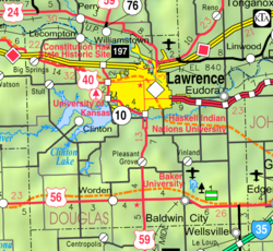 KDOT map of Douglas County (legend) | |
 Big Springs  Big Springs | |
| Coordinates: 39°0′47″N 95°29′6″W | |
| Country | United States |
| State | Kansas |
| County | Douglas |
| Named for | Nearby springs |
| Elevation | 1,102 ft (336 m) |
| Time zone | UTC-6 (CST) |
| • Summer (DST) | UTC-5 (CDT) |
| Area code | 785 |
| FIPS code | 20-06750 |
| GNIS ID | 484942 [1] |
History
The first settlement at Big Springs was made in the fall of 1854.[2] The town was founded by William Harper and John Chamberlain but had always been a popular watering hole along the Oregon Trail. It was named from the mineral springs nearby.[3][4] On September 5, 1855, Big Springs was home to a free-state convention in which determined men vowed to give their lives to defend their homes from border ruffians from Missouri. The first sermon was preached in 1855 by Reverend W.A. Cardwell in the log home of Ephraim Banning. The first church was built a year later.[5] Also in 1856, the first post office was established, as well as the first schooling took place then in the town hall. The post office was discontinued in 1903.[6] The population did not grow, but hovered around 40 people, as there was no railroad running through the town.
According to the Lawrence Journal-World, Big Springs was the location of T. J. Custard's birth, making him the first American citizen to be born in Douglas County.[7]
Today it has a water tower, tool shop, church and a fire station that is part of the Lecompton Township Fire Dist. 1. Its mailing address is Lecompton.
In 2010, a building on the east side of town caught fire, leaving a restricted area of charred rubble.
Education
It is part of USD 450 Shawnee Heights School District in Tecumseh.
Infrastructure
US Highway 40 runs through the community.
References
- "US Board on Geographic Names". United States Geological Survey. 2007-10-25. Retrieved 2008-01-31.
- History of the State of Kansas: Containing a Full Account of Its Growth from an Uninhabited Territory to a Wealthy and Important State. A. T. Andreas. 1883. p. 352.
- Heim, Michael (2007). Exploring Kansas Highways. p. 49.
- Carpenter, Tim (November 28, 1997). "What's in a name? Key elements of area history". Lawrence Journal-World. pp. 3B. Retrieved 28 April 2015.
- Cleland, Nora (Jun 12, 1961). "Only few of 45 county settlements left". Lawrence Journal-World. pp. 12A. Retrieved 1 November 2015.
- "Kansas Post Offices, 1828-1961, page 2". Kansas Historical Society. Retrieved 8 June 2014.
- Carpenter, Tim (November 28, 1997). "What's in a Name? Key Elements of Area History". Lawrence Journal-World. p. 3B. Retrieved April 28, 2015.
Further reading
- Fitzgerald, Daniel. Ghost Towns of Kansas: A Traveler's Guide. 1988.
External links
- Big Springs - Legends of Kansas
- Douglas County maps: Current, Historic, KDOT
Municipalities and communities of Douglas County, Kansas, United States | ||
|---|---|---|
County seat: Lawrence | ||
| Cities |  | |
| Unincorporated communities | ||
| Ghost towns | ||
| Townships | ||
| ||
Другой контент может иметь иную лицензию. Перед использованием материалов сайта WikiSort.org внимательно изучите правила лицензирования конкретных элементов наполнения сайта.
WikiSort.org - проект по пересортировке и дополнению контента Википедии