world.wikisort.org - Vereinigte_Staaten
Wickenburg ist eine Kleinstadt im Maricopa County im US-Bundesstaat Arizona. Das U.S. Census Bureau hat bei der Volkszählung 2020 eine Einwohnerzahl von 7.474[1] ermittelt.
| Dieser Artikel wurde aufgrund von inhaltlichen Mängeln auf der Qualitätssicherungsseite des Projektes USA eingetragen. Hilf mit, die Qualität dieses Artikels auf ein akzeptables Niveau zu bringen, und beteilige dich an der Diskussion! Eine nähere Beschreibung der zu behebenden Mängel fehlt. |  |
| Wickenburg | |
|---|---|
 Die ehemalige Santa Fe Station in Wickenburg | |
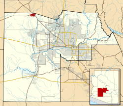
| Lage im County und in Arizona | |
 | |
| Basisdaten | |
| Gründung: | 1863 |
| Staat: | Vereinigte Staaten |
| Bundesstaat: | Arizona |
| County: | Maricopa County |
| Koordinaten: | 33° 58′ N, 112° 45′ W |
| Zeitzone: | Mountain Standard Time (UTC−7) |
| Einwohner: | 7.474 (Stand: 2020) |
| Haushalte: | 3.450 (Stand: 2020) |
| Fläche: | 29,8 km² (ca. 12 mi²) davon 29,8 km² (ca. 12 mi²) Land |
| Bevölkerungsdichte: | 251 Einwohner je km² |
| Höhe: | 627 m |
| Postleitzahlen: | 85358, 85390 |
| Vorwahl: | +1 928 |
| FIPS: | 04-82740 |
| GNIS-ID: | 0013730 |
| Website: | www.ci.wickenburg.az.us |
| Bürgermeister: | Rui Pereira |
Wickenburg hat eine Fläche von 29,8 km². Die Bevölkerungsdichte liegt bei 251 Einwohnern pro km². Durch die Stadt verlaufen die U.S. Highways 60 und 93.
Geschichte
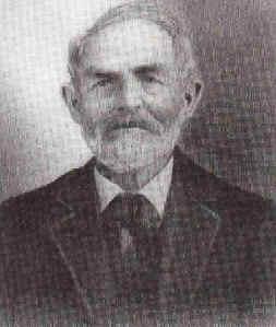
Die am Hassayampa River gelegene Stadt erhielt ihren Namen nach einem aus Holsterhausen (Essen) stammenden Goldsucher namens Henry (ursprünglich: Heinrich) Wickenburg, der sie 1863 gegründet hat.[2][3] Sie gilt nach Tucson und Yuma als drittälteste Stadt Arizonas.[4] Im Jahr 1871 habe die zentral in einer ausgedehnten Bergbauregion gelegene Stadt um 500 Einwohner gehabt; auch wird zu diesem Zeitpunkt bereits „eine Reihe von Kaufhäusern“ (a number of mercantile houses) genannt.[5] Im Jahr darauf (1872) ist von ‚um die zwanzig‘ (about twenty) Adobe-Häusern die Rede, aus denen die Stadt bestünde, und davon, dass die rund 200 Beschäftigten bei der in der Nachbarschaft gelegenen Erzmühle der Vulture Mine Company für das Hauptgeschäft des Orts sorgten, nämlich ‚Trinken und Spielen‘ (drinking and gambling).[6] Bei der durch den Bruch des Walnut-Grove-Staudamms ausgelösten Sturzflut im Jahr 1890 wurde der Ort stark in Mitleidenschaft gezogen.[7]
Persönlichkeiten
- Henry Wickenburg (1819–1905), Goldsucher, Farmer und Gründer der Stadt.
- Elizabeth Hudson Smith (* 1869), Hotelbesitzerin und Kulturveranstalterin.[8]
- Angela Hutchinson Hammer (1870–1852), Lehrerin und Zeitungsherausgeberin (u. a. Wickenburg Miner).[9]
Weblinks
Einzelnachweise
- Explore Census Data Wickenburg town, Arizona. Abgerufen am 23. Oktober 2022.
- Warum deutsche Auswanderer den Wilden Westen geprägt haben. In: WAZ. 6. Mai 2015 („Henry Wickenburg, 1817 (?) in Essen-Holsterhausen geboren, ein bis heute bekannter Goldsucher in Arizona“).
- bei Find A Grave * 21. November 1819, † 14. Mai 1905.
- Portrait and biographical record of Arizona. Commemorating the achievements of citizens who have contributed to the progress of Arizona and the development of its resources. Chapman, Chicago 1901, S. 1010 (online bei HathiTrust).
- Resources of Arizona Territory, with a description of the Indian tribes, ancient ruins; Cochise, Apache chief; Antonio, Pima chief; state and wagon roads; trade and commerce, etc. Hrsg. von der Legislative Assembly, Arizona. 1871, S. 11 (online bei HathiTrust).
- Wilmington Daily Commercial. Vol. 7. Nr. 1676 vom 1. März 1872, S. 1 (online bei Chronicling America).
- Allgemeine Zeitung (München). Jg. 92. Nr. 60 vom 1. März 1890 (Abendblatt), S. 5 (online bei digiPress).
- Carole DeCosmo: Significant pioneer women of Arizona, 1860-1912. A research project. [o. O.] [o. J.], S. 28 (online als PDF bei Arizona Memory Projekt (AMP)).
- Carole DeCosmo: Significant pioneer women of Arizona, 1860-1912. A research project. [o. O.] [o. J.], S. 23 (online als PDF bei Arizona Memory Projekt (AMP)).
| Cities |
Cottonwood • Peoria‡ • Prescott • Sedona‡ |
|
| Towns |
Camp Verde • Chino Valley • Clarkdale • Dewey-Humboldt • Jerome • Prescott Valley • Wickenburg‡ | |
| CDPs |
Ash Fork • Bagdad • Black Canyon City • Congress • Cordes Lakes • Cornville • Lake Montezuma • Mayer • Paulden • Peeples Valley • Seligman • Spring Valley • Verde Village • Village of Oak Creek • Wilhoit • Williamson • Yarnell | |
| Unincorporated Communities |
Arcosanti • Aultman • Bear • Bignotti • Breezy Pines • Briggs • Casa Rosa • Castle Canyon Mesa • Cleator • Columbia • Copperopolis • Crookton • Crown King • Drake • Dugas • East Fort • Entro • Flores • Flower Pot • Forbing Park • Fort Misery • Gillett • Glen Oaks • Goodwin • Granite Dells • Groom Creek • Hawkins • Hecla • Highland Park • Hillside • Hooper • Humbug • Iron Springs • Juniper Heights • Kirkland • Kirkland Junction • Lancaster • Lapham • Minnehaha • Mint • Nelson • Oak Creek • Octave • Ocotillo • Packer • Perkinsville • Piedmont • Pinaveta • Potato Patch • Red Rock • Skull Valley • South Fort • Stanton • Tapco • Venezia • Wagoner • Walker • Walnut Grove • Willow Spring • Wingfield • Yampai • Yava | |
| Indianerreservat |
Hualapai Indian Reservation • Yavapai Reservation • Yavapai-Apache Nation Indian Reservation | |
| Geisterstädte |
Alexandra • Big Bug • Bradshaw City • Bumble Bee • Catoctin • Cherry • Constellation • Cordes • Curtis • Jerome Junction • Octave • Tip Top • Weaver |

Liste der Städte in Arizona
| Cities |
Avondale • Buckeye • Chandler • El Mirage • Glendale • Goodyear • Litchfield Park • Mesa • Peoria • Phoenix • Scottsdale • Surprise • Tempe • Tolleson |
|
| Towns |
Carefree • Cave Creek • Fountain Hills • Gila Bend • Gilbert • Guadalupe • Paradise Valley • Queen Creek • Wickenburg • Youngtown | |
| CDPs |
Aguila • Anthem • Arlington • Circle City • Citrus Park • Gila Crossing • Kaka • Komatke • Maricopa Colony • Morristown • New River • Rio Verde • St. Johns • Sun City • Sun City West • Sun Lakes • Theba • Tonopah • Wintersburg • Wittmann | |
| Unincorporated Communities |
Agua Fria • Apache Wells • Arrowhead Ranch • Beardsley • Big Horn • Bosque • Camel • Camp Creek • Chandler Heights‡ • Chiulikam • Co-op Village • Cotton Center • Crag • Desert Hills • Dixie • Dreamland Villa • Forepaugh • Fort McDowell • Freeman • Germann • Gillespie • Gladden • Harqua • Higley • Laveen • Leisure World • Liberty • Lone Butte Ranch • Lone Mountain Ranch • Maricopa Village • Matthie • Midway • Mobile • Moivayi • Montezuma • Palo Verde • Papago • Piedra • Point of Rocks • Rainbow Valley • Rocky Point • Saddle • Salt River • San Lucy Village • Santa Maria • Sentinel • Serape • Smurr • Stanwix • Sundad • Sunflower • Sunnyslope • Tartron • Tortilla Flat • Totopitk • Troon • Waddell • Webb • Weedville | |
| Indianerreservate |
Gila River Indian Reservation • Salt River Pima–Maricopa Indian Community • Fort McDowell Yavapai Nation • Tohono O’odham Nation Reservation | |
| Geisterstädte |
Agua Caliente • Allenville • Cashion • Lizard Acres • Marinette • Vulture City |

На других языках
- [de] Wickenburg (Arizona)
[en] Wickenburg, Arizona
Wickenburg is a town in Maricopa and Yavapai counties, Arizona, United States. As of the 2020 census, the population of the town was 7,474,[2] up from 6,363 in 2010.[3][ru] Уикенберг
Уикенберг (англ. Wickenburg) — город на юго-западе США, находится в центральной части штата Аризона. По переписи 2010 года население города составляет 6 363 человека[4].Другой контент может иметь иную лицензию. Перед использованием материалов сайта WikiSort.org внимательно изучите правила лицензирования конкретных элементов наполнения сайта.
WikiSort.org - проект по пересортировке и дополнению контента Википедии