world.wikisort.org - Vereinigte_Staaten
Cottonwood ist eine US-amerikanische Stadt im Yavapai County des Bundesstaats Arizona. Das U.S. Census Bureau hat bei der Volkszählung 2020 eine Einwohnerzahl von 12.029[2] ermittelt.
| Cottonwood | |
|---|---|
 Cottonwood Historic Old Town | |
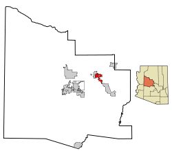
| Lage im Yavapai County und in Arizona | |
 | |
| Basisdaten | |
| Staat: | Vereinigte Staaten |
| Bundesstaat: | Arizona |
| County: | Yavapai County |
| Koordinaten: | 34° 44′ N, 112° 1′ W |
| Zeitzone: | Mountain Standard Time (UTC−7) |
| Einwohner: | 12.029 (Stand: 2020) |
| Haushalte: | 6.103 (Stand: 2020) |
| Fläche: | 27,7 km² (ca. 11 mi²) |
| Bevölkerungsdichte: | 434 Einwohner je km² |
| Höhe: | 1010 m |
| Postleitzahl: | 86326 |
| Vorwahl: | +1 928 |
| FIPS: | 04-16410 |
| GNIS-ID: | 0027993 |
| Website: | cottonwoodaz.gov |
| Bürgermeister: | Tim Elinski[1] |
Sie hatte eine Fläche von 27,7 km². Durch Cottonwood verläuft die Arizona State Route 89A, an der auch die Arizona State Route 260 beginnt.
Geschichte
Die ersten anglo-amerikanischen Siedler ließen sich auf dem Gebiet von Cottonwood, das von Apachen und Yavapai bewohnt wurde, Ende der 1870er Jahre nieder. Sie versorgten die Soldaten im nahe gelegenen Camp Verde und die zahlreichen mit der Ausbeutung der Gold-, Silber- und Kupferminen im benachbarten Jerome Beschäftigten.[3]
Den Status einer City erhielt Cottonwood im Jahr 1960.
Einwohnerentwicklung
| Jahr | 1960 | 1970 | 1980 | 1990 | 2000 | 2010 | 2020 |
|---|---|---|---|---|---|---|---|
| Einwohner | 1.879 | 2.610 | 4.550 | 5.918 | 9.179 | 11.265 | 12.029 |
| Quelle: United Stats Census Bureaux[4] | |||||||
Söhne und Töchter der Stadt
- Junior Brown (* 1952), Country-Musiker
- Ambyr Childers (* 1988), Schauspielerin
Weblinks
Einzelnachweise
- cottonwoodaz.gov. (abgerufen am 1. Juni 2022).
- Explore Census Data Cottonwood city, Arizona. Abgerufen am 23. Oktober 2022.
- City of Cottonwood – About Cottonwood, abgerufen am 12. April 2018
- United States Cenus Bureaux – Census of Population and Housing
| City | ||
| Towns | ||
| CDPs |
Alpine • Burnside • Chinle • Concho • Cornfields • Cottonwood • Del Muerto • Dennehotso • Fort Defiance • Ganado • Greer • Houck • Klagetoh • Lukachukai • Lupton • Many Farms • McNary • Nazlini • Nutrioso • Oak Springs • Red Mesa • Red Rock • Rock Point • Rough Rock • Round Rock • St. Michaels • Sanders • Sawmill • Sehili • Steamboat • Teec Nos Pos • Toyei • Tsaile • Vernon • Wide Ruins • Window Rock | |
| Unincorporated Communities |
Adamana • Allentown • Bannon • Blue Gap • Chambers • Chetco • Cove • Coyote Springs • El Tule • Emmanuel Mission • Feaster • Flat Rock • Horse Mesa • Hunt • Hunters Point • Kinlichee • Los Burros • Maverick • Mexican Water • Milkwater • Navajo • Navajo Springs • Paulcell Place • Pine Springs • Pinta • Richville • Rosebud • Salado • Salina • Sand Springs • Sunrise Springs • Tahchee • Tanner Springs • Tes Nez Iah • Totacon • Troweek • Tsintaa Yiti Ii • Twin Falls • Wheatfields • White Clay • Wood Springs • Yazzi | |
| Indianerreservat |
Fort Apache‡ • Navajo‡ • Zuni |

| Cities |
Cottonwood • Peoria‡ • Prescott • Sedona‡ |
|
| Towns |
Camp Verde • Chino Valley • Clarkdale • Dewey-Humboldt • Jerome • Prescott Valley • Wickenburg‡ | |
| CDPs |
Ash Fork • Bagdad • Black Canyon City • Congress • Cordes Lakes • Cornville • Lake Montezuma • Mayer • Paulden • Peeples Valley • Seligman • Spring Valley • Verde Village • Village of Oak Creek • Wilhoit • Williamson • Yarnell | |
| Unincorporated Communities |
Arcosanti • Aultman • Bear • Bignotti • Breezy Pines • Briggs • Casa Rosa • Castle Canyon Mesa • Cleator • Columbia • Copperopolis • Crookton • Crown King • Drake • Dugas • East Fort • Entro • Flores • Flower Pot • Forbing Park • Fort Misery • Gillett • Glen Oaks • Goodwin • Granite Dells • Groom Creek • Hawkins • Hecla • Highland Park • Hillside • Hooper • Humbug • Iron Springs • Juniper Heights • Kirkland • Kirkland Junction • Lancaster • Lapham • Minnehaha • Mint • Nelson • Oak Creek • Octave • Ocotillo • Packer • Perkinsville • Piedmont • Pinaveta • Potato Patch • Red Rock • Skull Valley • South Fort • Stanton • Tapco • Venezia • Wagoner • Walker • Walnut Grove • Willow Spring • Wingfield • Yampai • Yava | |
| Indianerreservat |
Hualapai Indian Reservation • Yavapai Reservation • Yavapai-Apache Nation Indian Reservation | |
| Geisterstädte |
Alexandra • Big Bug • Bradshaw City • Bumble Bee • Catoctin • Cherry • Constellation • Cordes • Curtis • Jerome Junction • Octave • Tip Top • Weaver |

Liste der Städte in Arizona
На других языках
- [de] Cottonwood (Arizona)
[en] Cottonwood, Arizona
Cottonwood is a city in Yavapai County, Arizona, United States. According to the 2010 census, the population of the city is 11,265.[2]Другой контент может иметь иную лицензию. Перед использованием материалов сайта WikiSort.org внимательно изучите правила лицензирования конкретных элементов наполнения сайта.
WikiSort.org - проект по пересортировке и дополнению контента Википедии