world.wikisort.org - Vereinigte_Staaten
South Dennis ist ein census-designated place (CDP) im Ort Dennis im Barnstable County in Massachusetts in den Vereinigten Staaten. Die Bevölkerungszahl betrug 3899 nach dem Zensus von 2020.
| South Dennis | |||
|---|---|---|---|
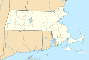
Lage in Massachusetts | |||
| Basisdaten | |||
| Staat: | Vereinigte Staaten | ||
| Bundesstaat: | Massachusetts | ||
| County: | Barnstable County | ||
| Koordinaten: | 41° 42′ N, 70° 10′ W | ||
| Einwohner: | 3.899 (Stand: 2020) | ||
| Haushalte: | 1.373 (Stand: 2020) | ||
| Fläche: | 12,3 km² (ca. 5 mi²) davon 11,8 km² (ca. 5 mi²) Land | ||
| Bevölkerungsdichte: | 330 Einwohner je km² | ||
| Höhe: | 10 m | ||
| Postleitzahl: | 02660 | ||
| FIPS: | 25-63655 | ||
| GNIS-ID: | 0615880 | ||
Geografie
Nach dem United States Census Bureau hat der CDP eine Gesamtfläche von 12,3 km², 11,8 km² davon ist Land und 0,5 km² davon ist Wasser.
Bildung
Die N. H. Wixon Middle School (Klassen 4 – 8) ist eine öffentliche Middle School in South Dennis in Massachusetts am Cape Cod.
Weblinks
| Cities | ||
| Towns |
Bourne • Brewster • Chatham • Dennis • Eastham • Falmouth • Harwich • Mashpee • Orleans • Provincetown • Sandwich • Truro • Wellfleet • Yarmouth | |
| CDPs |
Bourne • Brewster • Buzzards Bay • Chatham • Dennis • Dennis Port • East Dennis • East Falmouth • East Harwich • East Sandwich • Falmouth • Forestdale • Harwich Center • Harwich Port • Mashpee Neck • Monomoscoy Island • Monument Beach • New Seabury • North Eastham • North Falmouth • Northwest Harwich • Orleans • Pocasset • Popponesset • Popponesset Island • Provincetown • Sagamore • Sandwich • Seabrook • Seconsett Island • South Dennis • South Yarmouth • Teaticket • West Chatham • West Dennis • West Falmouth • West Yarmouth • Woods Hole • Yarmouth Port | |
| Villages |
Barnstable Village • Bournedale • Centerville • Cotuit • Craigville • Hatchville • Hyannis • Long Point • Marstons Mills • Menauhant • North Harwich • North Truro • Osterville • Pleasant Lake • Sagamore Beach • Santuit Historic District • South Harwich • West Barnstable • West Harwich |

На других языках
- [de] South Dennis
[en] South Dennis, Massachusetts
South Dennis is a census-designated place (CDP) in the town of Dennis in Barnstable County, Massachusetts, United States. The population was 3,643 at the 2010 census,[2] the most of the 5 CDPs in Dennis.Другой контент может иметь иную лицензию. Перед использованием материалов сайта WikiSort.org внимательно изучите правила лицензирования конкретных элементов наполнения сайта.
WikiSort.org - проект по пересортировке и дополнению контента Википедии