world.wikisort.org - Vereinigte_Staaten
Dennis ist ein Census-designated place (CDP) im Ort Dennis im Barnstable County in den Vereinigten Staaten. Die Bevölkerungszahl betrug 2.399 (Stand: 2020).
| Dennis | |||
|---|---|---|---|
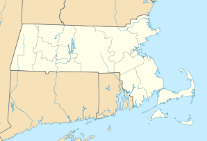
Lage in Massachusetts | |||
| Basisdaten | |||
| Staat: | Vereinigte Staaten | ||
| Bundesstaat: | Massachusetts | ||
| County: | Barnstable County | ||
| Koordinaten: | 41° 44′ N, 70° 12′ W | ||
| Zeitzone: | Eastern (UTC−5/−4) | ||
| Einwohner: | 2.399 (Stand: 2020) | ||
| Haushalte: | 1.031 (Stand: 2020) | ||
| Fläche: | 13,1 km² (ca. 5 mi²) davon 12,7 km² (ca. 5 mi²) Land | ||
| Bevölkerungsdichte: | 189 Einwohner je km² | ||
| Höhe: | 5 m | ||
| Postleitzahl: | 02638 | ||
| FIPS: | 25-16740 | ||
| GNIS-ID: | 0615824 | ||
| Website: | www.town.dennis.ma.us | ||
Geografie
Dem United States Census Bureau zufolge hat der CDP eine Gesamtfläche von 13,1 km². 12,7 km² davon ist Land und 0,4 km² davon ist Wasser.
Weblinks
| Cities | ||
| Towns |
Bourne • Brewster • Chatham • Dennis • Eastham • Falmouth • Harwich • Mashpee • Orleans • Provincetown • Sandwich • Truro • Wellfleet • Yarmouth | |
| CDPs |
Bourne • Brewster • Buzzards Bay • Chatham • Dennis • Dennis Port • East Dennis • East Falmouth • East Harwich • East Sandwich • Falmouth • Forestdale • Harwich Center • Harwich Port • Mashpee Neck • Monomoscoy Island • Monument Beach • New Seabury • North Eastham • North Falmouth • Northwest Harwich • Orleans • Pocasset • Popponesset • Popponesset Island • Provincetown • Sagamore • Sandwich • Seabrook • Seconsett Island • South Dennis • South Yarmouth • Teaticket • West Chatham • West Dennis • West Falmouth • West Yarmouth • Woods Hole • Yarmouth Port | |
| Villages |
Barnstable Village • Bournedale • Centerville • Cotuit • Craigville • Hatchville • Hyannis • Long Point • Marstons Mills • Menauhant • North Harwich • North Truro • Osterville • Pleasant Lake • Sagamore Beach • Santuit Historic District • South Harwich • West Barnstable • West Harwich |

Другой контент может иметь иную лицензию. Перед использованием материалов сайта WikiSort.org внимательно изучите правила лицензирования конкретных элементов наполнения сайта.
WikiSort.org - проект по пересортировке и дополнению контента Википедии