world.wikisort.org - Vereinigte_Staaten
Keyesville (früher Keysville und Hogeye[1]) ist eine Unincorporated Community im Kern County, Kalifornien, USA. Keyesville liegt in den Greenhorn Mountains, etwa 2 Meilen (3,2 km) westlich des Lake Isabella. Benannt ist der Ort nach Richard M. Keyes, der hier 1853 Gold entdeckte.[1][2]
| Keyesville | |||
|---|---|---|---|
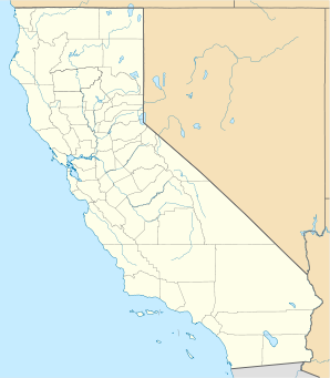
Lage in Kalifornien | |||
| Basisdaten | |||
| Gründung: | 1853 | ||
| Staat: | Vereinigte Staaten | ||
| Bundesstaat: | Kalifornien | ||
| County: | Kern County | ||
| Koordinaten: | 35° 38′ N, 118° 31′ W | ||
| Höhe: | 868 m | ||
| GNIS-ID: | 1660837 | ||
Geschichte
1853 wurde hier von Richard M. Keyes Gold entdeckt, und der Ort wurde zu einem Zentrum des Goldrauschs in Südkalifornien (Kern River Gold Rush).[2][3][4] Am 19. April 1863 kam es in der Nähe des Ortes zum Massaker von Keyesville an lokalen Ureinwohnern.[1] Die Gemeinde ist als California Historical Landmark #98 registriert.[3][4]
Weblinks
- California Historical Landmark No. 98 Keysville – Kern. California Historical Landmarks (englisch)
Einzelnachweise
- Keyesville (No. 98 California Historical Landmark). Sierra Nevada Geotourism (englisch)
- Keyesville. US Geological Survey (USGS), 31. Dezember 1981 (englisch)
- CHL No. 98 Keysville – Kern. California Historical Landmarks (englisch)
- Keyesville Historical Landmark. California State Parks, Office of Historic Preservation (OHP) (englisch)
| Cities |
Arvin • Bakersfield • California City • Delano • Maricopa • McFarland • Ridgecrest • Shafter • Taft • Tehachapi • Wasco |
|
| CDPs |
Alta Sierra • Bakersfield Country Club • Bear Valley Springs • Benton Park • Bodfish • Boron • Buttonwillow • Casa Loma • Cherokee Strip • China Lake Acres • Choctaw Valley • Cottonwood • Derby Acres • Di Giorgio • Dustin Acres • East Bakersfield • East Niles • Edison • Edmundson Acres • Edwards AFB • El Adobe • Fairfax • Fellows • Ford City • Frazier Park • Fuller Acres • Glennville • Goodmanville • Golden Hills • Greenacres • Greenfield • Hillcrest • Inyokern • Johannesburg • Keene • Kernville • La Cresta • Lake Isabella • Lake of the Woods • Lakeside • Lamont • Lebec • Lost Hills • McKittrick • Mettler • Mexican Colony • Mojave • Mountain Meadows • Mountain Mesa • North Edwards • Oildale • Old River • Old Stine • Olde Stockdale • Onyx • Pine Mountain Club • Potomac Park • Pumpkin Center • Randsburg • Rexland Acres • Ridgecrest Heights • Rivergrove • Rosamond • Rosedale • Smith Corner • South Taft • Squirrel Mountain Valley • Stallion Springs • Stebbins • Taft Heights • Tarina • Tupman • Valley Acres • Weedpatch • Weldon • Wofford Heights • Woody | |
| Unincorporated Communities |
Actis • Aerial Acres • |Alameda • Armistead • Baker • Bealville • Bena • Blackwells Corner • Brown • Caliente • Canebrake • Cantil • Cawelo • China Lake • Cinco • Claraville • Desert Lake • Edwards • Famoso • Fruitvale • Goler Heights • Grapevine • Gypsite • Havilah • Hights Corner • Indian Wells • Jasmin • Keyesville • Lerdo • Loraine • Mayfair • Meridian • Midoil • Millersville • Millux • Minter Village • Miracle Hot Springs • Missouri Triangle • Monolith • Neufeld • North Shafter • Oil City • Old Town • Panama • Pentland • Pinon Pines Estates • Pond • Reward • Ricardo • Rio Bravo • Riverkern • Rowen • Saco • Sageland • Saltdale • Sanborn • Sand Canyon • Shirley Meadows • South Lake • Spicer City • Thomas Lane • Twin Oaks • Wheeler Ridge • Willow Springs • Woodford |

На других языках
- [de] Keyesville (Kalifornien)
[en] Keyesville, California
Keyesville (formerly, Keysville[1] and Hogeye[2]) is an unincorporated community in Kern County, California.[1] It is located 2 miles (3.2 km) west of Lake Isabella and the Kern River Valley, at an elevation of 2,848 feet (868 m).[1] Keyesville, founded in 1854 is named for Richard M. Keyes, whose discovery of gold in 1853 started the Kern River Gold Rush.[1]Другой контент может иметь иную лицензию. Перед использованием материалов сайта WikiSort.org внимательно изучите правила лицензирования конкретных элементов наполнения сайта.
WikiSort.org - проект по пересортировке и дополнению контента Википедии